TopoQuest Logo
Do you find TopoQuest useful?
Help keep TopoQuest running and adding new maps/features by donating!
Bitcoin:  19c7KJd3qBynnjoSw5npx9KScwjBe4ifkT
Litecoin:  LXs6TkuXGGXo1vDsWCkWVdjQX94eUKd6ui
Home View Maps Find Maps Find Places Resources & Links


Scurry, Texas Topographic Map

USGS Map Title: Scurry, TX
USGS Map MRC: 32096E4
DRG (GeoTIFF) Download: o32096e4.tif


Neighboring USGS Topographic Map Quads:


  Seagoville, TX  
32096F5
 

  Forney South, TX  
32096F4
 

  Terrell South, TX  
32096F3
 

  India, TX  
32096E5
 

  Scurry, TX  
32096E4
 

  Kaufman, TX  
32096E3
 

  Bristol, TX  
32096D5
 

  Rosser, TX  
32096D4
 

  Grays Prairie, TX  
32096D3


Map MRC Location:

N33°
W97°
N33°
W96°
H8 H7 H6 H5 H4 H3 H2 H1
G8 G7 G6 G5 G4 G3 G2 G1
F8 F7 F6 F5 F4 F3 F2 F1
E8 E7 E6 E5 E4 E3 E2 E1
D8 D7 D6 D5 D4 D3 D2 D1
C8 C7 C6 C5 C4 C3 C2 C1
B8 B7 B6 B5 B4 B3 B2 B1
A8 A7 A6 A5 A4 A3 A2 A1
N32°
W97°
N32°
W96°

Scurry, TX USGS 1:24K Topographic Map Preview:
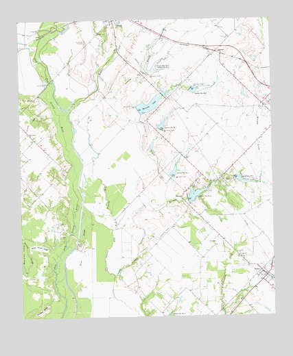
Scurry, TX USGS Topographic Map
Click on map above to begin viewing in our Map Viewer.

This topographic map contains these locations and features:
Feature Name Type Latitude Longitude GNIS ID View Map
Anthony BranchStreamN32.5962°W96.4608°1329584View Map
Baum AirportAirportN32.5647°W96.3984°1386992View Map
Buffalo CreekStreamN32.5299°W96.4775°1331565View Map
Crandall DivisionCivilN32.5552°W96.4479°1938653View Map
GastoniaPopulated PlaceN32.6118°W96.4025°1378346View Map
Lateral Site Number EightReservoirN32.5607°W96.4242°1339708View Map
Lateral Site Number ElevenReservoirN32.5010°W96.4275°1372174View Map
Lateral Site Number NineReservoirN32.5587°W96.3942°1339709View Map
Lateral Site Number SevenReservoirN32.5803°W96.4297°1339707View Map
Lateral Site Number SixReservoirN32.5954°W96.4140°1860868View Map
Lateral Site Number TenReservoirN32.5496°W96.4175°1339700View Map
Lower East Fork Lateral Site Number FiveReservoirN32.6034°W96.4373°1340684View Map
Mount Olive CemeteryCemeteryN32.5251°W96.3908°1342068View Map
Murphy LakeReservoirN32.5892°W96.4356°1342282View Map
Murphy Lake DamDamN32.5868°W96.4403°1860877View Map
Pecan SloughStreamN32.5087°W96.4742°1343783View Map
Pirate StadiumParkN32.6224°W96.4597°2027733View Map
Pleasant Grove ChurchChurchN32.5771°W96.4964°1344196View Map
Rainbow RidgeRidgeN32.5032°W96.4897°1344714View Map
Sand HillSummitN32.5315°W96.4717°1346518View Map
ScurryPopulated PlaceN32.5187°W96.3808°1379045View Map
Scurry Volunteer Fire DepartmentBuildingN32.5207°W96.3826°2551608View Map
Soil Conservation Service Site 10 ReservoirReservoirN32.5511°W96.4142°1860876View Map
Soil Conservation Service Site 5 DamDamN32.6035°W96.4369°1860865View Map
Soil Conservation Service Site 5 DamDamN32.5968°W96.4153°1860867View Map
Soil Conservation Service Site 6 DamDamN32.5785°W96.4303°1860869View Map
Soil Conservation Service Site 7 DamDamN32.5585°W96.4253°1860871View Map
Soil Conservation Service Site 7 ReservoirReservoirN32.5785°W96.4303°1860870View Map
Soil Conservation Service Site 8 DamDamN32.5585°W96.3936°1860873View Map
Soil Conservation Service Site 8 ReservoirReservoirN32.5583°W96.4247°1860872View Map
Soil Conservation Service Site 9 DamDamN32.5501°W96.4169°1860875View Map
Soil Conservation Service Site 9 ReservoirReservoirN32.5577°W96.3919°1860874View Map
Thunderbird RacetrackLocaleN32.6160°W96.4675°1384501View Map
Town of ScurryCivilN32.5128°W96.3854°2413268View Map
Valley RanchLocaleN32.5393°W96.4814°1349171View Map
WarsawPopulated PlaceN32.5501°W96.4203°1349502View Map
Warsaw CenterPopulated PlaceN32.5546°W96.4155°1379239View Map
Warsaw CreekStreamN32.5068°W96.4411°1349503View Map
White House RidgeRidgeN32.5296°W96.4914°1349953View Map

Note: Coordinates in the location and feature list above are referenced to NAD83 datum.


Copyright (C) 2008-2024 Ryan Niemi / Sunset Dynamics ... All Rights Reserved