TopoQuest Logo
Do you find TopoQuest useful?
Help keep TopoQuest running and adding new maps/features by donating!
Bitcoin:  19c7KJd3qBynnjoSw5npx9KScwjBe4ifkT
Litecoin:  LXs6TkuXGGXo1vDsWCkWVdjQX94eUKd6ui
Home View Maps Find Maps Find Places Resources & Links


Auburn, Indiana Topographic Map

USGS Map Title: Auburn, IN
USGS Map MRC: 41085C1
DRG (GeoTIFF) Download: o41085c1.tif


Neighboring USGS Topographic Map Quads:


  Corunna, IN  
41085D2
 

  Waterloo, IN  
41085D1
 

  Butler West, IN  
41084D8
 

  Garrett, IN  
41085C2
 

  Auburn, IN  
41085C1
 

  Saint Joe, IN  
41084C8
 

  Huntertown, IN  
41085B2
 

  Cedarville, IN  
41085B1
 

  Grabill, IN  
41084B8


Map MRC Location:

N42°
W86°
N42°
W85°
H8 H7 H6 H5 H4 H3 H2 H1
G8 G7 G6 G5 G4 G3 G2 G1
F8 F7 F6 F5 F4 F3 F2 F1
E8 E7 E6 E5 E4 E3 E2 E1
D8 D7 D6 D5 D4 D3 D2 D1
C8 C7 C6 C5 C4 C3 C2 C1
B8 B7 B6 B5 B4 B3 B2 B1
A8 A7 A6 A5 A4 A3 A2 A1
N41°
W86°
N41°
W85°

Auburn, IN USGS 1:24K Topographic Map Preview:
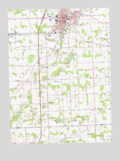
Auburn, IN USGS Topographic Map
Click on map above to begin viewing in our Map Viewer.

This topographic map contains these locations and features:
Feature Name Type Latitude Longitude GNIS ID View Map
AuburnPopulated PlaceN41.3670°W85.0589°430334View Map
Auburn Fire DepartmentBuildingN41.3610°W85.0707°2701461View Map
Auburn Fire Department Station 1BuildingN41.3658°W85.0227°2625536View Map
Auburn Fire Department Station 2BuildingN41.3618°W85.0708°2625976View Map
Auburn JunctionPopulated PlaceN41.3520°W85.0747°430337View Map
Auburn Police DepartmentBuildingN41.3661°W85.0542°2758394View Map
Beedy DitchCanalN41.2553°W85.0689°430739View Map
Beedy LakeReservoirN41.2528°W85.0613°448688View Map
Beedy Lake DamDamN41.2527°W85.0589°448687View Map
Carr FieldParkN41.3581°W85.0533°432170View Map
Cecil Metcalf DitchCanalN41.3612°W85.0266°432257View Map
City of AuburnCivilN41.3666°W85.0560°2394022View Map
City of GarrettCivilN41.3533°W85.1234°2394858View Map
County Line ChurchChurchN41.2659°W85.0491°433039View Map
De Kalb County AirportAirportN41.3094°W85.0642°449100View Map
De Kalb County SheriffBuildingN41.3663°W85.0537°2758103View Map
Dekalb Health HospitalHospitalN41.3689°W85.0354°433444View Map
Desoto ParkParkN41.3667°W85.0455°433493View Map
Dosch DitchCanalN41.3131°W85.0683°433648View Map
Dunton LakeLakeN41.2707°W85.0638°433802View Map
East Auburn Elementary SchoolSchoolN41.3717°W85.0430°446638View Map
Garrett DitchCanalN41.3412°W85.0958°434973View Map
Halkey DitchCanalN41.2714°W85.0427°435608View Map
HopewellPopulated PlaceN41.2812°W85.0205°436444View Map
Jackson Township Fire DepartmentBuildingN41.3093°W85.0313°2626094View Map
John Diehl DitchCanalN41.3425°W85.0608°449503View Map
McKenney Harrison Elementary SchoolSchoolN41.3637°W85.0611°435797View Map
Meese ChurchChurchN41.3095°W85.0550°438966View Map
Memorial ParkParkN41.3606°W85.0644°438995View Map
Mooney FieldAirportN41.3490°W85.0110°2676896View Map
New EraPopulated PlaceN41.2939°W85.1214°440044View Map
Northeastern CenterBuildingN41.3725°W85.0303°2660512View Map
Riley ParkParkN41.3706°W85.0589°442020View Map
Roselawn CemeteryCemeteryN41.3569°W85.0499°442307View Map
Saint Anthonys Center LakeReservoirN41.3313°W85.0454°448689View Map
Saint Anthonys Center Lake DamDamN41.3284°W85.0466°448690View Map
Saint JohnsPopulated PlaceN41.3087°W85.1136°442564View Map
Salem ChurchChurchN41.2506°W85.0969°442899View Map
Schmadel DitchCanalN41.2931°W85.0641°443077View Map
Swartz-Carnahan DitchCanalN41.2567°W85.0136°444473View Map
Thomas ParkParkN41.3717°W85.0536°444695View Map
Township of JacksonCivilN41.3098°W85.0210°453440View Map
WIFF-AM (Auburn)TowerN41.3345°W85.0516°448416View Map
WIFF-FM (Auburn)TowerN41.3337°W85.0522°449018View Map
Woodlawn CemeteryCemeteryN41.3548°W85.0508°446292View Map

Note: Coordinates in the location and feature list above are referenced to NAD83 datum.


Copyright (C) 2008-2025 Ryan Niemi / Sunset Dynamics ... All Rights Reserved