TopoQuest Logo
Do you find TopoQuest useful?
Help keep TopoQuest running and adding new maps/features by donating!
Bitcoin:  19c7KJd3qBynnjoSw5npx9KScwjBe4ifkT
Litecoin:  LXs6TkuXGGXo1vDsWCkWVdjQX94eUKd6ui
Home View Maps Find Maps Find Places Resources & Links


Auburn, Kansas Topographic Map

USGS Map Title: Auburn, KS
USGS Map MRC: 38095H7
DRG (GeoTIFF) Download: o38095h7.tif


Neighboring USGS Topographic Map Quads:


  Willard, KS  
39095A8
 

  Silver Lake, KS  
39095A7
 

  Topeka, KS  
39095A6
 

  Dover, KS  
38095H8
 

  Auburn, KS  
38095H7
 

  Wakarusa, KS  
38095H6
 

  Harveyville, KS  
38095G8
 

  Burlingame, KS  
38095G7
 

  Carbondale, KS  
38095G6


Map MRC Location:

N39°
W96°
N39°
W95°
H8 H7 H6 H5 H4 H3 H2 H1
G8 G7 G6 G5 G4 G3 G2 G1
F8 F7 F6 F5 F4 F3 F2 F1
E8 E7 E6 E5 E4 E3 E2 E1
D8 D7 D6 D5 D4 D3 D2 D1
C8 C7 C6 C5 C4 C3 C2 C1
B8 B7 B6 B5 B4 B3 B2 B1
A8 A7 A6 A5 A4 A3 A2 A1
N38°
W96°
N38°
W95°

Auburn, KS USGS 1:24K Topographic Map Preview:
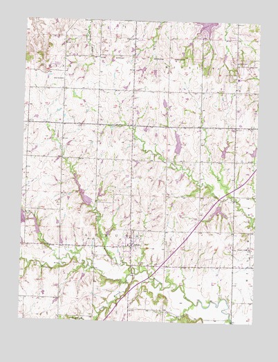
Auburn, KS USGS Topographic Map
Click on map above to begin viewing in our Map Viewer.

This topographic map contains these locations and features:
Feature Name Type Latitude Longitude GNIS ID View Map
AuburnPopulated PlaceN38.9061°W95.8161°479054View Map
Auburn CemeteryCemeteryN38.9085°W95.8347°479058View Map
Auburn Elementary SchoolSchoolN38.9068°W95.8184°2506536View Map
Auburn Police DepartmentBuildingN38.9075°W95.8173°2503908View Map
Auburn Post OfficePost OfficeN38.9070°W95.8170°2510378View Map
Auburn Presbyterian ChurchChurchN38.9096°W95.8159°480917View Map
Auburn United Methodist ChurchChurchN38.9057°W95.8142°480918View Map
Auburn Washburn Unified School District 437 Police DepartmentBuildingN38.9572°W95.7600°2504154View Map
Auburn Washburn Unified School District OfficeSchoolN38.9719°W95.7604°2506484View Map
Auburn Wastewater PlantLocaleN38.9040°W95.8066°2511200View Map
City of AuburnCivilN38.9072°W95.8162°2394025View Map
Dover Industrial ParkLocaleN38.9856°W95.8478°2509596View Map
Elevation CemeteryCemeteryN38.9833°W95.7617°479062View Map
Homestead of Auburn Assisted Living FacilityBuildingN38.9120°W95.8129°2510060View Map
Jay Shideler Elementary SchoolSchoolN38.9767°W95.7610°2506603View Map
Lone Tree School (historical)SchoolN38.9753°W95.8547°479059View Map
Middle Branch Wakarusa RiverStreamN38.8997°W95.8530°479057View Map
North Branch Wakarusa RiverStreamN38.8981°W95.8164°479056View Map
Pleasant Valley SchoolSchoolN38.9058°W95.7517°479053View Map
Prairie View Golf ClubLocaleN38.9891°W95.8487°2509859View Map
Shawnee County Fire District 2 Auburn StationBuildingN38.9081°W95.8160°2111868View Map
Skyranch Landing Strip (historical)AirportN38.9817°W95.8564°479060View Map
South Branch Wakarusa RiverStreamN38.8925°W95.8183°479052View Map
Tallgrass Student Learning Center SchoolSchoolN38.9580°W95.7554°2506485View Map
Township of AuburnCivilN38.9110°W95.8490°479055View Map
Vidette (historical)LocaleN38.9853°W95.8167°482030View Map
Vidette School (historical)SchoolN38.9925°W95.8175°479061View Map
Washburn Rural Alternative High SchoolSchoolN38.9575°W95.7591°2506638View Map
Washburn Rural High SchoolSchoolN38.9573°W95.7600°2506627View Map
Washburn Rural Middle SchoolSchoolN38.9578°W95.7526°2506569View Map
Waveland (historical)LocaleN38.8883°W95.7605°482034View Map

Note: Coordinates in the location and feature list above are referenced to NAD83 datum.


Copyright (C) 2008-2024 Ryan Niemi / Sunset Dynamics ... All Rights Reserved