TopoQuest Logo
Do you find TopoQuest useful?
Help keep TopoQuest running and adding new maps/features by donating!
Bitcoin:  19c7KJd3qBynnjoSw5npx9KScwjBe4ifkT
Litecoin:  LXs6TkuXGGXo1vDsWCkWVdjQX94eUKd6ui
Home View Maps Find Maps Find Places Resources & Links


Burlingame, Kansas Topographic Map

USGS Map Title: Burlingame, KS
USGS Map MRC: 38095G7
DRG (GeoTIFF) Download: o38095g7.tif


Neighboring USGS Topographic Map Quads:


  Dover, KS  
38095H8
 

  Auburn, KS  
38095H7
 

  Wakarusa, KS  
38095H6
 

  Harveyville, KS  
38095G8
 

  Burlingame, KS  
38095G7
 

  Carbondale, KS  
38095G6
 

  Miller, KS  
38095F8
 

  Osage City, KS  
38095F7
 

  Lyndon NW, KS  
38095F6


Map MRC Location:

N39°
W96°
N39°
W95°
H8 H7 H6 H5 H4 H3 H2 H1
G8 G7 G6 G5 G4 G3 G2 G1
F8 F7 F6 F5 F4 F3 F2 F1
E8 E7 E6 E5 E4 E3 E2 E1
D8 D7 D6 D5 D4 D3 D2 D1
C8 C7 C6 C5 C4 C3 C2 C1
B8 B7 B6 B5 B4 B3 B2 B1
A8 A7 A6 A5 A4 A3 A2 A1
N38°
W96°
N38°
W95°

Burlingame, KS USGS 1:24K Topographic Map Preview:
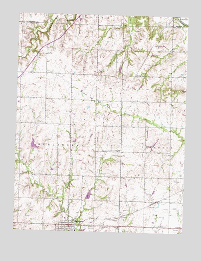
Burlingame, KS USGS Topographic Map
Click on map above to begin viewing in our Map Viewer.

This topographic map contains these locations and features:
Feature Name Type Latitude Longitude GNIS ID View Map
BurlingamePopulated PlaceN38.7539°W95.8350°479434View Map
Burlingame City HallBuildingN38.7534°W95.8344°2693092View Map
Burlingame Community LibraryBuildingN38.7540°W95.8358°2694691View Map
Burlingame Elementary SchoolSchoolN38.7564°W95.8374°2506480View Map
Burlingame Junior / Senior High SchoolSchoolN38.7576°W95.8375°480669View Map
Burlingame Municipal Power PlantLocaleN38.7553°W95.8373°2692426View Map
Burlingame Police DepartmentBuildingN38.7534°W95.8342°2503925View Map
Burlingame Post OfficePost OfficeN38.7527°W95.8350°2693644View Map
Burlingame Schuyler MuseumBuildingN38.7528°W95.8374°2694895View Map
Burlingame Unified School District OfficeSchoolN38.7584°W95.8378°2506479View Map
City of BurlingameCivilN38.7516°W95.8347°2393468View Map
Fairplain Grange HallLocaleN38.8517°W95.8533°479444View Map
Federated ChurchChurchN38.7503°W95.8342°2689646View Map
Fostoria SchoolSchoolN38.7533°W95.7980°479438View Map
Fountain Ridge SchoolSchoolN38.8406°W95.7872°479443View Map
Hoover BranchStreamN38.7553°W95.8286°479439View Map
Lincoln Middle School (historical)SchoolN38.7504°W95.8373°2506635View Map
Major DrawValleyN38.7673°W95.8392°479435View Map
Osage County Fire District 6 BurlingameBuildingN38.7552°W95.8366°2111692View Map
Pleasant Valley Grange HallBuildingN38.7969°W95.7980°479441View Map
Schuyler Elementary School (historical)SchoolN38.7527°W95.8374°2506560View Map
Stenger HillSummitN38.8319°W95.7536°479442View Map
Stormont (historical)LocaleN38.8250°W95.8044°482424View Map
Supple SchoolSchoolN38.7536°W95.7558°479437View Map
Township of BurlingameCivilN38.8043°W95.8721°479440View Map
Township of ScrantonCivilN38.8041°W95.7607°479447View Map

Note: Coordinates in the location and feature list above are referenced to NAD83 datum.


Copyright (C) 2008-2025 Ryan Niemi / Sunset Dynamics ... All Rights Reserved