TopoQuest Logo
Do you find TopoQuest useful?
Help keep TopoQuest running and adding new maps/features by donating!
Bitcoin:  19c7KJd3qBynnjoSw5npx9KScwjBe4ifkT
Litecoin:  LXs6TkuXGGXo1vDsWCkWVdjQX94eUKd6ui
Home View Maps Find Maps Find Places Resources & Links


Green Mountain, Oregon Topographic Map

USGS Map Title: Green Mountain, OR
USGS Map MRC: 46123A6
DRG (GeoTIFF) Download: o46123a6.tif


Neighboring USGS Topographic Map Quads:


  Astoria, OR  
46123B7
 

  Cathlamet Bay, OR  
46123B6
 

  Knappa, OR  
46123B5
 

  Olney, OR  
46123A7
 

  Green Mountain, OR  
46123A6
 

  Wickiup Mountain, OR  
46123A5
 

  Necanicum Junction, OR  
45123H7
 

  Saddle Mountain, OR  
45123H6
 

  Vinemaple, OR  
45123H5


Map MRC Location:

N47°
W124°
N47°
W123°
H8 H7 H6 H5 H4 H3 H2 H1
G8 G7 G6 G5 G4 G3 G2 G1
F8 F7 F6 F5 F4 F3 F2 F1
E8 E7 E6 E5 E4 E3 E2 E1
D8 D7 D6 D5 D4 D3 D2 D1
C8 C7 C6 C5 C4 C3 C2 C1
B8 B7 B6 B5 B4 B3 B2 B1
A8 A7 A6 A5 A4 A3 A2 A1
N46°
W124°
N46°
W123°

Green Mountain, OR USGS 1:24K Topographic Map Preview:
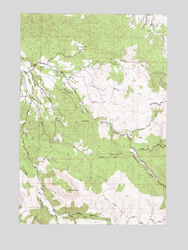
Green Mountain, OR USGS Topographic Map
Click on map above to begin viewing in our Map Viewer.

This topographic map contains these locations and features:
Feature Name Type Latitude Longitude GNIS ID View Map
Astoria Water Treatment PlantLocaleN46.1166°W123.6370°2660786View Map
Barth FallsFallsN46.0623°W123.6874°1117271View Map
Bear Creek DamDamN46.1182°W123.6412°1133453View Map
Bear Creek ReservoirReservoirN46.1154°W123.6390°1130259View Map
Clatsop CountyCivilN46.0175°W123.7170°1135846View Map
EstoosLocaleN46.1037°W123.6979°1136272View Map
Fox CreekStreamN46.0037°W123.7035°1120940View Map
Glazers GradeSlopeN46.0537°W123.6610°1160972View Map
Green MountainSummitN46.0184°W123.7054°1121384View Map
John Day CreekStreamN46.1240°W123.6354°1122444View Map
Klaskanine Fish HatcheryLocaleN46.0890°W123.7174°1163730View Map
Klaskanine SummitGapN46.0471°W123.6707°1132300View Map
LilleasLocaleN46.1048°W123.6982°1158321View Map
Middle Fork North Fork Klaskanine RiverStreamN46.0554°W123.6546°1124099View Map
Nobel Ridge FarmLocaleN46.0778°W123.7319°2664421View Map
North Fork Klaskanine RiverStreamN46.0901°W123.7468°1124784View Map
North Fork North Fork Klaskanine RiverStreamN46.0915°W123.7193°1124747View Map
Olney G SLocaleN46.0857°W123.7112°1124992View Map
Osgood CreekStreamN46.0051°W123.7212°1125050View Map
Perkins CreekStreamN46.0859°W123.6637°1132315View Map
Rock CreekStreamN46.0143°W123.7290°1126167View Map
Sigfredson County ParkParkN46.0915°W123.7249°1158647View Map
Snow PointSummitN46.0179°W123.6721°1132293View Map
South Fork Klaskanine RiverStreamN46.0901°W123.7468°1127295View Map
South Fork Youngs RiverStreamN46.0032°W123.6782°1127329View Map
Waterworks CreekStreamN46.1223°W123.6362°1128732View Map

Note: Coordinates in the location and feature list above are referenced to NAD83 datum.


Copyright (C) 2008-2024 Ryan Niemi / Sunset Dynamics ... All Rights Reserved