TopoQuest Logo
Do you find TopoQuest useful?
Help keep TopoQuest running and adding new maps/features by donating!
Bitcoin:  19c7KJd3qBynnjoSw5npx9KScwjBe4ifkT
Litecoin:  LXs6TkuXGGXo1vDsWCkWVdjQX94eUKd6ui
Home View Maps Find Maps Find Places Resources & Links


Greentop, Missouri Topographic Map

USGS Map Title: Greentop, MO
USGS Map MRC: 40092C5
DRG (GeoTIFF) Download: o40092c5.tif


Neighboring USGS Topographic Map Quads:


  Livonia, MO  
40092D6
 

  Queen City, MO  
40092D5
 

  Downing NW, MO  
40092D4
 

  Connelsville, MO  
40092C6
 

  Greentop, MO  
40092C5
 

  Willmathsville, MO  
40092C4
 

  Novinger, MO  
40092B6
 

  Kirksville, MO  
40092B5
 

  Brashear, MO  
40092B4


Map MRC Location:

N41°
W93°
N41°
W92°
H8 H7 H6 H5 H4 H3 H2 H1
G8 G7 G6 G5 G4 G3 G2 G1
F8 F7 F6 F5 F4 F3 F2 F1
E8 E7 E6 E5 E4 E3 E2 E1
D8 D7 D6 D5 D4 D3 D2 D1
C8 C7 C6 C5 C4 C3 C2 C1
B8 B7 B6 B5 B4 B3 B2 B1
A8 A7 A6 A5 A4 A3 A2 A1
N40°
W93°
N40°
W92°

Greentop, MO USGS 1:24K Topographic Map Preview:
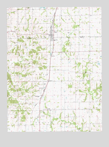
Greentop, MO USGS Topographic Map
Click on map above to begin viewing in our Map Viewer.

This topographic map contains these locations and features:
Feature Name Type Latitude Longitude GNIS ID View Map
Browns SchoolSchoolN40.3673°W92.5299°741580View Map
Bryant School (historical)SchoolN40.2800°W92.5449°741575View Map
Buck BranchStreamN40.3100°W92.6244°714948View Map
City of GreentopCivilN40.3508°W92.5657°2394993View Map
Fort Madison ChurchChurchN40.3098°W92.5232°718109View Map
Fugate CemeteryCemeteryN40.3745°W92.6002°718277View Map
Fugate School (historical)SchoolN40.3659°W92.6194°741582View Map
Gates School (historical)SchoolN40.3192°W92.5716°741578View Map
GreentopPopulated PlaceN40.3470°W92.5691°718830View Map
Greentop Fire Protection Association Station 1BuildingN40.3466°W92.5665°2620260View Map
Greentop Post OfficePost OfficeN40.3465°W92.5669°2783054View Map
Gregory Lake DamDamN40.3617°W92.5885°762180View Map
Hazel Creek ChurchChurchN40.3398°W92.6113°719277View Map
Horn LakeReservoirN40.3167°W92.6169°761159View Map
Horn Lake DamDamN40.3184°W92.5052°762179View Map
Kirksville Air Force Station (historical)MilitaryN40.2981°W92.5750°2087772View Map
Maple Grove School (historical)SchoolN40.3625°W92.5899°741581View Map
McKim School (historical)SchoolN40.3253°W92.6091°741577View Map
New Harmony ChurchChurchN40.3506°W92.6152°723211View Map
Oak Grove CemeteryCemeteryN40.2525°W92.5310°723570View Map
Oak Grove School (historical)SchoolN40.2520°W92.5321°733663View Map
Pleasant Hill SchoolSchoolN40.2795°W92.6021°741576View Map
Queen City Reservoir DamDamN40.3734°W92.5752°760492View Map
Refuge Community ChurchChurchN40.2723°W92.5691°725201View Map
Robert Horn DamDamN40.3167°W92.6169°761158View Map
Southwestern Adair County Rural Fire DistrictBuildingN40.2785°W92.5865°2621477View Map
SublettePopulated PlaceN40.3006°W92.5716°727209View Map
Towles CemeteryCemeteryN40.3492°W92.5438°727728View Map
Township of PolkCivilN40.3080°W92.5726°766216View Map
Township of Salt RiverCivilN40.3661°W92.5763°767374View Map
Wells SchoolSchoolN40.3236°W92.5438°741579View Map

Note: Coordinates in the location and feature list above are referenced to NAD83 datum.


Copyright (C) 2008-2024 Ryan Niemi / Sunset Dynamics ... All Rights Reserved