TopoQuest Logo
Do you find TopoQuest useful?
Help keep TopoQuest running and adding new maps/features by donating!
Bitcoin:  19c7KJd3qBynnjoSw5npx9KScwjBe4ifkT
Litecoin:  LXs6TkuXGGXo1vDsWCkWVdjQX94eUKd6ui
Home View Maps Find Maps Find Places Resources & Links


Gregory, Texas Topographic Map

USGS Map Title: Gregory, TX
USGS Map MRC: 27097H3
DRG (GeoTIFF) Download: o27097h3.tif


Neighboring USGS Topographic Map Quads:


  Taft, TX  
27097H4
 

  Gregory, TX  
27097H3
 

  Aransas Pass, TX  
27097H2
 

  Corpus Christi, TX  
27097G4
 

  Portland, TX  
27097G3
 

  Port Ingleside, TX  
27097G2


Map MRC Location:

N28°
W98°
N28°
W97°
H8 H7 H6 H5 H4 H3 H2 H1
G8 G7 G6 G5 G4 G3 G2 G1
F8 F7 F6 F5 F4 F3 F2 F1
E8 E7 E6 E5 E4 E3 E2 E1
D8 D7 D6 D5 D4 D3 D2 D1
C8 C7 C6 C5 C4 C3 C2 C1
B8 B7 B6 B5 B4 B3 B2 B1
A8 A7 A6 A5 A4 A3 A2 A1
N27°
W98°
N27°
W97°

Gregory, TX USGS 1:24K Topographic Map Preview:
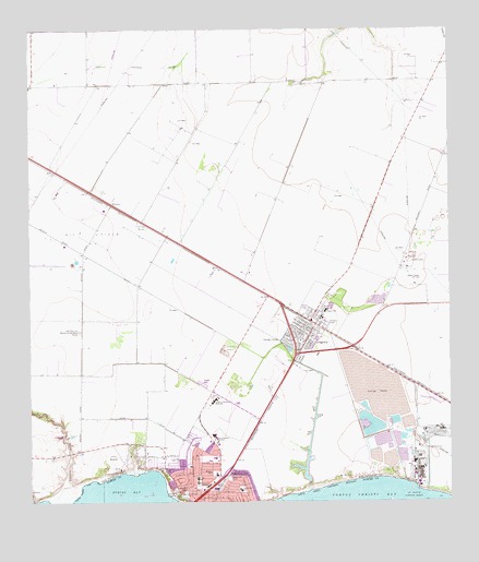
Gregory, TX USGS Topographic Map
Click on map above to begin viewing in our Map Viewer.

This topographic map contains these locations and features:
Feature Name Type Latitude Longitude GNIS ID View Map
Andrews Elementary SchoolSchoolN27.8904°W97.3300°2008911View Map
Assembly of God ChurchChurchN27.8892°W97.3247°2023642View Map
Austin Elementary SchoolSchoolN27.9259°W97.2873°2008864View Map
Austin SchoolSchoolN27.9256°W97.2867°1329856View Map
Baker ParkParkN27.8770°W97.3305°1329955View Map
Broadway ParkParkN27.8775°W97.3311°2028731View Map
Church of ChristChurchN27.8934°W97.3228°2023560View Map
City of GregoryCivilN27.9221°W97.2918°2410662View Map
City of PortlandCivilN27.8816°W97.3268°2411472View Map
Clark Elementary SchoolSchoolN27.8814°W97.3255°2008867View Map
Clark SchoolSchoolN27.8817°W97.3255°1332895View Map
Crescent CenterPopulated PlaceN27.8797°W97.3222°1378179View Map
DoylePopulated PlaceN27.8875°W97.3444°1852700View Map
Doyle Addition ColoniaPopulated PlaceN27.8884°W97.3442°2011362View Map
Doyle Census Designated Place (historical)CensusN27.8857°W97.3529°2408686View Map
East Cliff Elementary SchoolSchoolN27.8786°W97.3127°2008868View Map
East Cliff ParkParkN27.8814°W97.3161°1334896View Map
East Cliff SchoolSchoolN27.8781°W97.3128°1334897View Map
Grace Baptist ChurchChurchN27.8795°W97.3253°2023556View Map
GregoryPopulated PlaceN27.9222°W97.2900°1337010View Map
Gregory - Portland High SchoolSchoolN27.9021°W97.3203°1337011View Map
Gregory - Portland Intermediate SchoolSchoolN27.8951°W97.3174°2008873View Map
Gregory - Portland Junior High SchoolSchoolN27.9034°W97.3237°2008874View Map
Gregory City HallBuildingN27.9236°W97.2921°2753284View Map
Gregory Police DepartmentBuildingN27.9236°W97.2922°2335011View Map
Gregory Post OfficePost OfficeN27.9226°W97.2903°2731954View Map
Gregory Volunteer Fire DepartmentBuildingN27.9191°W97.2914°2334639View Map
Gregory-Portland Junior High SchoolSchoolN27.8928°W97.3208°1337012View Map
Gum HollowValleyN27.8791°W97.3627°1337122View Map
Hunt AirportAirportN27.8843°W97.3466°1387347View Map
Hunt Municipal ParkParkN27.8900°W97.3294°2029150View Map
KCTA-AM (Corpus Christi)TowerN27.9339°W97.2597°1385536View Map
KPCB-FM (Rockport)TowerN27.9114°W97.3358°1385986View Map
La Quinta Turning BasinHarborN27.8767°W97.2614°1339395View Map
Magee AirportAirportN27.9153°W97.3228°2675966View Map
MidwayPopulated PlaceN27.9539°W97.3505°1378670View Map
Nueces Bay ColoniaPopulated PlaceN27.8853°W97.3422°2011286View Map
Nueces Bayfront ColoniaPopulated PlaceN27.8853°W97.3442°2011287View Map
PortlandPopulated PlaceN27.8772°W97.3239°1344378View Map
Portland Church of the NazareneChurchN27.8892°W97.3247°2023563View Map
Portland City HallBuildingN27.8946°W97.3145°2753474View Map
Portland Fire DepartmentBuildingN27.9022°W97.3178°2334266View Map
Portland Police DepartmentBuildingN27.8947°W97.3137°2335158View Map
Portland Post OfficePost OfficeN27.8883°W97.3180°2731638View Map
Portland-Gregory DivisionCivilN27.9458°W97.2787°1938806View Map
Reynolds Metal Company ReservoirReservoirN27.8957°W97.2741°1862397View Map
Reynolds Metal Company Reservoir DamDamN27.8953°W97.2686°1862396View Map
Saint Stephen Lutheran ChurchChurchN27.8903°W97.3272°2023569View Map
San Patricio Memorial GardensCemeteryN27.9206°W97.3605°1384158View Map
Taft Drainage DitchCanalN27.9906°W97.3397°1348201View Map
Temple Public LibraryBuildingN27.8997°W97.3419°2014730View Map
TradewindsPopulated PlaceN27.9906°W97.2619°1852774View Map
Tradewinds Census Designated PlaceCensusN27.9950°W97.2602°2409346View Map
Tradewinds Estates ColoniaPopulated PlaceN27.9914°W97.2622°2011251View Map
Wildcat StadiumParkN27.9009°W97.3230°2027588View Map
Willacy ParkParkN27.8831°W97.3208°1350107View Map

Note: Coordinates in the location and feature list above are referenced to NAD83 datum.


Copyright (C) 2008-2024 Ryan Niemi / Sunset Dynamics ... All Rights Reserved