TopoQuest Logo
Do you find TopoQuest useful?
Help keep TopoQuest running and adding new maps/features by donating!
Bitcoin:  19c7KJd3qBynnjoSw5npx9KScwjBe4ifkT
Litecoin:  LXs6TkuXGGXo1vDsWCkWVdjQX94eUKd6ui
Home View Maps Find Maps Find Places Resources & Links


Grouse Butte, Idaho Topographic Map

USGS Map Title: Grouse Butte, ID
USGS Map MRC: 43115E2
DRG (GeoTIFF) Download: o43115e2.tif


Neighboring USGS Topographic Map Quads:


  Rocky Bar, ID  
43115F3
 

  Cayuse Point, ID  
43115F2
 

  Ross Peak, ID  
43115F1
 

  Featherville, ID  
43115E3
 

  Grouse Butte, ID  
43115E2
 

  Jumbo Mountain, ID  
43115E1
 

  Pine, ID  
43115D3
 

  Sprout Mountain, ID  
43115D2
 

  Deer Mountain, ID  
43115D1


Map MRC Location:

N44°
W116°
N44°
W115°
H8 H7 H6 H5 H4 H3 H2 H1
G8 G7 G6 G5 G4 G3 G2 G1
F8 F7 F6 F5 F4 F3 F2 F1
E8 E7 E6 E5 E4 E3 E2 E1
D8 D7 D6 D5 D4 D3 D2 D1
C8 C7 C6 C5 C4 C3 C2 C1
B8 B7 B6 B5 B4 B3 B2 B1
A8 A7 A6 A5 A4 A3 A2 A1
N43°
W116°
N43°
W115°

Grouse Butte, ID USGS 1:24K Topographic Map Preview:
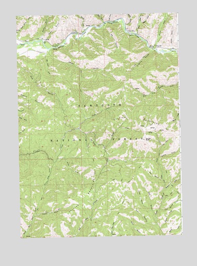
Grouse Butte, ID USGS Topographic Map
Click on map above to begin viewing in our Map Viewer.

This topographic map contains these locations and features:
Feature Name Type Latitude Longitude GNIS ID View Map
Abbot CampgroundLocaleN43.6080°W115.2179°376454View Map
Abbot GulchValleyN43.6043°W115.2256°376455View Map
Ada GulchValleyN43.5307°W115.1404°376466View Map
Barker GulchValleyN43.6116°W115.2304°376960View Map
Bird CreekStreamN43.6199°W115.1823°377681View Map
Bird Creek CampgroundLocaleN43.6205°W115.1756°377683View Map
Buckhorn CreekStreamN43.5257°W115.1392°378406View Map
Burgy CreekStreamN43.5507°W115.1845°378516View Map
Chaparral CampgroundLocaleN43.6143°W115.2034°379184View Map
Cold Spring CreekStreamN43.5146°W115.1434°379547View Map
Fox GulchValleyN43.5055°W115.1451°382001View Map
Gem GulchValleyN43.5082°W115.1459°382228View Map
Geum CreekStreamN43.5210°W115.1395°382258View Map
Grouse ButteSummitN43.5541°W115.1526°382707View Map
Joan GulchValleyN43.5499°W115.1406°383926View Map
Kodak GulchValleyN43.6057°W115.1301°384292View Map
Log Chute GulchValleyN43.6013°W115.2284°385044View Map
Lotah GulchValleyN43.5141°W115.1501°386192View Map
Lupine GulchValleyN43.5121°W115.2390°386298View Map
Marsh CreekStreamN43.6185°W115.1667°386482View Map
Middle Fork Grouse CreekStreamN43.5605°W115.2042°386814View Map
North Fork Grouse CreekStreamN43.5605°W115.2042°387705View Map
Ok GulchValleyN43.6180°W115.1837°387920View Map
Regina CreekStreamN43.6199°W115.1548°389282View Map
Rough GulchValleyN43.6213°W115.1781°389640View Map
Sedum GulchValleyN43.5402°W115.1420°390094View Map
Shake CreekStreamN43.6135°W115.1573°390135View Map
Shake Creek Ranger StationLocaleN43.6155°W115.1640°390138View Map
Shake Creek Recreation SiteLocaleN43.6141°W115.1576°394075View Map
Soldier MountainsRangeN43.5677°W115.1704°390825View Map
South Fork Grouse CreekStreamN43.5430°W115.2220°390944View Map
Swain GulchValleyN43.6113°W115.2281°391698View Map
Taylor CreekStreamN43.5038°W115.1429°391866View Map
Virginia GulchValleyN43.6038°W115.1459°392746View Map
Warbois CreekStreamN43.6160°W115.1973°392825View Map
Warm Spring GulchValleyN43.6157°W115.2495°392868View Map
Willow CreekStreamN43.6046°W115.1440°393496View Map
Willow Creek CampgroundLocaleN43.6066°W115.1434°393512View Map
Yellow Pine CreekStreamN43.5438°W115.2270°393751View Map

Note: Coordinates in the location and feature list above are referenced to NAD83 datum.


Copyright (C) 2008-2025 Ryan Niemi / Sunset Dynamics ... All Rights Reserved