TopoQuest Logo
Do you find TopoQuest useful?
Help keep TopoQuest running and adding new maps/features by donating!
Bitcoin:  19c7KJd3qBynnjoSw5npx9KScwjBe4ifkT
Litecoin:  LXs6TkuXGGXo1vDsWCkWVdjQX94eUKd6ui
Home View Maps Find Maps Find Places Resources & Links


Jumbo Mountain, Idaho Topographic Map

USGS Map Title: Jumbo Mountain, ID
USGS Map MRC: 43115E1
DRG (GeoTIFF) Download: o43115e1.tif


Neighboring USGS Topographic Map Quads:


  Cayuse Point, ID  
43115F2
 

  Ross Peak, ID  
43115F1
 

  Newman Peak, ID  
43114F8
 

  Grouse Butte, ID  
43115E2
 

  Jumbo Mountain, ID  
43115E1
 

  Boardman Creek, ID  
43114E8
 

  Sprout Mountain, ID  
43115D2
 

  Deer Mountain, ID  
43115D1
 

  Smoky Dome, ID  
43114D8


Map MRC Location:

N44°
W116°
N44°
W115°
H8 H7 H6 H5 H4 H3 H2 H1
G8 G7 G6 G5 G4 G3 G2 G1
F8 F7 F6 F5 F4 F3 F2 F1
E8 E7 E6 E5 E4 E3 E2 E1
D8 D7 D6 D5 D4 D3 D2 D1
C8 C7 C6 C5 C4 C3 C2 C1
B8 B7 B6 B5 B4 B3 B2 B1
A8 A7 A6 A5 A4 A3 A2 A1
N43°
W116°
N43°
W115°

Jumbo Mountain, ID USGS 1:24K Topographic Map Preview:
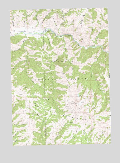
Jumbo Mountain, ID USGS Topographic Map
Click on map above to begin viewing in our Map Viewer.

This topographic map contains these locations and features:
Feature Name Type Latitude Longitude GNIS ID View Map
Alturas County (historical)CivilN43.6243°W115.0829°399567View Map
Baumgartner CampgroundLocaleN43.6057°W115.0762°377047View Map
Beaver CreekStreamN43.6007°W115.0584°377235View Map
Big Water GulchValleyN43.6060°W115.0942°377613View Map
Bighorn CampgroundLocaleN43.5999°W115.0623°377619View Map
Deadwood CreekStreamN43.5857°W115.0076°380344View Map
Deer ParkParkN43.5271°W115.0762°380470View Map
East Fork Beaver CreekStreamN43.5849°W115.0576°381036View Map
East Fork Kelley CreekStreamN43.5949°W115.1076°1966388View Map
Gardner GulchValleyN43.6016°W115.0804°382193View Map
Gardner Gulch CorralLocaleN43.6016°W115.0859°382194View Map
Heart LakeLakeN43.5450°W115.0403°383027View Map
Iron MountainSummitN43.5382°W115.0453°383760View Map
Jumbo CreekStreamN43.6018°W115.0673°384048View Map
Jumbo MountainSummitN43.6180°W115.0331°384050View Map
Kelley CreekStreamN43.6024°W115.1054°384131View Map
Kelley Creek CorralLocaleN43.5980°W115.1020°400967View Map
Little Jumbo CreekStreamN43.6043°W115.0704°384869View Map
Little Water GulchValleyN43.6077°W115.0870°384986View Map
Myrtle CreekStreamN43.5782°W115.1054°387444View Map
Skeleton CampgroundLocaleN43.5907°W115.0187°390510View Map
Skeleton CreekStreamN43.5896°W115.0220°390511View Map
South Fork Ranch AirportAirportN43.6059°W115.1134°2443839View Map
Stevens GulchValleyN43.6055°W115.1217°391441View Map
Van GulchValleyN43.6085°W115.1056°392688View Map
Weeks GulchValleyN43.5938°W115.0178°392980View Map
West Fork Kelley CreekStreamN43.5949°W115.1076°393129View Map

Note: Coordinates in the location and feature list above are referenced to NAD83 datum.


Copyright (C) 2008-2025 Ryan Niemi / Sunset Dynamics ... All Rights Reserved