TopoQuest Logo
Do you find TopoQuest useful?
Help keep TopoQuest running and adding new maps/features by donating!
Bitcoin:  19c7KJd3qBynnjoSw5npx9KScwjBe4ifkT
Litecoin:  LXs6TkuXGGXo1vDsWCkWVdjQX94eUKd6ui
Home View Maps Find Maps Find Places Resources & Links


Grouse Mountain, California Topographic Map

USGS Map Title: Grouse Mountain, CA
USGS Map MRC: 40123G6
DRG (GeoTIFF) Download: o40123g6.tif


Neighboring USGS Topographic Map Quads:


  Lord-Ellis Summit, CA  
40123H7
 

  Willow Creek, CA  
40123H6
 

  Salyer, CA  
40123H5
 

  Maple Creek, CA  
40123G7
 

  Grouse Mountain, CA  
40123G6
 

  Hennessy Peak, CA  
40123G5
 

  Mad River Buttes, CA  
40123F7
 

  Board Camp Mountain, CA  
40123F6
 

  Sims Mountain, CA  
40123F5


Map MRC Location:

N41°
W124°
N41°
W123°
H8 H7 H6 H5 H4 H3 H2 H1
G8 G7 G6 G5 G4 G3 G2 G1
F8 F7 F6 F5 F4 F3 F2 F1
E8 E7 E6 E5 E4 E3 E2 E1
D8 D7 D6 D5 D4 D3 D2 D1
C8 C7 C6 C5 C4 C3 C2 C1
B8 B7 B6 B5 B4 B3 B2 B1
A8 A7 A6 A5 A4 A3 A2 A1
N40°
W124°
N40°
W123°

Grouse Mountain, CA USGS 1:24K Topographic Map Preview:
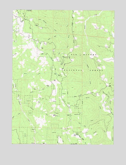
Grouse Mountain, CA USGS Topographic Map
Click on map above to begin viewing in our Map Viewer.

This topographic map contains these locations and features:
Feature Name Type Latitude Longitude GNIS ID View Map
Ammon RidgeRidgeN40.7979°W123.6606°256228View Map
Ammon StationLocaleN40.8046°W123.6323°256229View Map
Barney CreekStreamN40.7749°W123.6262°256539View Map
Bartlett RanchLocaleN40.7501°W123.7128°1665198View Map
Black RockPillarN40.8096°W123.7001°257155View Map
Bottleneck SpringSpringN40.7779°W123.6831°257374View Map
Bradford CreekStreamN40.7874°W123.7326°257427View Map
Buck FlatFlatN40.7904°W123.6864°257565View Map
Clear LakeLakeN40.8154°W123.6970°258439View Map
Cold SpringSpringN40.8340°W123.7132°258547View Map
Enquist CreekStreamN40.8518°W123.6934°259942View Map
Friday CampLocaleN40.8315°W123.6873°260416View Map
Friday RidgeRidgeN40.8635°W123.6770°260417View Map
Grouse Creek Tractor WayTrailN40.7551°W123.6650°260950View Map
Grouse MountainSummitN40.7590°W123.6723°260958View Map
Grouse Mountain LookoutLocaleN40.7590°W123.6725°276371View Map
Horse MountainSummitN40.8743°W123.7328°266825View Map
Horse Mountain CreekStreamN40.8487°W123.6845°261497View Map
Horse Mountain MineMineN40.8607°W123.7201°261498View Map
Janes PlacePopulated PlaceN40.7893°W123.7167°1658852View Map
Lake Prairie CreekStreamN40.8015°W123.7492°262291View Map
Lower Joe Green CabinLocaleN40.7774°W123.7003°263021View Map
McMillion CabinLocaleN40.8043°W123.7056°263405View Map
Minon CreekStreamN40.8068°W123.7489°263691View Map
Mud LakeLakeN40.7971°W123.6897°263934View Map
Packeka CreekStreamN40.7535°W123.6278°264436View Map
Panther CreekStreamN40.7882°W123.7409°264475View Map
Pardee CreekStreamN40.7796°W123.7373°264516View Map
Spike Buck CreekStreamN40.7807°W123.6428°267567View Map
Spike Buck MountainSummitN40.7787°W123.6664°267569View Map
Titlow HillSummitN40.8390°W123.7120°1660006View Map
Upper Joe Green CabinLocaleN40.7501°W123.6706°268619View Map
White Rock SpringSpringN40.8142°W123.6952°269021View Map

Note: Coordinates in the location and feature list above are referenced to NAD83 datum.


Copyright (C) 2008-2024 Ryan Niemi / Sunset Dynamics ... All Rights Reserved