TopoQuest Logo
Do you find TopoQuest useful?
Help keep TopoQuest running and adding new maps/features by donating!
Bitcoin:  19c7KJd3qBynnjoSw5npx9KScwjBe4ifkT
Litecoin:  LXs6TkuXGGXo1vDsWCkWVdjQX94eUKd6ui
Home View Maps Find Maps Find Places Resources & Links


Board Camp Mountain, California Topographic Map

USGS Map Title: Board Camp Mountain, CA
USGS Map MRC: 40123F6
DRG (GeoTIFF) Download: o40123f6.tif


Neighboring USGS Topographic Map Quads:


  Maple Creek, CA  
40123G7
 

  Grouse Mountain, CA  
40123G6
 

  Hennessy Peak, CA  
40123G5
 

  Mad River Buttes, CA  
40123F7
 

  Board Camp Mountain, CA  
40123F6
 

  Sims Mountain, CA  
40123F5
 

  Yager Junction, CA  
40123E7
 

  Showers Mountain, CA  
40123E6
 

  Blake Mountain, CA  
40123E5


Map MRC Location:

N41°
W124°
N41°
W123°
H8 H7 H6 H5 H4 H3 H2 H1
G8 G7 G6 G5 G4 G3 G2 G1
F8 F7 F6 F5 F4 F3 F2 F1
E8 E7 E6 E5 E4 E3 E2 E1
D8 D7 D6 D5 D4 D3 D2 D1
C8 C7 C6 C5 C4 C3 C2 C1
B8 B7 B6 B5 B4 B3 B2 B1
A8 A7 A6 A5 A4 A3 A2 A1
N40°
W124°
N40°
W123°

Board Camp Mountain, CA USGS 1:24K Topographic Map Preview:
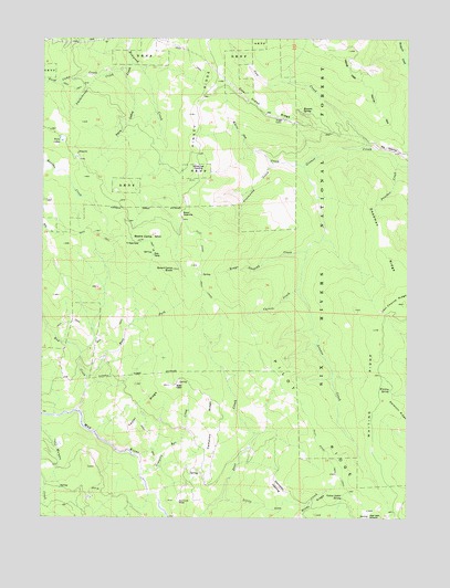
Board Camp Mountain, CA USGS Topographic Map
Click on map above to begin viewing in our Map Viewer.

This topographic map contains these locations and features:
Feature Name Type Latitude Longitude GNIS ID View Map
Big OpeningFlatN40.7215°W123.6334°256977View Map
Board Camp ButteSummitN40.6899°W123.7062°257297View Map
Board Camp MountainSummitN40.6974°W123.7181°257298View Map
Brays OpeningFlatN40.7040°W123.7034°257438View Map
Brays Opening CreekStreamN40.6943°W123.6603°257439View Map
Cameron RidgeRidgeN40.6501°W123.6931°257843View Map
Carson CreekStreamN40.6846°W123.6628°258002View Map
Cow CreekStreamN40.7224°W123.6403°258802View Map
Cow Creek RidgeRidgeN40.7321°W123.6775°258806View Map
Deadman RidgeRidgeN40.6965°W123.6364°259140View Map
Deer Creek RanchLocaleN40.6290°W123.7039°259224View Map
Delmont RidgeRidgeN40.6524°W123.6287°259267View Map
DinsmoresPopulated PlaceN40.7199°W123.7389°1658421View Map
East Fork Bug CreekStreamN40.6615°W123.7350°259714View Map
Fork CampLocaleN40.6935°W123.7131°260264View Map
Gravelly Bar CreekStreamN40.6379°W123.7164°260817View Map
Greenwood CreekStreamN40.7174°W123.6717°260881View Map
Grouse Creek Tractor TrailTrailN40.7376°W123.6400°260949View Map
Homers SpringSpringN40.7304°W123.6617°261430View Map
Kinsey RidgeRidgeN40.7407°W123.6900°262196View Map
Little Deer CreekStreamN40.6301°W123.6889°262582View Map
Nolan CabinLocaleN40.6599°W123.7031°264111View Map
Panther CreekStreamN40.7174°W123.6295°264474View Map
Ridge CabinLocaleN40.7287°W123.6689°265416View Map
Smokehouse CreekStreamN40.7421°W123.7234°267274View Map
Snow Camp CreekStreamN40.7421°W123.7223°267307View Map
Starvation OpeningFlatN40.6332°W123.6700°267693View Map
Taylor RidgeRidgeN40.6521°W123.7175°268110View Map
Tri Board CampLocaleN40.6971°W123.7220°268403View Map
Twin LakesLakeN40.7237°W123.7451°268528View Map
Twin Lakes CreekStreamN40.7432°W123.7203°268537View Map
White Oak CreekStreamN40.7165°W123.6614°269010View Map
White Oak OpeningFlatN40.7157°W123.6975°269011View Map
Whiting RidgeRidgeN40.6568°W123.6356°269038View Map
Whiting SpringSpringN40.6584°W123.6321°269039View Map
Yellow Jacket SpringSpringN40.6296°W123.6488°269347View Map

Note: Coordinates in the location and feature list above are referenced to NAD83 datum.


Copyright (C) 2008-2025 Ryan Niemi / Sunset Dynamics ... All Rights Reserved