TopoQuest Logo
Do you find TopoQuest useful?
Help keep TopoQuest running and adding new maps/features by donating!
Bitcoin:  19c7KJd3qBynnjoSw5npx9KScwjBe4ifkT
Litecoin:  LXs6TkuXGGXo1vDsWCkWVdjQX94eUKd6ui
Home View Maps Find Maps Find Places Resources & Links


Groveton West, Texas Topographic Map

USGS Map Title: Groveton West, TX
USGS Map MRC: 31095A2
DRG (GeoTIFF) Download: o31095a2.tif


Neighboring USGS Topographic Map Quads:


  Fodice, TX  
31095B3
 

  Pennington, TX  
31095B2
 

  Crecy, TX  
31095B1
 

  Glendale, TX  
31095A3
 

  Groveton West, TX  
31095A2
 

  Groveton East, TX  
31095A1
 

  Trinity East, TX  
30095H3
 

  Chita, TX  
30095H2
 

  Colita, TX  
30095H1


Map MRC Location:

N32°
W96°
N32°
W95°
H8 H7 H6 H5 H4 H3 H2 H1
G8 G7 G6 G5 G4 G3 G2 G1
F8 F7 F6 F5 F4 F3 F2 F1
E8 E7 E6 E5 E4 E3 E2 E1
D8 D7 D6 D5 D4 D3 D2 D1
C8 C7 C6 C5 C4 C3 C2 C1
B8 B7 B6 B5 B4 B3 B2 B1
A8 A7 A6 A5 A4 A3 A2 A1
N31°
W96°
N31°
W95°

Groveton West, TX USGS 1:24K Topographic Map Preview:
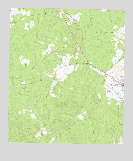
Groveton West, TX USGS Topographic Map
Click on map above to begin viewing in our Map Viewer.

This topographic map contains these locations and features:
Feature Name Type Latitude Longitude GNIS ID View Map
Avery LakeLakeN31.0474°W95.1324°1381347View Map
Boontown CemeteryCemeteryN31.0721°W95.2335°1381486View Map
City of GrovetonCivilN31.0572°W95.1269°2410670View Map
Dean CemeteryCemeteryN31.0252°W95.1997°1381750View Map
Ellis Prairie CemeteryCemeteryN31.1113°W95.2469°1381840View Map
Glenwood CemeteryCemeteryN31.0641°W95.1288°1381916View Map
GrovetonPopulated PlaceN31.0549°W95.1258°1381950View Map
Groveton City HallBuildingN31.0541°W95.1269°2753971View Map
Groveton DivisionCivilN31.0445°W95.1712°1938808View Map
Groveton Elementary SchoolSchoolN31.0594°W95.1263°2009107View Map
Groveton Fire StationBuildingN31.0548°W95.1288°2655205View Map
Groveton Police DepartmentBuildingN31.0541°W95.1269°2751306View Map
Groveton Post OfficePost OfficeN31.0561°W95.1254°2732119View Map
Groveton-Trinity County AirportAirportN31.0840°W95.1649°1384801View Map
Lower Lake AveryReservoirN31.0460°W95.1312°1855229View Map
Lower Lake Avery DamDamN31.0452°W95.1302°1855228View Map
New Light ChurchChurchN31.0821°W95.1991°1382390View Map
Parker Ridge CemeteryCemeteryN31.0416°W95.1513°1382460View Map
Rose Hill ChurchChurchN31.0494°W95.1410°1382653View Map
Trinity CountyCivilN31.0888°W95.1355°1384013View Map
Trinity County JailBuildingN31.0560°W95.1270°2738690View Map
Trinity County ParkParkN31.0735°W95.1633°2030051View Map
Trinity County Sheriff's OfficeBuildingN31.0553°W95.1271°2751152View Map
Upper Lake AveryReservoirN31.0478°W95.1335°1855227View Map
Upper Lake Avery DamDamN31.0485°W95.1319°1855226View Map
WestvillePopulated PlaceN31.0724°W95.1888°1382942View Map
White Oak CreekStreamN31.0171°W95.2163°1382952View Map

Note: Coordinates in the location and feature list above are referenced to NAD83 datum.


Copyright (C) 2008-2025 Ryan Niemi / Sunset Dynamics ... All Rights Reserved