TopoQuest Logo
Do you find TopoQuest useful?
Help keep TopoQuest running and adding new maps/features by donating!
Bitcoin:  19c7KJd3qBynnjoSw5npx9KScwjBe4ifkT
Litecoin:  LXs6TkuXGGXo1vDsWCkWVdjQX94eUKd6ui
Home View Maps Find Maps Find Places Resources & Links


Guage, Kentucky Topographic Map

USGS Map Title: Guage, KY
USGS Map MRC: 37083E2
DRG (GeoTIFF) Download: o37083e2.tif


Neighboring USGS Topographic Map Quads:


  Lee City, KY  
37083F3
 

  Seitz, KY  
37083F2
 

  Salyersville South, KY  
37083F1
 

  Quicksand, KY  
37083E3
 

  Guage, KY  
37083E2
 

  Tiptop, KY  
37083E1
 

  Haddix, KY  
37083D3
 

  Noble, KY  
37083D2
 

  Vest, KY  
37083D1


Map MRC Location:

N38°
W84°
N38°
W83°
H8 H7 H6 H5 H4 H3 H2 H1
G8 G7 G6 G5 G4 G3 G2 G1
F8 F7 F6 F5 F4 F3 F2 F1
E8 E7 E6 E5 E4 E3 E2 E1
D8 D7 D6 D5 D4 D3 D2 D1
C8 C7 C6 C5 C4 C3 C2 C1
B8 B7 B6 B5 B4 B3 B2 B1
A8 A7 A6 A5 A4 A3 A2 A1
N37°
W84°
N37°
W83°

Guage, KY USGS 1:24K Topographic Map Preview:
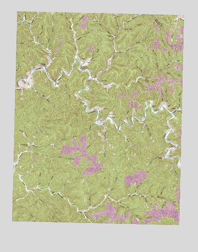
Guage, KY USGS Topographic Map
Click on map above to begin viewing in our Map Viewer.

This topographic map contains these locations and features:
Feature Name Type Latitude Longitude GNIS ID View Map
Allen Patton BranchStreamN37.6023°W83.1755°485871View Map
Alum Cave BranchStreamN37.5473°W83.1277°485905View Map
Big BranchStreamN37.5698°W83.1385°487112View Map
Big Caney ChurchChurchN37.5926°W83.2013°487149View Map
Big Caney CreekStreamN37.5856°W83.1955°487150View Map
Big Laurel BranchStreamN37.5926°W83.1438°487206View Map
Big Sourwood BranchStreamN37.5879°W83.1557°487257View Map
Big Sue BranchStreamN37.5870°W83.1538°487279View Map
Boat Gunwale BranchStreamN37.6065°W83.2341°487587View Map
Buck Lick BranchStreamN37.6165°W83.1732°488235View Map
Calhoun BranchStreamN37.5834°W83.2416°488606View Map
Calhoun CemeteryCemeteryN37.5851°W83.2424°488608View Map
Calico BranchStreamN37.5956°W83.1988°488612View Map
Camp LewisLocaleN37.5840°W83.1863°488703View Map
Carpenter CemeteryCemeteryN37.5679°W83.1452°488958View Map
Clemons CemeteryCemeteryN37.5601°W83.1852°489659View Map
Cook ForkStreamN37.5423°W83.2405°490006View Map
Crafts CemeteryCemeteryN37.6206°W83.1896°490257View Map
Deep Ford BranchStreamN37.5973°W83.1327°490756View Map
Eaf HollowValleyN37.5171°W83.1392°491404View Map
Fivemile BranchStreamN37.5151°W83.1346°492155View Map
Flat BranchStreamN37.5598°W83.1657°492175View Map
Fletcher ForkStreamN37.6195°W83.2438°492243View Map
Fourmile BranchStreamN37.5170°W83.1510°492383View Map
Fugate SchoolSchoolN37.5170°W83.2207°492601View Map
GuagePopulated PlaceN37.5962°W83.1971°508141View Map
Hade ForkStreamN37.5723°W83.1257°493532View Map
Hard CemeteryCemeteryN37.5409°W83.1349°493714View Map
Hard ForkStreamN37.6234°W83.1285°493715View Map
Harkin ForkStreamN37.6234°W83.1282°493745View Map
Hogston BranchStreamN37.6095°W83.2055°494365View Map
Holley BranchStreamN37.5559°W83.1721°494395View Map
Howard CemeteryCemeteryN37.5706°W83.1357°494659View Map
Howard SchoolSchoolN37.5698°W83.1477°494676View Map
Hunting CreekStreamN37.5923°W83.2280°494791View Map
Improvement BranchStreamN37.5584°W83.1843°494898View Map
Jims BranchStreamN37.5093°W83.1916°495278View Map
Jones BranchStreamN37.5179°W83.2385°495458View Map
Keith SchoolSchoolN37.5462°W83.1291°495609View Map
LambricPopulated PlaceN37.5687°W83.1304°508423View Map
Laurel BranchStreamN37.5170°W83.1793°496012View Map
Leatherwood CreekStreamN37.5184°W83.2363°496126View Map
Lick BranchStreamN37.5206°W83.2238°496419View Map
Lick BranchStreamN37.5398°W83.1313°496420View Map
Licking ForkStreamN37.6179°W83.2396°496524View Map
Little Caney CreekStreamN37.5859°W83.1902°496658View Map
Little Sue BranchStreamN37.5848°W83.1602°496871View Map
LunahPopulated PlaceN37.5626°W83.1768°508517View Map
Lynn ForkStreamN37.6209°W83.2096°497380View Map
McDaniel CemeteryCemeteryN37.5506°W83.2060°497834View Map
McQuinn CemeteryCemeteryN37.5923°W83.2010°497947View Map
Negro ForkStreamN37.6211°W83.2443°485694View Map
Old House BranchStreamN37.5184°W83.1582°499837View Map
Old Trace BranchStreamN37.5609°W83.1538°499890View Map
Open ForkStreamN37.5173°W83.2152°499945View Map
Peach Orchard BranchStreamN37.5687°W83.1263°500317View Map
Pond BranchStreamN37.6181°W83.2085°501031View Map
Press Howard Fork SchoolSchoolN37.5451°W83.2393°501295View Map
Richie BranchStreamN37.6112°W83.1757°501809View Map
Richie SchoolSchoolN37.6118°W83.1771°501810View Map
Risner BranchStreamN37.5818°W83.2193°501968View Map
Risner CemeteryCemeteryN37.5829°W83.2199°501970View Map
Roark CemeteryCemeteryN37.5979°W83.2018°502046View Map
RousseauPopulated PlaceN37.5931°W83.2296°508980View Map
Rousseau DivisionCivilN37.5684°W83.1703°1937226View Map
Russell CemeteryCemeteryN37.5651°W83.1779°502516View Map
Shack Allen CemeteryCemeteryN37.5712°W83.1977°503199View Map
Spicewood BranchStreamN37.5065°W83.1966°504071View Map
Spring Fork Quicksand CreekStreamN37.5665°W83.1327°504137View Map
Stacy BranchStreamN37.5212°W83.2313°504216View Map
Stacy CemeteryCemeteryN37.5684°W83.1838°504217View Map
Steer ForkStreamN37.5462°W83.2355°504324View Map
Sulphur Springs ForkStreamN37.5459°W83.2382°504772View Map
Tackett ForkStreamN37.6073°W83.2360°504910View Map
Twin BranchStreamN37.5404°W83.1374°505702View Map
Twomile BranchStreamN37.5915°W83.1382°505729View Map
Twomile ForkStreamN37.5134°W83.1713°505735View Map
Wells ForkPopulated PlaceN37.5379°W83.2093°509337View Map
Willow BranchStreamN37.5706°W83.1396°506857View Map
Winnie BranchStreamN37.5595°W83.1899°506952View Map
Winnie BranchStreamN37.6023°W83.2260°506953View Map
Wolf CreekStreamN37.5973°W83.2052°507000View Map
Wynn BranchStreamN37.6170°W83.1702°507179View Map

Note: Coordinates in the location and feature list above are referenced to NAD83 datum.


Copyright (C) 2008-2024 Ryan Niemi / Sunset Dynamics ... All Rights Reserved