TopoQuest Logo
Do you find TopoQuest useful?
Help keep TopoQuest running and adding new maps/features by donating!
Bitcoin:  19c7KJd3qBynnjoSw5npx9KScwjBe4ifkT
Litecoin:  LXs6TkuXGGXo1vDsWCkWVdjQX94eUKd6ui
Home View Maps Find Maps Find Places Resources & Links


Haddix, Kentucky Topographic Map

USGS Map Title: Haddix, KY
USGS Map MRC: 37083D3
DRG (GeoTIFF) Download: o37083d3.tif


Neighboring USGS Topographic Map Quads:


  Jackson, KY  
37083E4
 

  Quicksand, KY  
37083E3
 

  Guage, KY  
37083E2
 

  Canoe, KY  
37083D4
 

  Haddix, KY  
37083D3
 

  Noble, KY  
37083D2
 

  Buckhorn, KY  
37083C4
 

  Krypton, KY  
37083C3
 

  Hazard North, KY  
37083C2


Map MRC Location:

N38°
W84°
N38°
W83°
H8 H7 H6 H5 H4 H3 H2 H1
G8 G7 G6 G5 G4 G3 G2 G1
F8 F7 F6 F5 F4 F3 F2 F1
E8 E7 E6 E5 E4 E3 E2 E1
D8 D7 D6 D5 D4 D3 D2 D1
C8 C7 C6 C5 C4 C3 C2 C1
B8 B7 B6 B5 B4 B3 B2 B1
A8 A7 A6 A5 A4 A3 A2 A1
N37°
W84°
N37°
W83°

Haddix, KY USGS 1:24K Topographic Map Preview:
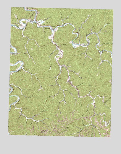
Haddix, KY USGS Topographic Map
Click on map above to begin viewing in our Map Viewer.

This topographic map contains these locations and features:
Feature Name Type Latitude Longitude GNIS ID View Map
Barge CreekStreamN37.4640°W83.2810°486340View Map
Barn BranchStreamN37.4223°W83.3668°486367View Map
Big BranchStreamN37.4790°W83.3593°487105View Map
Big Stone Gap Police DepartmentBuildingN37.4408°W83.2864°2085835View Map
Broadtree BranchStreamN37.3856°W83.2818°487935View Map
Broadtree HollowValleyN37.3955°W83.3594°487937View Map
Buckhorn Post Office (historical)Post OfficeN37.4574°W83.3457°2337584View Map
Campbell BranchStreamN37.4220°W83.2930°488727View Map
Campbell BranchStreamN37.4868°W83.3343°488728View Map
Campbell CemeteryCemeteryN37.4423°W83.3674°488735View Map
Caney CreekStreamN37.4059°W83.3691°488832View Map
Caney CreekStreamN37.4587°W83.2630°488840View Map
Caney SchoolSchoolN37.4573°W83.2641°488875View Map
ClayholePopulated PlaceN37.4673°W83.2974°507710View Map
Clayhole ChurchChurchN37.4662°W83.2791°489588View Map
Cockrell ForkStreamN37.4120°W83.2718°485674View Map
Combs CemeteryCemeteryN37.4484°W83.3155°489903View Map
CoplandPopulated PlaceN37.4548°W83.3691°507755View Map
Cow BranchStreamN37.4612°W83.3163°490172View Map
Dry Bread BranchStreamN37.4798°W83.3643°491163View Map
Elkbutt KnobSummitN37.3834°W83.3038°491682View Map
EnglePopulated PlaceN37.3862°W83.2705°507941View Map
Engle Post Office (historical)Post OfficeN37.3789°W83.2623°2557383View Map
Faith ChurchChurchN37.4584°W83.2624°491937View Map
Fishtrap BranchStreamN37.4237°W83.3743°492133View Map
FlintvillePopulated PlaceN37.4848°W83.3005°508016View Map
Fugate ForkStreamN37.4156°W83.2774°492598View Map
Ganderbill BranchStreamN37.4379°W83.3032°492671View Map
HaddixPopulated PlaceN37.4873°W83.3482°493525View Map
Haddix CemeteryCemeteryN37.4662°W83.3205°493527View Map
Haddix CemeteryCemeteryN37.4818°W83.3602°493528View Map
Haddix DivisionCivilN37.4323°W83.3700°1937039View Map
HardshellPopulated PlaceN37.4576°W83.2510°508184View Map
Hays BranchStreamN37.4820°W83.3124°493929View Map
Hen BranchStreamN37.3884°W83.3396°494021View Map
Hickory GapGapN37.4548°W83.3588°494124View Map
Hilltop ChurchChurchN37.4840°W83.3677°494281View Map
Hollybush BranchStreamN37.3854°W83.2693°512754View Map
John Littles BranchStreamN37.4415°W83.3613°495329View Map
Lane BranchStreamN37.4423°W83.3057°495966View Map
Leatherwood CreekStreamN37.4429°W83.3121°496124View Map
Left Fork Caney CreekStreamN37.3920°W83.3460°496206View Map
Levis BranchStreamN37.4768°W83.2752°496311View Map
LittlePopulated PlaceN37.4398°W83.3618°508475View Map
Little Leatherwood CreekStreamN37.4201°W83.3091°496783View Map
Lost CreekPopulated PlaceN37.4818°W83.3252°508507View Map
Lost CreekStreamN37.4779°W83.3224°497178View Map
MacIntosh ForkStreamN37.4215°W83.3121°497405View Map
McIntosh CemeteriesCemeteryN37.4698°W83.2793°497887View Map
Meadow BranchStreamN37.4261°W83.3165°497970View Map
Medlock CemeteryCemeteryN37.4418°W83.3591°498022View Map
Mill BranchStreamN37.4612°W83.3166°498205View Map
Mullins BranchStreamN37.3793°W83.2874°499090View Map
Mullins HollowValleyN37.3896°W83.3340°499098View Map
Neace Memorial ChurchChurchN37.4040°W83.2691°499192View Map
NedPopulated PlaceN37.4084°W83.2707°508680View Map
New Bethlehem ChurchChurchN37.4704°W83.2796°499291View Map
New Bethlehem ChurchChurchN37.4812°W83.2893°499292View Map
Nix BranchStreamN37.4659°W83.2680°499489View Map
Oatspatch HollowValleyN37.3912°W83.3518°499763View Map
Orchard BranchStreamN37.4001°W83.3591°499977View Map
Orchard HollowValleyN37.4883°W83.3115°499987View Map
Perkins BranchStreamN37.4076°W83.2732°500406View Map
Pilgrim Rest ChurchChurchN37.4309°W83.3160°500632View Map
Polly ForkStreamN37.4548°W83.2810°501013View Map
Right Fork John Littles BranchStreamN37.4345°W83.3474°501893View Map
Right Fork Leatherwood CreekStreamN37.4104°W83.3074°501897View Map
Riley BranchStreamN37.4645°W83.2891°501954View Map
Riverside Christian Training SchoolSchoolN37.4798°W83.3257°501989View Map
Roberts CemeteryCemeteryN37.4551°W83.3127°502064View Map
Rockhouse ForkStreamN37.3879°W83.2730°515048View Map
RooseveltPopulated PlaceN37.4062°W83.3668°508967View Map
Russell BranchStreamN37.4754°W83.2696°502501View Map
Rye Cove BranchStreamN37.4948°W83.3438°502539View Map
Saw BranchStreamN37.3823°W83.2855°503008View Map
Short ForkStreamN37.4195°W83.3596°503450View Map
Spring ForkStreamN37.4573°W83.2824°504134View Map
Stillhouse BranchStreamN37.4862°W83.3432°504408View Map
Strong BranchStreamN37.4140°W83.2891°504597View Map
Strong CemeteryCemeteryN37.4793°W83.3171°504598View Map
Teapoint CemeteriesCemeteryN37.4659°W83.2824°517041View Map
TenmileLocaleN37.3810°W83.2867°2557385View Map
Tenmile CreekStreamN37.3987°W83.2693°515891View Map
Tenmile School (historical)SchoolN37.3868°W83.2708°2557387View Map
Thorpe CemeteryCemeteryN37.4834°W83.3357°505230View Map
Trace BranchStreamN37.4329°W83.3160°505408View Map
Troublesome CreekStreamN37.4856°W83.3460°505515View Map
Tumbling BranchStreamN37.4818°W83.3352°505564View Map
Turner CemeteryCemeteryN37.4356°W83.3727°505655View Map
Turnippatch HollowValleyN37.3895°W83.3440°505676View Map
WattsPopulated PlaceN37.4445°W83.3138°509325View Map
Watts Volunteer Fire DepartmentBuildingN37.4582°W83.3119°2637228View Map
Wendell H Ford AirportAirportN37.3875°W83.2626°517396View Map
Whick ChurchChurchN37.4201°W83.3724°506550View Map

Note: Coordinates in the location and feature list above are referenced to NAD83 datum.


Copyright (C) 2008-2024 Ryan Niemi / Sunset Dynamics ... All Rights Reserved