TopoQuest Logo
Do you find TopoQuest useful?
Help keep TopoQuest running and adding new maps/features by donating!
Bitcoin:  19c7KJd3qBynnjoSw5npx9KScwjBe4ifkT
Litecoin:  LXs6TkuXGGXo1vDsWCkWVdjQX94eUKd6ui
Home View Maps Find Maps Find Places Resources & Links


Gustin Coulee, Montana Topographic Map

USGS Map Title: Gustin Coulee, MT
USGS Map MRC: 48107H6
DRG (GeoTIFF) Download: o48107h6.tif


Neighboring USGS Topographic Map Quads:


  Morgan, MT  
48107H7
 

  Gustin Coulee, MT  
48107H6
 

  Pea Lake, MT  
48107H5
 

  Loring, MT  
48107G7
 

  Whitewater West, MT  
48107G6
 

  Whitewater East, MT  
48107G5


Map MRC Location:

N49°
W108°
N49°
W107°
H8 H7 H6 H5 H4 H3 H2 H1
G8 G7 G6 G5 G4 G3 G2 G1
F8 F7 F6 F5 F4 F3 F2 F1
E8 E7 E6 E5 E4 E3 E2 E1
D8 D7 D6 D5 D4 D3 D2 D1
C8 C7 C6 C5 C4 C3 C2 C1
B8 B7 B6 B5 B4 B3 B2 B1
A8 A7 A6 A5 A4 A3 A2 A1
N48°
W108°
N48°
W107°

Gustin Coulee, MT USGS 1:24K Topographic Map Preview:
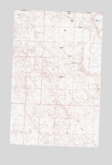
Gustin Coulee, MT USGS Topographic Map
Click on map above to begin viewing in our Map Viewer.

This topographic map contains these locations and features:
Feature Name Type Latitude Longitude GNIS ID View Map
3 Way Number 2 ReservoirReservoirN48.9358°W107.6808°800130View Map
37N30E24CC__01 WellWellN48.9611°W107.6937°1637199View Map
Ada ReservoirReservoirN48.8874°W107.6689°800127View Map
French Fry Number 2 DamDamN48.9817°W107.7140°797989View Map
Hilo ReservoirReservoirN48.9826°W107.6799°800133View Map
Kohola ReservoirReservoirN48.9918°W107.6297°800135View Map
Palea ReservoirReservoirN48.9850°W107.6515°800136View Map
Split Rock DamDamN48.9233°W107.6290°797663View Map
Titan ReservoirReservoirN48.9985°W107.6752°800134View Map
Tondra ReservoirReservoirN48.9584°W107.6723°800131View Map
Walchuk SpringSpringN48.9917°W107.6676°800129View Map
Waterfowl ReservoirReservoirN48.9642°W107.6840°800132View Map

Note: Coordinates in the location and feature list above are referenced to NAD83 datum.


Copyright (C) 2008-2025 Ryan Niemi / Sunset Dynamics ... All Rights Reserved