TopoQuest Logo
Do you find TopoQuest useful?
Help keep TopoQuest running and adding new maps/features by donating!
Bitcoin:  19c7KJd3qBynnjoSw5npx9KScwjBe4ifkT
Litecoin:  LXs6TkuXGGXo1vDsWCkWVdjQX94eUKd6ui
Home View Maps Find Maps Find Places Resources & Links


Guthrie Center West, Iowa Topographic Map

USGS Map Title: Guthrie Center West, IA
USGS Map MRC: 41094F5
DRG (GeoTIFF) Download: o41094f5.tif


Neighboring USGS Topographic Map Quads:


  Coon Rapids South, IA  
41094G6
 

  Bayard, IA  
41094G5
 

  Bagley, IA  
41094G4
 

  North Branch, IA  
41094F6
 

  Guthrie Center West, IA  
41094F5
 

  Guthrie Center East, IA  
41094F4
 

  Adair North, IA  
41094E6
 

  Casey, IA  
41094E5
 

  Menlo, IA  
41094E4


Map MRC Location:

N42°
W95°
N42°
W94°
H8 H7 H6 H5 H4 H3 H2 H1
G8 G7 G6 G5 G4 G3 G2 G1
F8 F7 F6 F5 F4 F3 F2 F1
E8 E7 E6 E5 E4 E3 E2 E1
D8 D7 D6 D5 D4 D3 D2 D1
C8 C7 C6 C5 C4 C3 C2 C1
B8 B7 B6 B5 B4 B3 B2 B1
A8 A7 A6 A5 A4 A3 A2 A1
N41°
W95°
N41°
W94°

Guthrie Center West, IA USGS 1:24K Topographic Map Preview:
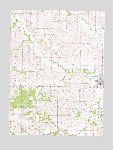
Guthrie Center West, IA USGS Topographic Map
Click on map above to begin viewing in our Map Viewer.

This topographic map contains these locations and features:
Feature Name Type Latitude Longitude GNIS ID View Map
Baker Number Two School (historical)SchoolN41.6728°W94.5100°1996089View Map
Bear Grove CemeteryCemeteryN41.6455°W94.6197°454425View Map
Christian ChurchChurchN41.6780°W94.5044°1996102View Map
Eye Care Associates CenterHospitalN41.6778°W94.5030°1996095View Map
First Baptist ChurchChurchN41.6783°W94.5025°1996104View Map
First United Methodist ChurchChurchN41.6767°W94.5025°1996103View Map
Frost CreekStreamN41.7386°W94.6147°456795View Map
Guthrie CenterPopulated PlaceN41.6772°W94.5033°457185View Map
Guthrie Center (historical)LocaleN41.6778°W94.5072°1996092View Map
Guthrie Center Elementary SchoolSchoolN41.6853°W94.5037°1996108View Map
Guthrie Center FairgroundsLocaleN41.6728°W94.5100°1996090View Map
Guthrie Center Feed Mill ElevatorLocaleN41.6833°W94.5086°1996084View Map
Guthrie Center Fire DepartmentBuildingN41.6773°W94.5071°1996088View Map
Guthrie Center LibraryBuildingN41.6789°W94.5033°1996087View Map
Guthrie Center Municipal Airport (historical)AirportN41.6819°W94.5127°466808View Map
Guthrie Center Post OfficePost OfficeN41.6777°W94.5020°1996093View Map
Guthrie CountyCivilN41.6838°W94.5011°465227View Map
Guthrie County CourthouseBuildingN41.6786°W94.5019°1996086View Map
Guthrie County Sheriff's OfficeBuildingN41.6787°W94.5019°1996085View Map
Guthrie Family Medicine CenterHospitalN41.6780°W94.5022°1996094View Map
Kingdom Hall of Jehovah's WitnessesChurchN41.6772°W94.5033°1996106View Map
Lone Grove CreekStreamN41.6753°W94.5800°458573View Map
Mada Post Office (historical)Post OfficeN41.7361°W94.6114°1996030View Map
Maplewood Cemetery (historical)CemeteryN41.6389°W94.5225°1996158View Map
Menefee FeedlotLocaleN41.7331°W94.5375°2611864View Map
Mitchell ParkParkN41.6750°W94.5086°459155View Map
Saint Mary's ChurchChurchN41.6786°W94.5008°1996098View Map
Seeley Creek TimberParkN41.6583°W94.6072°1996143View Map
Seely CreekStreamN41.6908°W94.5461°461499View Map
Sheeder Prairie State PreserveParkN41.6903°W94.5878°461550View Map
Township of BakerCivilN41.6451°W94.5703°467407View Map
Township of SeelyCivilN41.7324°W94.5704°468678View Map
Wesleyan ChurchChurchN41.6772°W94.5005°1996105View Map
WichitaPopulated PlaceN41.7333°W94.6041°463021View Map
Wichita CemeteryCemeteryN41.7319°W94.6152°463022View Map
Wichita Post Office (historical)Post OfficeN41.7333°W94.6041°1996031View Map

Note: Coordinates in the location and feature list above are referenced to NAD83 datum.


Copyright (C) 2008-2025 Ryan Niemi / Sunset Dynamics ... All Rights Reserved