TopoQuest Logo
Do you find TopoQuest useful?
Help keep TopoQuest running and adding new maps/features by donating!
Bitcoin:  19c7KJd3qBynnjoSw5npx9KScwjBe4ifkT
Litecoin:  LXs6TkuXGGXo1vDsWCkWVdjQX94eUKd6ui
Home View Maps Find Maps Find Places Resources & Links


Guthrie Center East, Iowa Topographic Map

USGS Map Title: Guthrie Center East, IA
USGS Map MRC: 41094F4
DRG (GeoTIFF) Download: o41094f4.tif


Neighboring USGS Topographic Map Quads:


  Bayard, IA  
41094G5
 

  Bagley, IA  
41094G4
 

  Yale, IA  
41094G3
 

  Guthrie Center West, IA  
41094F5
 

  Guthrie Center East, IA  
41094F4
 

  Panora, IA  
41094F3
 

  Casey, IA  
41094E5
 

  Menlo, IA  
41094E4
 

  Stuart North, IA  
41094E3


Map MRC Location:

N42°
W95°
N42°
W94°
H8 H7 H6 H5 H4 H3 H2 H1
G8 G7 G6 G5 G4 G3 G2 G1
F8 F7 F6 F5 F4 F3 F2 F1
E8 E7 E6 E5 E4 E3 E2 E1
D8 D7 D6 D5 D4 D3 D2 D1
C8 C7 C6 C5 C4 C3 C2 C1
B8 B7 B6 B5 B4 B3 B2 B1
A8 A7 A6 A5 A4 A3 A2 A1
N41°
W95°
N41°
W94°

Guthrie Center East, IA USGS 1:24K Topographic Map Preview:
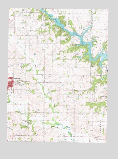
Guthrie Center East, IA USGS Topographic Map
Click on map above to begin viewing in our Map Viewer.

This topographic map contains these locations and features:
Feature Name Type Latitude Longitude GNIS ID View Map
Adair - Casey / Guthrie Center High SchoolSchoolN41.6709°W94.4951°1996107View Map
Brushy CreekStreamN41.6430°W94.4405°454898View Map
Bundt PrairieParkN41.7333°W94.4947°1996138View Map
City of Guthrie CenterCivilN41.6781°W94.4989°2394261View Map
FanslersPopulated PlaceN41.7494°W94.4558°456538View Map
Fanslers Post Office (historical)Post OfficeN41.7497°W94.4558°1996034View Map
Guthrie Center Golf ClubLocaleN41.6792°W94.4808°1996091View Map
Guthrie Center Junior High SchoolSchoolN41.6703°W94.4944°2719754View Map
Guthrie Center Seventh Day Adventist ChurchChurchN41.6800°W94.4927°1996099View Map
Guthrie County Care FacilityBuildingN41.6672°W94.4214°463426View Map
Guthrie County HospitalHospitalN41.6838°W94.4936°1996096View Map
Guthrie County Regional AirportAirportN41.6828°W94.4332°466809View Map
Immanuel Lutheran ChurchChurchN41.6844°W94.4950°1996100View Map
Knox Knolls CampLocaleN41.6436°W94.4755°1823119View Map
Lake PanoramaPopulated PlaceN41.7111°W94.3906°2631656View Map
Lake PanoramaReservoirN41.7219°W94.4094°1823140View Map
Lake Panorama Census Designated PlaceCensusN41.7199°W94.4026°2629969View Map
Lake Panorama DamDamN41.6958°W94.3808°463437View Map
Lake Panorama Golf CourseLocaleN41.7083°W94.4141°1996056View Map
Lake Panorama National ResortLocaleN41.7083°W94.4114°1996055View Map
Mason CreekStreamN41.6630°W94.4961°458842View Map
MonteithPopulated PlaceN41.6314°W94.4286°459189View Map
Monteith (historical)LocaleN41.6314°W94.4266°1996033View Map
Monteith CemeteryCemeteryN41.6311°W94.4347°1996167View Map
Monteith Memorial CemeteryCemeteryN41.6303°W94.4347°1996168View Map
Monteith Post Office (historical)Post OfficeN41.6314°W94.4286°1996032View Map
Open Bible ChurchChurchN41.6786°W94.4905°1996101View Map
Panorama Charter High SchoolSchoolN41.6922°W94.3752°2719818View Map
Panorama Elementary SchoolSchoolN41.6959°W94.3753°1996054View Map
Panorama High SchoolSchoolN41.6925°W94.3753°1823194View Map
Panorama Middle SchoolSchoolN41.6929°W94.3752°2719921View Map
Presbyterian ChurchChurchN41.6769°W94.5000°1996097View Map
Resurrection CemeteryCemeteryN41.6875°W94.4552°1823120View Map
Township of ValleyCivilN41.6473°W94.4584°468852View Map
Township of VictoryCivilN41.7325°W94.4546°468868View Map
Union CemeteryCemeteryN41.6803°W94.4897°1823121View Map
Valley Township CemeteryCemeteryN41.6814°W94.4889°1823118View Map
Van Order Cemetery (historical)CemeteryN41.7222°W94.4447°1996157View Map
Vandevanter Cemetery (historical)CemeteryN41.7250°W94.4252°1996156View Map
Victory Union CemeteryCemeteryN41.7280°W94.4736°462568View Map
West CemeteryCemeteryN41.6925°W94.3774°462831View Map

Note: Coordinates in the location and feature list above are referenced to NAD83 datum.


Copyright (C) 2008-2025 Ryan Niemi / Sunset Dynamics ... All Rights Reserved