TopoQuest Logo
Do you find TopoQuest useful?
Help keep TopoQuest running and adding new maps/features by donating!
Bitcoin:  19c7KJd3qBynnjoSw5npx9KScwjBe4ifkT
Litecoin:  LXs6TkuXGGXo1vDsWCkWVdjQX94eUKd6ui
Home View Maps Find Maps Find Places Resources & Links


Aurora West, Nebraska Topographic Map

USGS Map Title: Aurora West, NE
USGS Map MRC: 40098G1
DRG (GeoTIFF) Download: o40098g1.tif


Neighboring USGS Topographic Map Quads:


  Phillips, NE  
40098H2
 

  Murphy, NE  
40098H1
 

  Hampton, NE  
40097H8
 

  Giltner, NE  
40098G2
 

  Aurora West, NE  
40098G1
 

  Aurora East, NE  
40097G8
 

  Harvard NW, NE  
40098F2
 

  Harvard NE, NE  
40098F1
 

  Stockham, NE  
40097F8


Map MRC Location:

N41°
W99°
N41°
W98°
H8 H7 H6 H5 H4 H3 H2 H1
G8 G7 G6 G5 G4 G3 G2 G1
F8 F7 F6 F5 F4 F3 F2 F1
E8 E7 E6 E5 E4 E3 E2 E1
D8 D7 D6 D5 D4 D3 D2 D1
C8 C7 C6 C5 C4 C3 C2 C1
B8 B7 B6 B5 B4 B3 B2 B1
A8 A7 A6 A5 A4 A3 A2 A1
N40°
W99°
N40°
W98°

Aurora West, NE USGS 1:24K Topographic Map Preview:
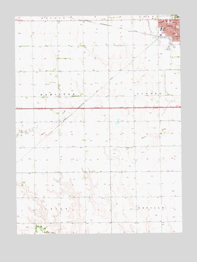
Aurora West, NE USGS Topographic Map
Click on map above to begin viewing in our Map Viewer.

This topographic map contains these locations and features:
Feature Name Type Latitude Longitude GNIS ID View Map
Aarons Field (historical)AirportN40.8625°W98.0645°837483View Map
Assembly of God ChurchChurchN40.8667°W98.0098°1881684View Map
AuroraLocaleN40.8631°W98.0156°1881668View Map
AuroraPopulated PlaceN40.8672°W98.0042°827118View Map
Aurora Cooperative Elevator Company ElevatorLocaleN40.8628°W98.0028°1881652View Map
Aurora Dental ClinicHospitalN40.8697°W98.0026°1881672View Map
Aurora MallLocaleN40.8706°W98.0109°1881649View Map
Aurora Police DepartmentBuildingN40.8656°W98.0012°1881661View Map
Aurora Post OfficePost OfficeN40.8675°W98.0039°1881666View Map
Aurora Public SchoolsSchoolN40.8667°W98.0142°1881690View Map
Aurora Volunteer Fire DepartmentBuildingN40.8657°W98.0007°1881653View Map
Baha'i FaithChurchN40.8689°W98.0014°1881682View Map
Central Park SquareParkN40.8683°W98.0020°1881692View Map
City of AuroraCivilN40.8644°W98.0072°2394036View Map
Coles ParkParkN40.8711°W98.0089°828260View Map
Deep Well Irrigation Historical MarkerParkN40.8728°W98.0017°1881691View Map
Election Precinct 4CivilN40.8356°W98.0394°1929187View Map
Evangelical Covenant ChurchChurchN40.8658°W98.0173°1881683View Map
Evangelical Free ChurchChurchN40.8575°W98.0017°1881678View Map
Faith Community ChurchChurchN40.8647°W98.0028°1881686View Map
First Christian ChurchChurchN40.8675°W98.0048°1881681View Map
Hamilton CountyCivilN40.8730°W98.0229°835862View Map
Hamilton County Ambulance ServiceBuildingN40.8660°W98.0009°2553736View Map
Hamilton County CourthouseBuildingN40.8681°W98.0023°1881693View Map
Hamilton County Courthouse Historical MarkerParkN40.8681°W98.0023°1881694View Map
Hamilton County FairgroundsLocaleN40.8556°W98.0087°1881689View Map
Hamilton County Sheriff's OfficeBuildingN40.8641°W98.0032°1881662View Map
Hamilton ManorHospitalN40.8711°W98.0134°1881674View Map
Hearn School (historical)SchoolN40.8706°W98.0064°829905View Map
Hospice of TabithaHospitalN40.8714°W98.0109°1881671View Map
KHNE-TV (Hastings)TowerN40.7714°W98.0898°837447View Map
Kostal DamDamN40.7549°W98.1013°1769816View Map
Kostal ReservoirLakeN40.7552°W98.0996°1769817View Map
Kostal-Hawthorne DamDamN40.7563°W98.1033°1766979View Map
Kostal-Hawthorne DamLakeN40.7592°W98.1040°1766980View Map
Memorial Community CareHospitalN40.8714°W98.0109°1881670View Map
Memorial Health ClinicHospitalN40.8706°W98.0120°1881673View Map
Memorial Health ClinicHospitalN40.8692°W98.0017°1881675View Map
Memorial HospitalHospitalN40.8713°W98.0107°1881669View Map
Memorial Hospital HeliportAirportN40.8683°W98.0148°837481View Map
Messiah Lutheran ChurchChurchN40.8664°W98.0039°1881680View Map
Miller School (historical)SchoolN40.8670°W98.0128°831325View Map
Modern Motel and Trailer ParkLocaleN40.8728°W98.0070°1881663View Map
Pleasant View ChurchChurchN40.8289°W98.0828°832252View Map
Prairie Gem CemeteryCemeteryN40.7992°W98.0367°832361View Map
Saint Marys Catholic ChurchChurchN40.8706°W98.0059°1881685View Map
Seaton CemeteryCemeteryN40.7569°W98.0875°833330View Map
Seventh Day Adventist ChurchChurchN40.8717°W98.0031°1881687View Map
South ParkParkN40.8636°W98.0031°833609View Map
Streeter ParkParkN40.8742°W98.0020°833859View Map
Streeter Park CampgroundLocaleN40.8731°W98.0031°1881667View Map
Township of HamiltonCivilN40.8278°W98.1087°1881656View Map
United Church of ChristChurchN40.8658°W98.0056°1881679View Map
United Methodist ChurchChurchN40.8575°W98.0031°1881677View Map
Village Square MallLocaleN40.8692°W98.0012°1881665View Map

Note: Coordinates in the location and feature list above are referenced to NAD83 datum.


Copyright (C) 2008-2025 Ryan Niemi / Sunset Dynamics ... All Rights Reserved