TopoQuest Logo
Do you find TopoQuest useful?
Help keep TopoQuest running and adding new maps/features by donating!
Bitcoin:  19c7KJd3qBynnjoSw5npx9KScwjBe4ifkT
Litecoin:  LXs6TkuXGGXo1vDsWCkWVdjQX94eUKd6ui
Home View Maps Find Maps Find Places Resources & Links


Stockham, Nebraska Topographic Map

USGS Map Title: Stockham, NE
USGS Map MRC: 40097F8
DRG (GeoTIFF) Download: o40097f8.tif


Neighboring USGS Topographic Map Quads:


  Aurora West, NE  
40098G1
 

  Aurora East, NE  
40097G8
 

  Henderson, NE  
40097G7
 

  Harvard NE, NE  
40098F1
 

  Stockham, NE  
40097F8
 

  Bixby, NE  
40097F7
 

  Harvard, NE  
40098E1
 

  Saronville, NE  
40097E8
 

  Sutton, NE  
40097E7


Map MRC Location:

N41°
W98°
N41°
W97°
H8 H7 H6 H5 H4 H3 H2 H1
G8 G7 G6 G5 G4 G3 G2 G1
F8 F7 F6 F5 F4 F3 F2 F1
E8 E7 E6 E5 E4 E3 E2 E1
D8 D7 D6 D5 D4 D3 D2 D1
C8 C7 C6 C5 C4 C3 C2 C1
B8 B7 B6 B5 B4 B3 B2 B1
A8 A7 A6 A5 A4 A3 A2 A1
N40°
W98°
N40°
W97°

Stockham, NE USGS 1:24K Topographic Map Preview:
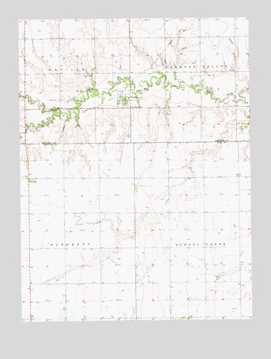
Stockham, NE USGS Topographic Map
Click on map above to begin viewing in our Map Viewer.

This topographic map contains these locations and features:
Feature Name Type Latitude Longitude GNIS ID View Map
EldoradoPopulated PlaceN40.6842°W97.9956°829041View Map
Eldorado Post Office (historical)Post OfficeN40.6842°W97.9956°1882371View Map
Election Precinct 1CivilN40.7419°W97.9399°1929166View Map
North Branch West Fork Big Blue RiverStreamN40.7111°W97.9781°831673View Map
Nuss DamDamN40.6878°W97.9128°1769914View Map
Nuss ReservoirReservoirN40.6873°W97.9148°1769915View Map
Rainwater Basin Wildlife Management DistrictParkN40.7222°W97.9864°1881603View Map
Sandpiper Federal Waterfowl Production AreaParkN40.6278°W97.9698°1882361View Map
StockhamPopulated PlaceN40.7161°W97.9398°833833View Map
Stockham (historical)LocaleN40.7192°W97.9448°1881648View Map
Stockham CemeteryCemeteryN40.7111°W97.9412°837260View Map
Stockham City School (historical)SchoolN40.7172°W97.9409°1881647View Map
Stockham Community ChurchChurchN40.7161°W97.9398°1881645View Map
Stockham Post Office (historical)Post OfficeN40.7161°W97.9398°1881646View Map
Township of EldoradoCivilN40.6550°W97.9951°837977View Map
Township of Farmers ValleyCivilN40.7417°W97.8809°1881659View Map
Township of OrvilleCivilN40.7417°W97.9948°1881660View Map
Township of School CreekCivilN40.6554°W97.8818°838235View Map
Village of StockhamCivilN40.7164°W97.9434°2399903View Map

Note: Coordinates in the location and feature list above are referenced to NAD83 datum.


Copyright (C) 2008-2025 Ryan Niemi / Sunset Dynamics ... All Rights Reserved