TopoQuest Logo
Do you find TopoQuest useful?
Help keep TopoQuest running and adding new maps/features by donating!
Bitcoin:  19c7KJd3qBynnjoSw5npx9KScwjBe4ifkT
Litecoin:  LXs6TkuXGGXo1vDsWCkWVdjQX94eUKd6ui
Home View Maps Find Maps Find Places Resources & Links


Austin, Oregon Topographic Map

USGS Map Title: Austin, OR
USGS Map MRC: 44118E4
DRG (GeoTIFF) Download: o44118e4.tif


Neighboring USGS Topographic Map Quads:


  Vinegar Hill, OR  
44118F5
 

  Greenhorn, OR  
44118F4
 

  Whitney, OR  
44118F3
 

  Bates, OR  
44118E5
 

  Austin, OR  
44118E4
 

  Pogue Point, OR  
44118E3
 

  Isham Creek, OR  
44118D5
 

  Deardorff Mountain, OR  
44118D4
 

  Rail Gulch, OR  
44118D3


Map MRC Location:

N45°
W119°
N45°
W118°
H8 H7 H6 H5 H4 H3 H2 H1
G8 G7 G6 G5 G4 G3 G2 G1
F8 F7 F6 F5 F4 F3 F2 F1
E8 E7 E6 E5 E4 E3 E2 E1
D8 D7 D6 D5 D4 D3 D2 D1
C8 C7 C6 C5 C4 C3 C2 C1
B8 B7 B6 B5 B4 B3 B2 B1
A8 A7 A6 A5 A4 A3 A2 A1
N44°
W119°
N44°
W118°

Austin, OR USGS 1:24K Topographic Map Preview:
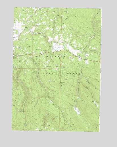
Austin, OR USGS Topographic Map
Click on map above to begin viewing in our Map Viewer.

This topographic map contains these locations and features:
Feature Name Type Latitude Longitude GNIS ID View Map
AustinPopulated PlaceN44.6027°W118.4966°1137344View Map
Austin Post Office (historical)Post OfficeN44.6027°W118.4966°1164870View Map
Big SpringsSpringN44.5502°W118.4447°1138081View Map
Bjerkson FlatFlatN44.5779°W118.3958°1138170View Map
Blue Mountain Work CenterBuildingN44.5757°W118.4947°1138324View Map
Camp FlatFlatN44.5785°W118.4591°1139244View Map
Camp Noxage SpringSpringN44.5647°W118.4295°1139261View Map
Crawford CreekStreamN44.5868°W118.4472°1140412View Map
Dry Fork Clear CreekStreamN44.5760°W118.4916°1141327View Map
Fisks Post Office (historical)Post OfficeN44.6096°W118.4649°1638253View Map
Fly CreekStreamN44.6113°W118.3866°1142269View Map
Frosty GulchValleyN44.5202°W118.4480°1142510View Map
Frosty MeadowFlatN44.5007°W118.4561°1145266View Map
Idaho CreekStreamN44.5824°W118.4038°1143980View Map
Japanese MeadowFlatN44.6216°W118.4241°1144225View Map
Little Phipps CreekStreamN44.5824°W118.4413°1153778View Map
Mill CreekStreamN44.6007°W118.4930°1146240View Map
Newtons (historical)LocaleN44.5971°W118.4599°1153777View Map
Olmstead CreekStreamN44.5496°W118.4058°1147217View Map
Olmstead MeadowFlatN44.5268°W118.3794°1147218View Map
Papoose CreekStreamN44.5565°W118.4033°1147406View Map
Penola Post Office (historical)Post OfficeN44.5839°W118.4406°1164591View Map
Phipps CreekStreamN44.5827°W118.4394°1147640View Map
Phipps MeadowFlatN44.5843°W118.4372°1147641View Map
Quaking Aspen SpringSpringN44.5653°W118.4517°1148077View Map
Rock Creek SpringSpringN44.5613°W118.3828°1156170View Map
Rock SpringSpringN44.6182°W118.3840°1148631View Map
Savage CreekStreamN44.5065°W118.3924°1149086View Map
Section Corner SpringSpringN44.5486°W118.4322°1149214View Map
Sheep CreekStreamN44.5349°W118.4061°1149322View Map
Sixteen GulchValleyN44.6154°W118.4352°1149573View Map
Steamboat SpringSpringN44.5057°W118.4166°1150380View Map
Sullens Cow CampLocaleN44.5760°W118.4074°1150569View Map
Summit CreekStreamN44.5846°W118.4299°1150614View Map
Summit SpringSpringN44.5647°W118.4356°1150643View Map
Twin PondsLakeN44.6073°W118.4518°1151578View Map
Wíwaanaytt CreekStreamN44.5846°W118.4299°1150254View Map
Wíwaanaytt MeadowFlatN44.5213°W118.4091°1150283View Map
Wood Camp SpringSpringN44.5524°W118.4222°1152618View Map

Note: Coordinates in the location and feature list above are referenced to NAD83 datum.


Copyright (C) 2008-2024 Ryan Niemi / Sunset Dynamics ... All Rights Reserved