TopoQuest Logo
Do you find TopoQuest useful?
Help keep TopoQuest running and adding new maps/features by donating!
Bitcoin:  19c7KJd3qBynnjoSw5npx9KScwjBe4ifkT
Litecoin:  LXs6TkuXGGXo1vDsWCkWVdjQX94eUKd6ui
Home View Maps Find Maps Find Places Resources & Links


Rail Gulch, Oregon Topographic Map

USGS Map Title: Rail Gulch, OR
USGS Map MRC: 44118D3
DRG (GeoTIFF) Download: o44118d3.tif


Neighboring USGS Topographic Map Quads:


  Austin, OR  
44118E4
 

  Pogue Point, OR  
44118E3
 

  Unity Reservoir, OR  
44118E2
 

  Deardorff Mountain, OR  
44118D4
 

  Rail Gulch, OR  
44118D3
 

  Unity, OR  
44118D2
 

  Little Baldy Mountain, OR  
44118C4
 

  Bullrun Rock, OR  
44118C3
 

  Rastus Mountain, OR  
44118C2


Map MRC Location:

N45°
W119°
N45°
W118°
H8 H7 H6 H5 H4 H3 H2 H1
G8 G7 G6 G5 G4 G3 G2 G1
F8 F7 F6 F5 F4 F3 F2 F1
E8 E7 E6 E5 E4 E3 E2 E1
D8 D7 D6 D5 D4 D3 D2 D1
C8 C7 C6 C5 C4 C3 C2 C1
B8 B7 B6 B5 B4 B3 B2 B1
A8 A7 A6 A5 A4 A3 A2 A1
N44°
W119°
N44°
W118°

Rail Gulch, OR USGS 1:24K Topographic Map Preview:
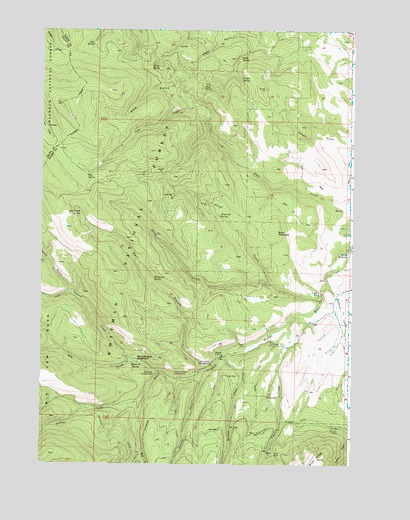
Rail Gulch, OR USGS Topographic Map
Click on map above to begin viewing in our Map Viewer.

This topographic map contains these locations and features:
Feature Name Type Latitude Longitude GNIS ID View Map
Alder SpringSpringN44.4888°W118.3478°1153970View Map
Amelia CreekStreamN44.4124°W118.2749°1137184View Map
Barney CreekStreamN44.4068°W118.3013°1137537View Map
Bear CreekStreamN44.3785°W118.3347°1137683View Map
Buck MountainSummitN44.4418°W118.2805°1138802View Map
Bullrun CreekStreamN44.4274°W118.2602°1138940View Map
Bullrun MineMineN44.3843°W118.2547°1138941View Map
Cavin DitchCanalN44.4241°W118.2510°1153973View Map
Cavin SwampSwampN44.4185°W118.2647°1153972View Map
Cold SpringSpringN44.4958°W118.3551°1139939View Map
Curup SpringSpringN44.4893°W118.3317°1140567View Map
Eldorado DitchCanalN44.3841°W118.3485°1141723View Map
Elk CreekStreamN44.4049°W118.3388°1141753View Map
Elk Creek Recreation SiteLocaleN44.4007°W118.3291°1141767View Map
Last Chance CreekStreamN44.4016°W118.3274°1144846View Map
Mahogany SpringSpringN44.4291°W118.3296°1145751View Map
Mammoth SpringSpringN44.4040°W118.3365°1145782View Map
Mammoth Spring Recreation SiteLocaleN44.4032°W118.3363°1167374View Map
Maple SpringSpringN44.4925°W118.2954°1145796View Map
Orion MineMineN44.3777°W118.2808°1147272View Map
Pluto SpringSpringN44.4840°W118.3104°1147811View Map
Pole GulchValleyN44.4788°W118.3155°1147854View Map
Pole SpringSpringN44.4575°W118.3571°1147858View Map
Powell SpringSpringN44.4860°W118.2953°1147967View Map
Rail GulchValleyN44.4018°W118.3105°1148156View Map
Rail Gulch SpringSpringN44.4476°W118.3596°1148157View Map
Sheep CreekStreamN44.4243°W118.2624°1149321View Map
Sheep SpringSpringN44.4223°W118.3539°1153971View Map
South Fork Recreation SiteLocaleN44.4035°W118.3066°1149944View Map
Spring CreekStreamN44.3929°W118.3352°1150177View Map
Steep CreekStreamN44.4266°W118.2827°1150392View Map
Stevens CreekStreamN44.4021°W118.3088°1150416View Map
Stevens Creek Recreation SiteLocaleN44.4004°W118.3210°1156237View Map
Tamarack SpringSpringN44.4470°W118.3038°1150879View Map
Tamarack Spring Campground (historical)LocaleN44.4149°W118.3035°1153969View Map
Thirsty GulchValleyN44.4243°W118.3630°1151065View Map

Note: Coordinates in the location and feature list above are referenced to NAD83 datum.


Copyright (C) 2008-2025 Ryan Niemi / Sunset Dynamics ... All Rights Reserved