TopoQuest Logo
Do you find TopoQuest useful?
Help keep TopoQuest running and adding new maps/features by donating!
Bitcoin:  19c7KJd3qBynnjoSw5npx9KScwjBe4ifkT
Litecoin:  LXs6TkuXGGXo1vDsWCkWVdjQX94eUKd6ui
Home View Maps Find Maps Find Places Resources & Links


Hallock, Minnesota Topographic Map

USGS Map Title: Hallock, MN
USGS Map MRC: 48096G8
DRG (GeoTIFF) Download: o48096g8.tif


Neighboring USGS Topographic Map Quads:


  Humboldt, MN  
48097H1
 

  Orleans, MN  
48096H8
 

  Hallock NE, MN  
48096H7
 

  Hill Siding, MN  
48097G1
 

  Hallock, MN  
48096G8
 

  Lancaster, MN  
48096G7
 

  Mattson, MN  
48097F1
 

  Kennedy, MN  
48096F8
 

  Enok, MN  
48096F7


Map MRC Location:

N49°
W97°
N49°
W96°
H8 H7 H6 H5 H4 H3 H2 H1
G8 G7 G6 G5 G4 G3 G2 G1
F8 F7 F6 F5 F4 F3 F2 F1
E8 E7 E6 E5 E4 E3 E2 E1
D8 D7 D6 D5 D4 D3 D2 D1
C8 C7 C6 C5 C4 C3 C2 C1
B8 B7 B6 B5 B4 B3 B2 B1
A8 A7 A6 A5 A4 A3 A2 A1
N48°
W97°
N48°
W96°

Hallock, MN USGS 1:24K Topographic Map Preview:
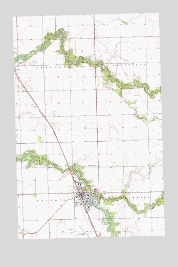
Hallock, MN USGS Topographic Map
Click on map above to begin viewing in our Map Viewer.

This topographic map contains these locations and features:
Feature Name Type Latitude Longitude GNIS ID View Map
Assembly of God ChurchChurchN48.7653°W96.9400°2107649View Map
City of HallockCivilN48.7661°W96.9429°2394269View Map
Grace Lutheran ChurchChurchN48.7731°W96.9433°2107648View Map
Grasshopper School (historical)SchoolN48.8614°W96.9303°2120442View Map
Greenwood CemeteryCemeteryN48.7720°W96.9325°644469View Map
HallockPopulated PlaceN48.7744°W96.9464°644582View Map
Hallock City Public LibraryBuildingN48.7750°W96.9453°2107636View Map
Hallock Fire DepartmentBuildingN48.7752°W96.9454°2107637View Map
Hallock Mission Covenant ChurchChurchN48.7731°W96.9392°2107647View Map
Hallock Municipal AirportAirportN48.7527°W96.9430°660200View Map
Hallock Police DepartmentBuildingN48.7739°W96.9444°2107638View Map
Hallock Post OfficePost OfficeN48.7750°W96.9444°2107641View Map
Hallock StationLocaleN48.7736°W96.9458°2107642View Map
Jerome School (historical)SchoolN48.7903°W96.9953°2120449View Map
Kittson Central High SchoolSchoolN48.7800°W96.9472°2107652View Map
Kittson County JailBuildingN48.7721°W96.9402°2758692View Map
Kittson County Sheriff's OfficeBuildingN48.7721°W96.9403°2107639View Map
Kittson County Volunteer Ambulance ServiceBuildingN48.7756°W96.9451°2721297View Map
Kittson Memorial ClinicHospitalN48.7672°W96.9392°2107650View Map
Kittson Memorial Healthcare CenterHospitalN48.7673°W96.9398°2107651View Map
Little Joe RiverStreamN48.8650°W96.9645°646825View Map
Maurice Sugden Flying Service Strip (historical)AirportN48.7894°W96.9362°660201View Map
Middle Branch Two RiversStreamN48.7728°W96.9303°647801View Map
Morrison CemeteryCemeteryN48.8525°W96.9975°2575847View Map
Oak View Catholic CemeteryCemeteryN48.8490°W96.9963°648862View Map
Presbyterian ChurchChurchN48.7783°W96.9469°2107646View Map
Rocket SpeedwayLocaleN48.7689°W96.9483°2107644View Map
Saint Patrick's Catholic ChurchChurchN48.7714°W96.9422°2107645View Map
South Branch Two RiversStreamN48.7728°W96.9303°652278View Map
Swanson CemeteryCemeteryN48.7716°W96.9368°2612460View Map
Tourist ParkParkN48.7767°W96.9417°2107640View Map
Township of HallockCivilN48.7601°W96.9994°664373View Map
Township of HampdenCivilN48.8473°W96.9965°664384View Map
Two Rivers DamDamN48.7516°W96.9353°1775910View Map
Viking Land TerracePopulated PlaceN48.7694°W96.9450°2107643View Map
West Granville School (historical)SchoolN48.8256°W96.8867°2120443View Map

Note: Coordinates in the location and feature list above are referenced to NAD83 datum.


Copyright (C) 2008-2025 Ryan Niemi / Sunset Dynamics ... All Rights Reserved