TopoQuest Logo
Do you find TopoQuest useful?
Help keep TopoQuest running and adding new maps/features by donating!
Bitcoin:  19c7KJd3qBynnjoSw5npx9KScwjBe4ifkT
Litecoin:  LXs6TkuXGGXo1vDsWCkWVdjQX94eUKd6ui
Home View Maps Find Maps Find Places Resources & Links


Mattson, Minnesota Topographic Map

USGS Map Title: Mattson, MN
USGS Map MRC: 48097F1
DRG (GeoTIFF) Download: o48097f1.tif


Neighboring USGS Topographic Map Quads:


  Joliette, ND  
48097G2
 

  Hill Siding, MN  
48097G1
 

  Hallock, MN  
48096G8
 

  Bowesmont, ND  
48097F2
 

  Mattson, MN  
48097F1
 

  Kennedy, MN  
48096F8
 

  Drayton, ND  
48097E2
 

  Drayton SE, MN  
48097E1
 

  Donaldson, MN  
48096E8


Map MRC Location:

N49°
W98°
N49°
W97°
H8 H7 H6 H5 H4 H3 H2 H1
G8 G7 G6 G5 G4 G3 G2 G1
F8 F7 F6 F5 F4 F3 F2 F1
E8 E7 E6 E5 E4 E3 E2 E1
D8 D7 D6 D5 D4 D3 D2 D1
C8 C7 C6 C5 C4 C3 C2 C1
B8 B7 B6 B5 B4 B3 B2 B1
A8 A7 A6 A5 A4 A3 A2 A1
N48°
W98°
N48°
W97°

Mattson, MN USGS 1:24K Topographic Map Preview:
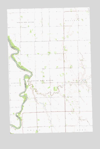
Mattson, MN USGS Topographic Map
Click on map above to begin viewing in our Map Viewer.

This topographic map contains these locations and features:
Feature Name Type Latitude Longitude GNIS ID View Map
County Ditch Number NineCanalN48.6308°W97.0026°642373View Map
County Ditch Number TwentyoneCanalN48.7486°W97.0728°641814View Map
Dahlgren School (historical)SchoolN48.6725°W97.0197°2120342View Map
MattsonPopulated PlaceN48.6894°W97.0737°654822View Map
Mattson Post Office (historical)Post OfficeN48.6894°W97.0733°2105644View Map
Mattson School (historical)SchoolN48.6892°W97.0739°2120341View Map
North Red River School (historical)SchoolN48.7317°W97.1064°2120339View Map
Red River CemeteryCemeteryN48.6599°W97.0360°2105776View Map
Red River ChurchChurchN48.6600°W97.0367°649874View Map
Tabitha ChurchChurchN48.7311°W97.1003°652974View Map
Tabitha Lutheran CemeteryCemeteryN48.7312°W97.1010°2105840View Map
Township of South Red RiverCivilN48.6747°W97.0754°665655View Map
Westerson School (historical)SchoolN48.7392°W97.0172°2120340View Map
Willow Grove School (historical)SchoolN48.6317°W97.0625°2120343View Map

Note: Coordinates in the location and feature list above are referenced to NAD83 datum.


Copyright (C) 2008-2025 Ryan Niemi / Sunset Dynamics ... All Rights Reserved