TopoQuest Logo
Do you find TopoQuest useful?
Help keep TopoQuest running and adding new maps/features by donating!
Bitcoin:  19c7KJd3qBynnjoSw5npx9KScwjBe4ifkT
Litecoin:  LXs6TkuXGGXo1vDsWCkWVdjQX94eUKd6ui
Home View Maps Find Maps Find Places Resources & Links


Hamburg, Arkansas Topographic Map

USGS Map Title: Hamburg, AR
USGS Map MRC: 33091B7
DRG (GeoTIFF) Download: o33091b7.tif


Neighboring USGS Topographic Map Quads:


  Milo, AR  
33091C8
 

  Fountain Hill, AR  
33091C7
 

  Mist, AR  
33091C6
 

  Crossett North, AR  
33091B8
 

  Hamburg, AR  
33091B7
 

  Wilmot NW, AR  
33091B6
 

  Crossett South, AR  
33091A8
 

  Berlin, AR  
33091A7
 

  Wilmot SW, AR  
33091A6


Map MRC Location:

N34°
W92°
N34°
W91°
H8 H7 H6 H5 H4 H3 H2 H1
G8 G7 G6 G5 G4 G3 G2 G1
F8 F7 F6 F5 F4 F3 F2 F1
E8 E7 E6 E5 E4 E3 E2 E1
D8 D7 D6 D5 D4 D3 D2 D1
C8 C7 C6 C5 C4 C3 C2 C1
B8 B7 B6 B5 B4 B3 B2 B1
A8 A7 A6 A5 A4 A3 A2 A1
N33°
W92°
N33°
W91°

Hamburg, AR USGS 1:24K Topographic Map Preview:
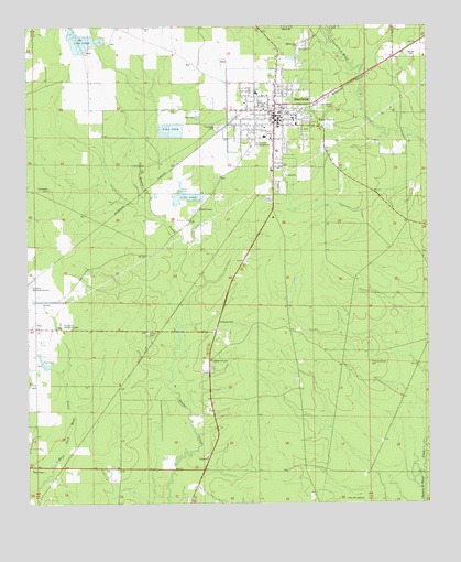
Hamburg, AR USGS Topographic Map
Click on map above to begin viewing in our Map Viewer.

This topographic map contains these locations and features:
Feature Name Type Latitude Longitude GNIS ID View Map
Allbritton Upper Elementary SchoolSchoolN33.2261°W91.7917°2039368View Map
Antioch CemeteryCemeteryN33.1376°W91.8198°62408View Map
Antioch Methodist ChurchChurchN33.1373°W91.8193°76174View Map
Ashley CountyCivilN33.1912°W91.7684°63756View Map
Ashley County CourthouseBuildingN33.2273°W91.7960°62331View Map
Ashley County Sheriff's OfficeBuildingN33.2291°W91.8133°2118697View Map
Buck BranchStreamN33.2485°W91.7804°47118View Map
Carter CemeteryCemeteryN33.1699°W91.8374°47490View Map
City of HamburgCivilN33.2248°W91.7974°2403784View Map
Evergreen CemeteryCemeteryN33.2073°W91.8682°48945View Map
First Baptist Church of HamburgChurchN33.2246°W91.7962°62332View Map
Gardner Baptist ChurchChurchN33.2301°W91.8065°62333View Map
HamburgPopulated PlaceN33.2282°W91.7976°77109View Map
Hamburg CemeteryCemeteryN33.2237°W91.8162°49798View Map
Hamburg Church of ChristChurchN33.2348°W91.7976°62334View Map
Hamburg Fire DepartmentBuildingN33.2266°W91.7957°2116524View Map
Hamburg High SchoolSchoolN33.2079°W91.7966°62409View Map
Hamburg Junior High SchoolSchoolN33.2088°W91.7941°62335View Map
Hamburg Lower Elementary SchoolSchoolN33.2237°W91.7962°62336View Map
Hamburg Police DepartmentBuildingN33.2267°W91.7955°2118696View Map
Hamburg Post OfficePost OfficeN33.2268°W91.7962°84142View Map
Hamburg Presbyterian ChurchChurchN33.2257°W91.7946°62337View Map
Hamburg United Methodist ChurchChurchN33.2248°W91.7979°62338View Map
Hamburg Upper Elementary SchoolSchoolN33.2246°W91.7910°62339View Map
Hollis ChapelChurchN33.2021°W91.8212°50204View Map
MartinvillePopulated PlaceN33.2440°W91.7907°62340View Map
Martinville Baptist ChurchChurchN33.2448°W91.7910°77608View Map
Noble Lower Elementary SchoolSchoolN33.2248°W91.7909°2039369View Map
Phillip Grove ChurchChurchN33.1623°W91.8182°53330View Map
Pine Street School (historical)SchoolN33.2326°W91.8035°62341View Map
Pinewood Memorial ParkCemeteryN33.1721°W91.8651°53474View Map
Pleasant Grove CemeteryCemeteryN33.1621°W91.7685°53526View Map
Pleasant Grove Church (historical)ChurchN33.1618°W91.7685°62410View Map
Rolfe Chapel Freewill Baptist ChurchChurchN33.1340°W91.8737°78210View Map
Southark Emergency Medical ServicesBuildingN33.2330°W91.7970°2119026View Map
Township of CarterCivilN33.2188°W91.7999°63674View Map

Note: Coordinates in the location and feature list above are referenced to NAD83 datum.


Copyright (C) 2008-2024 Ryan Niemi / Sunset Dynamics ... All Rights Reserved