TopoQuest Logo
Do you find TopoQuest useful?
Help keep TopoQuest running and adding new maps/features by donating!
Bitcoin:  19c7KJd3qBynnjoSw5npx9KScwjBe4ifkT
Litecoin:  LXs6TkuXGGXo1vDsWCkWVdjQX94eUKd6ui
Home View Maps Find Maps Find Places Resources & Links


Fountain Hill, Arkansas Topographic Map

USGS Map Title: Fountain Hill, AR
USGS Map MRC: 33091C7
DRG (GeoTIFF) Download: o33091c7.tif


Neighboring USGS Topographic Map Quads:


  Longview, AR  
33091D8
 

  Ladelle, AR  
33091D7
 

  Mist NW, AR  
33091D6
 

  Milo, AR  
33091C8
 

  Fountain Hill, AR  
33091C7
 

  Mist, AR  
33091C6
 

  Crossett North, AR  
33091B8
 

  Hamburg, AR  
33091B7
 

  Wilmot NW, AR  
33091B6


Map MRC Location:

N34°
W92°
N34°
W91°
H8 H7 H6 H5 H4 H3 H2 H1
G8 G7 G6 G5 G4 G3 G2 G1
F8 F7 F6 F5 F4 F3 F2 F1
E8 E7 E6 E5 E4 E3 E2 E1
D8 D7 D6 D5 D4 D3 D2 D1
C8 C7 C6 C5 C4 C3 C2 C1
B8 B7 B6 B5 B4 B3 B2 B1
A8 A7 A6 A5 A4 A3 A2 A1
N33°
W92°
N33°
W91°

Fountain Hill, AR USGS 1:24K Topographic Map Preview:
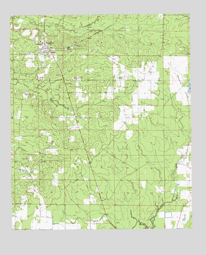
Fountain Hill, AR USGS Topographic Map
Click on map above to begin viewing in our Map Viewer.

This topographic map contains these locations and features:
Feature Name Type Latitude Longitude GNIS ID View Map
First Baptist Church of Fountain HillChurchN33.3537°W91.8485°62346View Map
Flat Creek CemeteryCemeteryN33.3554°W91.8360°49105View Map
Flat Creek Church (historical)ChurchN33.3551°W91.8354°62347View Map
Fountain HillPopulated PlaceN33.3579°W91.8504°76957View Map
Fountain Hill Elementary SchoolSchoolN33.3534°W91.8501°62348View Map
Fountain Hill Fire DepartmentBuildingN33.3564°W91.8478°2116452View Map
Fountain Hill High SchoolSchoolN33.3531°W91.8504°62349View Map
Fountain Hill Police DepartmentBuildingN33.3577°W91.8513°2118702View Map
Fountain PrairieAreaN33.3223°W91.7890°62350View Map
Judson CemeteryCemeteryN33.2902°W91.8548°62371View Map
Judson Missionary Baptist ChurchChurchN33.2898°W91.8549°77391View Map
Kirkpatrick CemeteryCemeteryN33.3582°W91.8521°50885View Map
Norris Hill CemeteryCemeteryN33.3568°W91.8257°52800View Map
RoarkPopulated PlaceN33.3618°W91.8201°57169View Map
Shiloh ChurchChurchN33.3362°W91.7871°54784View Map
Shiloh LakeReservoirN33.3401°W91.7635°80306View Map
Shiloh Lake DamDamN33.3401°W91.7635°80305View Map
Spring Hill CemeteryCemeteryN33.2658°W91.8729°55104View Map
Town of Fountain HillCivilN33.3577°W91.8511°2406513View Map
Township of WhiteCivilN33.3443°W91.8210°63685View Map

Note: Coordinates in the location and feature list above are referenced to NAD83 datum.


Copyright (C) 2008-2024 Ryan Niemi / Sunset Dynamics ... All Rights Reserved