TopoQuest Logo
Do you find TopoQuest useful?
Help keep TopoQuest running and adding new maps/features by donating!
Bitcoin:  19c7KJd3qBynnjoSw5npx9KScwjBe4ifkT
Litecoin:  LXs6TkuXGGXo1vDsWCkWVdjQX94eUKd6ui
Home View Maps Find Maps Find Places Resources & Links


Hamilton, Kansas Topographic Map

USGS Map Title: Hamilton, KS
USGS Map MRC: 37096H2
DRG (GeoTIFF) Download: o37096h2.tif


Neighboring USGS Topographic Map Quads:


  Thrall, KS  
38096A3
 

  Madison SW, KS  
38096A2
 

  Lamont, KS  
38096A1
 

  Eureka NE, KS  
37096H3
 

  Hamilton, KS  
37096H2
 

  Virgil, KS  
37096H1
 

  Eureka, KS  
37096G3
 

  Tonovay, KS  
37096G2
 

  Neal, KS  
37096G1


Map MRC Location:

N38°
W97°
N38°
W96°
H8 H7 H6 H5 H4 H3 H2 H1
G8 G7 G6 G5 G4 G3 G2 G1
F8 F7 F6 F5 F4 F3 F2 F1
E8 E7 E6 E5 E4 E3 E2 E1
D8 D7 D6 D5 D4 D3 D2 D1
C8 C7 C6 C5 C4 C3 C2 C1
B8 B7 B6 B5 B4 B3 B2 B1
A8 A7 A6 A5 A4 A3 A2 A1
N37°
W97°
N37°
W96°

Hamilton, KS USGS 1:24K Topographic Map Preview:
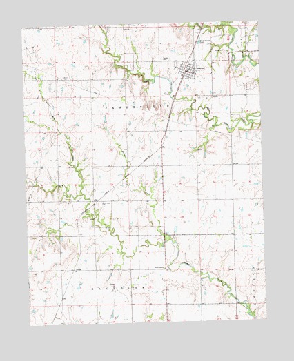
Hamilton, KS USGS Topographic Map
Click on map above to begin viewing in our Map Viewer.

This topographic map contains these locations and features:
Feature Name Type Latitude Longitude GNIS ID View Map
Chelsea TownshipStreamN37.9098°W96.1753°474434View Map
City of HamiltonCivilN37.9805°W96.1638°2394278View Map
Gaffney Oil FieldOilfieldN37.9731°W96.2406°474435View Map
Greenwood CountyCivilN37.8778°W96.2326°485003View Map
HamiltonPopulated PlaceN37.9795°W96.1642°474437View Map
Hamilton City LibraryBuildingN37.9794°W96.1635°2694762View Map
Hamilton Elementary SchoolSchoolN37.9833°W96.1587°480847View Map
Hamilton High SchoolSchoolN37.9831°W96.1590°480846View Map
Hamilton Post OfficePost OfficeN37.9793°W96.1631°2693753View Map
Hamilton Volunteer Fire DepartmentBuildingN37.9799°W96.1637°2111399View Map
Hamilton Wastewater PlantLocaleN37.9922°W96.1566°2691970View Map
Homer Creek CemeteryCemeteryN37.9260°W96.2097°474432View Map
King Ranch AirportAirportN37.9399°W96.2300°481392View Map
Onion CreekStreamN37.9997°W96.1425°474430View Map
Ott CemeteryCemeteryN37.9686°W96.1506°474436View Map
Township CemeteryCemeteryN37.9853°W96.1769°474438View Map
Township of JanesvilleCivilN37.9847°W96.1999°474443View Map
UtopiaPopulated PlaceN37.8978°W96.2242°484686View Map
Utopia Community ChurchChurchN37.8975°W96.1783°474431View Map
Wiggins Oil FieldOilfieldN37.9322°W96.2464°474433View Map

Note: Coordinates in the location and feature list above are referenced to NAD83 datum.


Copyright (C) 2008-2025 Ryan Niemi / Sunset Dynamics ... All Rights Reserved