TopoQuest Logo
Do you find TopoQuest useful?
Help keep TopoQuest running and adding new maps/features by donating!
Bitcoin:  19c7KJd3qBynnjoSw5npx9KScwjBe4ifkT
Litecoin:  LXs6TkuXGGXo1vDsWCkWVdjQX94eUKd6ui
Home View Maps Find Maps Find Places Resources & Links


Hampden Sydney, Virginia Topographic Map

USGS Map Title: Hampden Sydney, VA
USGS Map MRC: 37078B4
DRG (GeoTIFF) Download: o37078b4.tif


Neighboring USGS Topographic Map Quads:


  Prospect, VA  
37078C5
 

  Farmville, VA  
37078C4
 

  Rice, VA  
37078C3
 

  Abilene, VA  
37078B5
 

  Hampden Sydney, VA  
37078B4
 

  Green Bay, VA  
37078B3
 

  Eureka, VA  
37078A5
 

  Keysville, VA  
37078A4
 

  Meherrin, VA  
37078A3


Map MRC Location:

N38°
W79°
N38°
W78°
H8 H7 H6 H5 H4 H3 H2 H1
G8 G7 G6 G5 G4 G3 G2 G1
F8 F7 F6 F5 F4 F3 F2 F1
E8 E7 E6 E5 E4 E3 E2 E1
D8 D7 D6 D5 D4 D3 D2 D1
C8 C7 C6 C5 C4 C3 C2 C1
B8 B7 B6 B5 B4 B3 B2 B1
A8 A7 A6 A5 A4 A3 A2 A1
N37°
W79°
N37°
W78°

Hampden Sydney, VA USGS 1:24K Topographic Map Preview:
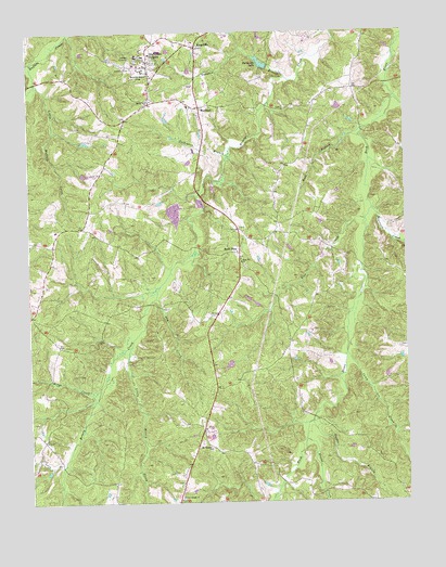
Hampden Sydney, VA USGS Topographic Map
Click on map above to begin viewing in our Map Viewer.

This topographic map contains these locations and features:
Feature Name Type Latitude Longitude GNIS ID View Map
Athletic ComplexLocaleN37.2453°W78.4589°2102443View Map
Atkinson HallBuildingN37.2413°W78.4594°1494324View Map
Bagby HallBuildingN37.2415°W78.4606°1494325View Map
Blake ApartmentsBuildingN37.2397°W78.4639°2102446View Map
Blake VillagePopulated PlaceN37.2399°W78.4636°1494326View Map
Burrell HouseBuildingN37.2417°W78.4567°2102447View Map
Cabell HouseBuildingN37.2408°W78.4597°2102448View Map
Camp CreekStreamN37.1643°W78.3950°1464320View Map
Carpenter DormitoryBuildingN37.2439°W78.4617°2102449View Map
Chalgrove LakeReservoirN37.2427°W78.4637°1492251View Map
College Presbyterian ChurchChurchN37.2427°W78.4589°1492254View Map
Cunninghams CreekStreamN37.2327°W78.3778°1465532View Map
Cushing HallBuildingN37.2438°W78.4608°1494327View Map
Dickinson BranchStreamN37.2171°W78.4336°1465780View Map
District 401CivilN37.1798°W78.4810°1927257View Map
Dry CreekStreamN37.1793°W78.4581°1465982View Map
Dupuy HouseBuildingN37.2414°W78.4572°2102453View Map
Eggleston LibraryBuildingN37.2415°W78.4628°1492259View Map
EscourtBuildingN37.2422°W78.4553°2102455View Map
Esther Atkinson MuseumBuildingN37.2403°W78.4597°2102456View Map
Evans CreekStreamN37.1415°W78.4092°1466356View Map
Farmville DamDamN37.2385°W78.4197°1490676View Map
Farmville LakeReservoirN37.2385°W78.4197°1502014View Map
Feldon School (historical)SchoolN37.1932°W78.4292°1492274View Map
Financial Aid BuildingBuildingN37.2417°W78.4583°2102457View Map
Fraternity CircleLocaleN37.2425°W78.4575°2102458View Map
Gammon GymnasiumBuildingN37.2443°W78.4589°1492279View Map
Gilmer HallBuildingN37.2415°W78.4642°1494328View Map
Goodes BranchStreamN37.1460°W78.4069°1467222View Map
Graham Hall Student CenterBuildingN37.2421°W78.4603°1494329View Map
Hampden - Sydney CollegeSchoolN37.2425°W78.4614°1467693View Map
Hampden - Sydney Volunteer Fire DepartmentBuildingN37.2363°W78.4602°2086056View Map
Hampden HouseBuildingN37.2453°W78.4611°2102462View Map
Hampden House HallsBuildingN37.2454°W78.4619°1494330View Map
Hampden House UnitsLocaleN37.2453°W78.4619°2102463View Map
Hampden SydneyPopulated PlaceN37.2424°W78.4597°1495648View Map
Hampden Sydney College Historic DistrictParkN37.2421°W78.4597°1492285View Map
Hampden Sydney Post OfficePost OfficeN37.2420°W78.4603°1492286View Map
Hampden Sydney School (historical)SchoolN37.2302°W78.4611°1492287View Map
Hampden-Sydney Census Designated PlaceCensusN37.2416°W78.4692°2389892View Map
Hundley StadiumParkN37.2454°W78.4589°1492291View Map
Johns AuditoriumBuildingN37.2413°W78.4617°1492298View Map
KingsvillePopulated PlaceN37.2460°W78.4439°1469029View Map
Kirby Field HouseBuildingN37.2452°W78.4556°1492299View Map
Lacy BranchStreamN37.1346°W78.4897°1469089View Map
Lane Chapel (historical)ChurchN37.1977°W78.4297°1492301View Map
Little Briery CreekStreamN37.1668°W78.4664°1469480View Map
Little Buffalo CreekStreamN37.2368°W78.4969°1469485View Map
Mercy Seat ChurchChurchN37.2318°W78.4589°1470364View Map
MiddlecourtBuildingN37.2404°W78.4619°1494331View Map
Mingo CreekStreamN37.1524°W78.4786°1470604View Map
Morton HallBuildingN37.2424°W78.4614°1494332View Map
Mount Pleasant CemeteryCemeteryN37.1388°W78.4405°1492314View Map
Mount Pleasant ChurchChurchN37.1390°W78.4403°1471037View Map
Mountain CreekStreamN37.2029°W78.3858°1471167View Map
New Bethel CemeteryCemeteryN37.1260°W78.4497°1492317View Map
New Bethel ChurchChurchN37.1265°W78.4497°1471396View Map
New Bethel School (historical)SchoolN37.1260°W78.4503°1492318View Map
New Wit CemeteryCemeteryN37.1876°W78.4283°1492319View Map
New Wit ChurchChurchN37.1890°W78.4294°1471504View Map
PenshurstBuildingN37.2404°W78.4597°1494333View Map
Penshurst LawnLocaleN37.2403°W78.4603°2102467View Map
Prince Edward CountyCivilN37.2243°W78.4411°1492359View Map
Providence AirportAirportN37.2246°W78.4181°1498666View Map
Redd BranchStreamN37.2243°W78.3883°1473070View Map
Redd ShopLocaleN37.1915°W78.4300°1473071View Map
RestoverBuildingN37.2415°W78.4586°1494334View Map
Restover BuildingBuildingN37.2414°W78.4589°2102468View Map
Rice CreekStreamN37.1999°W78.3881°1473175View Map
Seminary CemeteryCemeteryN37.2410°W78.4655°1474163View Map
Settle HallBuildingN37.2422°W78.4625°2102469View Map
Spring CreekStreamN37.2427°W78.4983°1474989View Map
Sterling LakeReservoirN37.1619°W78.4337°1490690View Map
Sterling Lake DamDamN37.1625°W78.4329°1490689View Map
Tanyard BranchStreamN37.2377°W78.4139°1475465View Map
The AlamoBuildingN37.2440°W78.4622°1494335View Map
The BirthplaceBuildingN37.2410°W78.4589°1494336View Map
The ForumBuildingN37.2460°W78.4600°1494337View Map
The MaplesBuildingN37.2404°W78.4636°1494338View Map
Venable HallBuildingN37.2404°W78.4611°1494339View Map
Watkins Bell TowerBuildingN37.2424°W78.4608°1494340View Map
Whitehouse HallBuildingN37.2440°W78.4636°1494341View Map
Whitehouse QuadrangleLocaleN37.2439°W78.4636°2102474View Map
Winston HallBuildingN37.2404°W78.4628°1494342View Map
WorshamPopulated PlaceN37.2302°W78.4431°1477899View Map
Worsham Baptist ChurchChurchN37.2243°W78.4419°1492355View Map
Worsham High School (historical)SchoolN37.2304°W78.4467°1492356View Map
WWHS-FM (Hampden-Sydney)TowerN37.2388°W78.4631°1498990View Map

Note: Coordinates in the location and feature list above are referenced to NAD83 datum.


Copyright (C) 2008-2024 Ryan Niemi / Sunset Dynamics ... All Rights Reserved