TopoQuest Logo
Do you find TopoQuest useful?
Help keep TopoQuest running and adding new maps/features by donating!
Bitcoin:  19c7KJd3qBynnjoSw5npx9KScwjBe4ifkT
Litecoin:  LXs6TkuXGGXo1vDsWCkWVdjQX94eUKd6ui
Home View Maps Find Maps Find Places Resources & Links


Meherrin, Virginia Topographic Map

USGS Map Title: Meherrin, VA
USGS Map MRC: 37078A3
DRG (GeoTIFF) Download: o37078a3.tif


Neighboring USGS Topographic Map Quads:


  Hampden Sydney, VA  
37078B4
 

  Green Bay, VA  
37078B3
 

  Crewe West, VA  
37078B2
 

  Keysville, VA  
37078A4
 

  Meherrin, VA  
37078A3
 

  Rubermont, VA  
37078A2
 

  Fort Mitchell, VA  
36078H4
 

  Lunenburg, VA  
36078H3
 

  Kenbridge West, VA  
36078H2


Map MRC Location:

N38°
W79°
N38°
W78°
H8 H7 H6 H5 H4 H3 H2 H1
G8 G7 G6 G5 G4 G3 G2 G1
F8 F7 F6 F5 F4 F3 F2 F1
E8 E7 E6 E5 E4 E3 E2 E1
D8 D7 D6 D5 D4 D3 D2 D1
C8 C7 C6 C5 C4 C3 C2 C1
B8 B7 B6 B5 B4 B3 B2 B1
A8 A7 A6 A5 A4 A3 A2 A1
N37°
W79°
N37°
W78°

Meherrin, VA USGS 1:24K Topographic Map Preview:
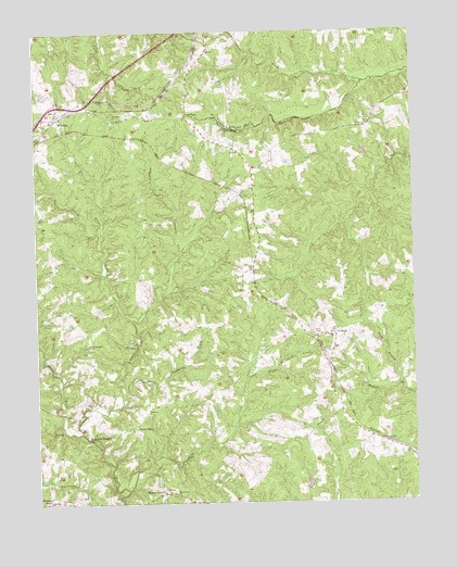
Meherrin, VA USGS Topographic Map
Click on map above to begin viewing in our Map Viewer.

This topographic map contains these locations and features:
Feature Name Type Latitude Longitude GNIS ID View Map
Arvins StorePopulated PlaceN37.0199°W78.3428°1492126View Map
Aryins StoreLocaleN37.0199°W78.3425°1462573View Map
Bethel ChurchChurchN37.1002°W78.2647°1463170View Map
Blakenship Mill PondReservoirN37.0933°W78.2658°1492134View Map
Bragg DamDamN37.0035°W78.2864°1490364View Map
Bruce CemeteryCemeteryN37.0896°W78.3683°1492136View Map
Brydies Store (historical)LocaleN37.0935°W78.3081°1492139View Map
Concord Church (historical)ChurchN37.0968°W78.2908°1492144View Map
Double BridgesLocaleN37.0179°W78.3575°1465901View Map
Laurel Hill (historical)Populated PlaceN37.0913°W78.2550°1492169View Map
Ledbetter ChurchChurchN37.0240°W78.3386°1469256View Map
Ledbetter CreekStreamN37.0179°W78.3575°1469257View Map
Levi ChurchChurchN37.1204°W78.3164°1469322View Map
Levi School (historical)SchoolN37.1210°W78.3167°1492307View Map
Little Ledbetter CreekStreamN37.0277°W78.3467°1469582View Map
Little Tussekiah CreekStreamN37.0329°W78.3053°1469677View Map
Macedonia ChurchChurchN37.0021°W78.3292°1469971View Map
MeherrinPopulated PlaceN37.1032°W78.3667°1470344View Map
Meherrin Post OfficePost OfficeN37.1049°W78.3631°1492308View Map
Meherrin River DistrictCivilN37.0493°W78.2814°1927401View Map
Meherrin Volunteer Fire / RescueBuildingN37.1015°W78.3691°2331657View Map
Meherrin Volunteer Fire and RescueBuildingN37.1017°W78.3691°2086148View Map
Moores CornerPopulated PlaceN37.0029°W78.3333°1477554View Map
Mount Moriah ChurchChurchN37.0446°W78.2769°1470940View Map
North Fork Nottoway RiverStreamN37.1118°W78.2664°1471614View Map
NutbushPopulated PlaceN37.0449°W78.2764°1496025View Map
Nutbush School (historical)SchoolN37.0310°W78.2786°1492195View Map
Pleasant GrovePopulated PlaceN37.0007°W78.3711°1477630View Map
Saint Matthews ChurchChurchN37.1018°W78.3489°1473847View Map
Saint Pauls ChurchChurchN37.1027°W78.3489°1473874View Map
ScholfieldPopulated PlaceN37.1029°W78.3247°1477722View Map
Sewish CreekStreamN37.0488°W78.3433°1474183View Map
Shady Grove Church (historical)ChurchN37.0127°W78.3656°1492217View Map
Spencer CemeteryCemeteryN37.0688°W78.3364°1492220View Map
Spring CreekStreamN37.0196°W78.3661°1474987View Map
Springfield ChurchChurchN37.0415°W78.3569°1475019View Map
Still BranchStreamN37.0321°W78.2544°1475139View Map
Tussekiah CreekStreamN37.0035°W78.3456°1492226View Map

Note: Coordinates in the location and feature list above are referenced to NAD83 datum.


Copyright (C) 2008-2025 Ryan Niemi / Sunset Dynamics ... All Rights Reserved