TopoQuest Logo
Do you find TopoQuest useful?
Help keep TopoQuest running and adding new maps/features by donating!
Bitcoin:  19c7KJd3qBynnjoSw5npx9KScwjBe4ifkT
Litecoin:  LXs6TkuXGGXo1vDsWCkWVdjQX94eUKd6ui
Home View Maps Find Maps Find Places Resources & Links


Hanover East, Kansas Topographic Map

USGS Map Title: Hanover East, KS
USGS Map MRC: 39096H7
DRG (GeoTIFF) Download: o39096h7.tif


Neighboring USGS Topographic Map Quads:


  Diller, NE  
40096A8
 

  Odell, NE  
40096A7
 

  Wymore, NE  
40096A6
 

  Hanover West, KS  
39096H8
 

  Hanover East, KS  
39096H7
 

  Herkimer, KS  
39096H6
 

  Hanover SW, KS  
39096G8
 

  Hanover SE, KS  
39096G7
 

  Marysville, KS  
39096G6


Map MRC Location:

N40°
W97°
N40°
W96°
H8 H7 H6 H5 H4 H3 H2 H1
G8 G7 G6 G5 G4 G3 G2 G1
F8 F7 F6 F5 F4 F3 F2 F1
E8 E7 E6 E5 E4 E3 E2 E1
D8 D7 D6 D5 D4 D3 D2 D1
C8 C7 C6 C5 C4 C3 C2 C1
B8 B7 B6 B5 B4 B3 B2 B1
A8 A7 A6 A5 A4 A3 A2 A1
N39°
W97°
N39°
W96°

Hanover East, KS USGS 1:24K Topographic Map Preview:
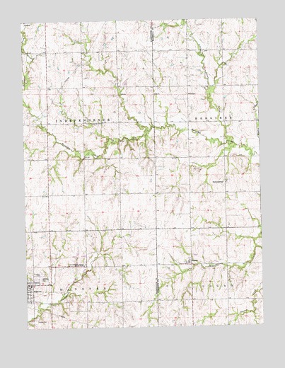
Hanover East, KS USGS Topographic Map
Click on map above to begin viewing in our Map Viewer.

This topographic map contains these locations and features:
Feature Name Type Latitude Longitude GNIS ID View Map
BremenPopulated PlaceN39.9014°W96.7892°472665View Map
Hanover CemeteryCemeteryN39.8780°W96.8706°472661View Map
Hanover Elementary SchoolSchoolN39.8925°W96.8735°480178View Map
Hanover High SchoolSchoolN39.8926°W96.8739°2497616View Map
Hanover Public LibraryBuildingN39.8910°W96.8743°2694838View Map
HermansbergPopulated PlaceN39.9339°W96.7684°484612View Map
Hollenberg Pony Express StationBuildingN39.9009°W96.8438°2694973View Map
Hollenberg Ranch State ParkParkN39.9014°W96.8442°472664View Map
Immanuel Lutheran ChurchChurchN39.9335°W96.7685°2690295View Map
Little Indian CreekStreamN39.9492°W96.7653°472660View Map
Logan Township Volunteer Fire Department - BremenBuildingN39.9007°W96.7892°2111560View Map
Saint John's Catholic ChurchChurchN39.8922°W96.8729°2690091View Map
Saint John's CemeteryCemeteryN39.8973°W96.8669°472662View Map
Saint John's SchoolSchoolN39.8925°W96.8728°2497326View Map
Township of IndependenceCivilN39.9582°W96.8621°472650View Map
Trinity Lutheran ChurchChurchN39.9582°W96.8358°472666View Map
Veterans Memorial ParkParkN39.8956°W96.8656°472663View Map
Zion Lutheran ChurchChurchN39.8861°W96.8731°2689892View Map

Note: Coordinates in the location and feature list above are referenced to NAD83 datum.


Copyright (C) 2008-2025 Ryan Niemi / Sunset Dynamics ... All Rights Reserved