TopoQuest Logo
Do you find TopoQuest useful?
Help keep TopoQuest running and adding new maps/features by donating!
Bitcoin:  19c7KJd3qBynnjoSw5npx9KScwjBe4ifkT
Litecoin:  LXs6TkuXGGXo1vDsWCkWVdjQX94eUKd6ui
Home View Maps Find Maps Find Places Resources & Links


Wymore, Nebraska Topographic Map

USGS Map Title: Wymore, NE
USGS Map MRC: 40096A6
DRG (GeoTIFF) Download: o40096a6.tif


Neighboring USGS Topographic Map Quads:


  Odell NE, NE  
40096B7
 

  Blue Springs, NE  
40096B6
 

  Wymore NE, NE  
40096B5
 

  Odell, NE  
40096A7
 

  Wymore, NE  
40096A6
 

  Barneston, NE  
40096A5
 

  Hanover East, KS  
39096H7
 

  Herkimer, KS  
39096H6
 

  Oketo, KS  
39096H5


Map MRC Location:

N41°
W97°
N41°
W96°
H8 H7 H6 H5 H4 H3 H2 H1
G8 G7 G6 G5 G4 G3 G2 G1
F8 F7 F6 F5 F4 F3 F2 F1
E8 E7 E6 E5 E4 E3 E2 E1
D8 D7 D6 D5 D4 D3 D2 D1
C8 C7 C6 C5 C4 C3 C2 C1
B8 B7 B6 B5 B4 B3 B2 B1
A8 A7 A6 A5 A4 A3 A2 A1
N40°
W97°
N40°
W96°

Wymore, NE USGS 1:24K Topographic Map Preview:
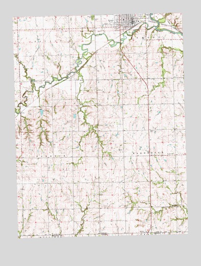
Wymore, NE USGS Topographic Map
Click on map above to begin viewing in our Map Viewer.

This topographic map contains these locations and features:
Feature Name Type Latitude Longitude GNIS ID View Map
Bethel CemeteryCemeteryN40.0589°W96.6517°827372View Map
Big Indian CreekStreamN40.1172°W96.6453°827419View Map
Big Indian Creek Dam 11-ADamN40.0627°W96.6946°1768717View Map
Big Indian Creek Dam 11-BDamN40.0692°W96.7055°1768609View Map
Big Indian Creek Dam 2-ADamN40.0935°W96.7164°1768629View Map
Big Indian Creek Dam 2-BDamN40.0725°W96.7312°1768611View Map
Big Indian Creek Reservoir 11-ALakeN40.0617°W96.6940°1768718View Map
Big Indian Creek Reservoir 11-BLakeN40.0677°W96.7065°1768610View Map
Big Indian Creek Reservoir 2-ALakeN40.0973°W96.7171°1768630View Map
Big Indian Creek Reservoir 2-BLakeN40.0703°W96.7307°1768612View Map
Calvary CemeteryCemeteryN40.1225°W96.6920°827860View Map
City of WymoreCivilN40.1221°W96.6643°2397386View Map
Community Physicians ClinicHospitalN40.1228°W96.6620°1883249View Map
Immanuel State Line Lutheran ChurchChurchN40.0017°W96.6575°830245View Map
KriderPopulated PlaceN40.0708°W96.7461°835354View Map
Otoe CreekStreamN40.1022°W96.6997°833745View Map
Saint Johns CemeteryCemeteryN40.0450°W96.6383°832891View Map
Saint Josephs Catholic ChurchChurchN40.1231°W96.6681°1883255View Map
Saint Peters Lutheran ChurchChurchN40.1200°W96.6659°1883258View Map
Sicily CreekStreamN40.0853°W96.7364°833421View Map
Southern High SchoolSchoolN40.1217°W96.6686°1883252View Map
Thomsen AirportAirportN40.0574°W96.6614°837760View Map
Township of BarnestonCivilN40.0447°W96.6332°837866View Map
Township of PaddockCivilN40.0450°W96.7464°838181View Map
United Methodist ChurchChurchN40.1217°W96.6667°1883256View Map
Vitosh ReservoirReservoirN40.0243°W96.7493°1769975View Map
WymorePopulated PlaceN40.1222°W96.6625°834893View Map
Wymore CemeteryCemeteryN40.1242°W96.6920°834894View Map
Wymore Country ClubLocaleN40.1194°W96.6831°1883259View Map
Wymore Good Samaritan CenterHospitalN40.1189°W96.6614°1883251View Map
Wymore Medical ClinicHospitalN40.1194°W96.6614°1883250View Map
Wymore Police DepartmentBuildingN40.1199°W96.6604°2739907View Map
Wymore Post OfficePost OfficeN40.1211°W96.6632°1883246View Map
Wymore Public LibraryBuildingN40.1214°W96.6622°1883248View Map
Wymore Volunteer Fire and Rescue DepartmentBuildingN40.1195°W96.6611°1883247View Map

Note: Coordinates in the location and feature list above are referenced to NAD83 datum.


Copyright (C) 2008-2025 Ryan Niemi / Sunset Dynamics ... All Rights Reserved