TopoQuest Logo
Do you find TopoQuest useful?
Help keep TopoQuest running and adding new maps/features by donating!
Bitcoin:  19c7KJd3qBynnjoSw5npx9KScwjBe4ifkT
Litecoin:  LXs6TkuXGGXo1vDsWCkWVdjQX94eUKd6ui
Home View Maps Find Maps Find Places Resources & Links


Hansell, Iowa Topographic Map

USGS Map Title: Hansell, IA
USGS Map MRC: 42093G1
DRG (GeoTIFF) Download: o42093g1.tif


Neighboring USGS Topographic Map Quads:


  Sheffield, IA  
42093H2
 

  Dougherty, IA  
42093H1
 

  Aureola, IA  
42092H8
 

  Hampton North, IA  
42093G2
 

  Hansell, IA  
42093G1
 

  Dumont North, IA  
42092G8
 

  Hampton South, IA  
42093F2
 

  Ackley NE, IA  
42093F1
 

  Dumont South, IA  
42092F8


Map MRC Location:

N43°
W94°
N43°
W93°
H8 H7 H6 H5 H4 H3 H2 H1
G8 G7 G6 G5 G4 G3 G2 G1
F8 F7 F6 F5 F4 F3 F2 F1
E8 E7 E6 E5 E4 E3 E2 E1
D8 D7 D6 D5 D4 D3 D2 D1
C8 C7 C6 C5 C4 C3 C2 C1
B8 B7 B6 B5 B4 B3 B2 B1
A8 A7 A6 A5 A4 A3 A2 A1
N42°
W94°
N42°
W93°

Hansell, IA USGS 1:24K Topographic Map Preview:
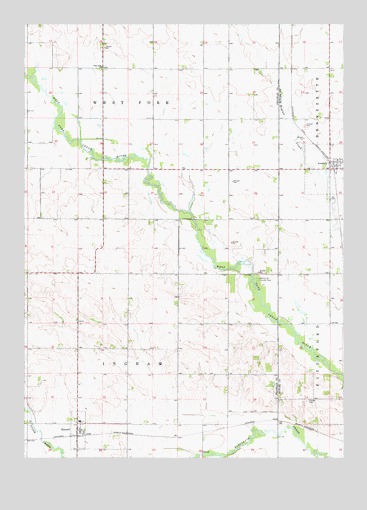
Hansell, IA USGS Topographic Map
Click on map above to begin viewing in our Map Viewer.

This topographic map contains these locations and features:
Feature Name Type Latitude Longitude GNIS ID View Map
AredalePopulated PlaceN42.8330°W93.0055°454224View Map
Aredale (historical)LocaleN42.8344°W93.0058°1945536View Map
Aredale Fire DepartmentBuildingN42.8355°W93.0036°2577254View Map
Aredale Post OfficePost OfficeN42.8330°W93.0055°1945538View Map
Aredale Town HallBuildingN42.8330°W93.0055°1945537View Map
City of AredaleCivilN42.8332°W93.0054°2393980View Map
City of HansellCivilN42.7578°W93.1041°2394290View Map
Cream Hill Post Office (historical)Post OfficeN42.7680°W93.0446°1944692View Map
Deer Meadow Wildlife AreaParkN42.7575°W93.0294°1944695View Map
HansellPopulated PlaceN42.7578°W93.1041°457236View Map
HansellLocaleN42.7561°W93.1046°1944778View Map
Hansell CemeteryCemeteryN42.7666°W93.1048°1944780View Map
Hansell Post OfficePost OfficeN42.7578°W93.1041°1944779View Map
Hansell United Methodist ChurchChurchN42.7580°W93.1027°1944734View Map
Hansell Volunteer Fire DepartmentBuildingN42.7573°W93.1047°2577273View Map
Harlan CemeteryCemeteryN42.7664°W93.0146°457260View Map
Ingham Post Office (historical)Post OfficeN42.8736°W93.1038°466668View Map
Menzie Post Office (historical)Post OfficeN42.7822°W93.0910°466471View Map
Thorn Apple WoodsParkN42.8152°W93.0558°1944697View Map
Township of InghamCivilN42.7748°W93.0846°468073View Map
Township of West ForkCivilN42.8632°W93.0842°468977View Map
United Methodist ChurchChurchN42.8330°W93.0055°1945539View Map
West Fork ChurchChurchN42.8625°W93.0949°462848View Map
West Fork County ParkParkN42.8016°W93.0341°462849View Map
Westfork Wildlife AreaParkN42.7944°W93.0321°1944696View Map

Note: Coordinates in the location and feature list above are referenced to NAD83 datum.


Copyright (C) 2008-2025 Ryan Niemi / Sunset Dynamics ... All Rights Reserved