TopoQuest Logo
Do you find TopoQuest useful?
Help keep TopoQuest running and adding new maps/features by donating!
Bitcoin:  19c7KJd3qBynnjoSw5npx9KScwjBe4ifkT
Litecoin:  LXs6TkuXGGXo1vDsWCkWVdjQX94eUKd6ui
Home View Maps Find Maps Find Places Resources & Links


Hampton South, Iowa Topographic Map

USGS Map Title: Hampton South, IA
USGS Map MRC: 42093F2
DRG (GeoTIFF) Download: o42093f2.tif


Neighboring USGS Topographic Map Quads:


  Latimer, IA  
42093G3
 

  Hampton North, IA  
42093G2
 

  Hansell, IA  
42093G1
 

  Coulter, IA  
42093F3
 

  Hampton South, IA  
42093F2
 

  Ackley NE, IA  
42093F1
 

  Iowa Falls West, IA  
42093E3
 

  Iowa Falls East, IA  
42093E2
 

  Ackley, IA  
42093E1


Map MRC Location:

N43°
W94°
N43°
W93°
H8 H7 H6 H5 H4 H3 H2 H1
G8 G7 G6 G5 G4 G3 G2 G1
F8 F7 F6 F5 F4 F3 F2 F1
E8 E7 E6 E5 E4 E3 E2 E1
D8 D7 D6 D5 D4 D3 D2 D1
C8 C7 C6 C5 C4 C3 C2 C1
B8 B7 B6 B5 B4 B3 B2 B1
A8 A7 A6 A5 A4 A3 A2 A1
N42°
W94°
N42°
W93°

Hampton South, IA USGS 1:24K Topographic Map Preview:
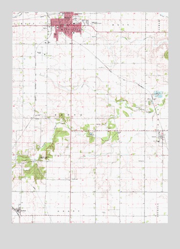
Hampton South, IA USGS Topographic Map
Click on map above to begin viewing in our Map Viewer.

This topographic map contains these locations and features:
Feature Name Type Latitude Longitude GNIS ID View Map
BradfordPopulated PlaceN42.6330°W93.2449°454797View Map
BradfordLocaleN42.6330°W93.2449°1944798View Map
Bradford Census Designated PlaceCensusN42.6371°W93.2486°2585467View Map
Bradford Post OfficePost OfficeN42.6330°W93.2449°1944799View Map
Bradford School (historical)SchoolN42.6330°W93.2449°1944723View Map
Burkley ParkParkN42.6772°W93.1663°1823491View Map
Calvary Assembly ChurchChurchN42.7378°W93.2019°1944730View Map
Campsite of First Settlers in Franklin County Historical MarkerParkN42.6611°W93.2252°1944706View Map
Centennial Tree Historical MarkerParkN42.7428°W93.2083°1944705View Map
Church of ChristChurchN42.7419°W93.2088°1944729View Map
City of GenevaCivilN42.6748°W93.1298°2394877View Map
City of HamptonCivilN42.7420°W93.2050°467996View Map
East ParkParkN42.7425°W93.1933°1944738View Map
Faith Baptist ChurchChurchN42.7411°W93.1869°1944725View Map
Farmers Co-op ElevatorLocaleN42.7414°W93.2127°1944713View Map
Farmers Co-op Elevator Company ElevatorLocaleN42.6330°W93.2449°1944800View Map
First Cabin in Franklin County Historical MarkerParkN42.6797°W93.1808°1944708View Map
First Christian ChurchChurchN42.7475°W93.2019°1944731View Map
First Congregational ChurchChurchN42.7405°W93.2083°1944727View Map
First Post Office/First Store Site Historical MarkerParkN42.6672°W93.1946°1944820View Map
Franklin County CourthouseBuildingN42.7422°W93.2080°1944722View Map
Franklin County FairgroundsLocaleN42.7403°W93.2238°1944741View Map
Franklin County Historical MuseumBuildingN42.7416°W93.2252°1944710View Map
Franklin County Sheriffs DepartmentBuildingN42.7422°W93.2080°1944716View Map
Franklin General HospitalHospitalN42.7436°W93.1856°1823493View Map
GenevaLocaleN42.6761°W93.1283°1944783View Map
GenevaPopulated PlaceN42.6755°W93.1294°456868View Map
Geneva Ackley SchoolSchoolN42.6736°W93.1327°1823490View Map
Geneva ElevatorLocaleN42.6755°W93.1294°1944785View Map
Geneva Post OfficePost OfficeN42.6755°W93.1294°1944786View Map
Geneva United Methodist ChurchChurchN42.6755°W93.1294°1944784View Map
HamptonPopulated PlaceN42.7419°W93.2024°457225View Map
HamptonLocaleN42.7494°W93.2071°1944712View Map
Hampton CemeteryCemeteryN42.7452°W93.1977°1944742View Map
Hampton City HallBuildingN42.7422°W93.2085°1944715View Map
Hampton City ParkParkN42.7414°W93.2166°1944740View Map
Hampton Fire DepartmentBuildingN42.7439°W93.2103°2577274View Map
Hampton Health Care CenterHospitalN42.7339°W93.2052°1944720View Map
Hampton Municipal AirportAirportN42.7254°W93.2247°466814View Map
Hampton Police DepartmentBuildingN42.7423°W93.2098°1944717View Map
Hampton Post OfficePost OfficeN42.7411°W93.2071°1944721View Map
Hampton Public LibraryBuildingN42.7422°W93.2085°1944714View Map
Hampton United Methodist ChurchChurchN42.7422°W93.2058°1944726View Map
Hamptons First Resident Historical MarkerParkN42.7458°W93.2113°1944704View Map
Hibnes QuarryMineN42.6781°W93.1861°2611888View Map
Koenen and Collins Chiropractic ClinicHospitalN42.7416°W93.2033°1944718View Map
KQHJ-FM (Hampton)TowerN42.7491°W93.1949°463739View Map
Mallory Memorial County ParkParkN42.6628°W93.2321°1823489View Map
MarysvilleLocaleN42.6691°W93.1977°463998View Map
Maynes GroveParkN42.6791°W93.2085°1944797View Map
Maysville CemeteryCemeteryN42.6511°W93.2027°458875View Map
Maysville School (historical)SchoolN42.6678°W93.1941°1944782View Map
North Iowa Mental Health CenterHospitalN42.7416°W93.2052°1944719View Map
Old Stone HouseBuildingN42.6805°W93.1669°1944781View Map
Park SchoolSchoolN42.7408°W93.2141°1823492View Map
Progress ParkParkN42.7472°W93.2108°1944739View Map
Redding CemeteryCemeteryN42.6619°W93.1444°460564View Map
Reeve (historical)LocaleN42.6875°W93.2327°1944687View Map
Reeve Post Office (historical)Post OfficeN42.6875°W93.2327°1944686View Map
Saint Pauls Lutheran ChurchChurchN42.7425°W93.2044°1944732View Map
Site of First Franklin County School House Historical MarkerParkN42.6833°W93.1835°1944707View Map
South Side Elementary SchoolSchoolN42.7375°W93.2009°1944737View Map
Towle CemeteryCemeteryN42.6836°W93.1791°462286View Map
Township of ReeveCivilN42.6866°W93.2024°468595View Map

Note: Coordinates in the location and feature list above are referenced to NAD83 datum.


Copyright (C) 2008-2024 Ryan Niemi / Sunset Dynamics ... All Rights Reserved