TopoQuest Logo
Do you find TopoQuest useful?
Help keep TopoQuest running and adding new maps/features by donating!
Bitcoin:  19c7KJd3qBynnjoSw5npx9KScwjBe4ifkT
Litecoin:  LXs6TkuXGGXo1vDsWCkWVdjQX94eUKd6ui
Home View Maps Find Maps Find Places Resources & Links


Harrell Brake, Arkansas Topographic Map

USGS Map Title: Harrell Brake, AR
USGS Map MRC: 33092C4
DRG (GeoTIFF) Download: o33092c4.tif


Neighboring USGS Topographic Map Quads:


  Smackover NE, AR  
33092D5
 

  Artesian, AR  
33092D4
 

  Jersey, AR  
33092D3
 

  Calion, AR  
33092C5
 

  Harrell Brake, AR  
33092C4
 

  Moro Bay, AR  
33092C3
 

  El Dorado East, AR  
33092B5
 

  Urbana, AR  
33092B4
 

  New London, AR  
33092B3


Map MRC Location:

N34°
W93°
N34°
W92°
H8 H7 H6 H5 H4 H3 H2 H1
G8 G7 G6 G5 G4 G3 G2 G1
F8 F7 F6 F5 F4 F3 F2 F1
E8 E7 E6 E5 E4 E3 E2 E1
D8 D7 D6 D5 D4 D3 D2 D1
C8 C7 C6 C5 C4 C3 C2 C1
B8 B7 B6 B5 B4 B3 B2 B1
A8 A7 A6 A5 A4 A3 A2 A1
N33°
W93°
N33°
W92°

Harrell Brake, AR USGS 1:24K Topographic Map Preview:
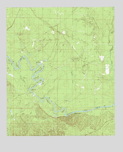
Harrell Brake, AR USGS Topographic Map
Click on map above to begin viewing in our Map Viewer.

This topographic map contains these locations and features:
Feature Name Type Latitude Longitude GNIS ID View Map
Bangs LandingLocaleN33.3207°W92.4618°57323View Map
Bell Ginhouse BendBendN33.3143°W92.4865°46352View Map
Beulah Springs SchoolSchoolN33.2582°W92.4929°46495View Map
Big Swamp RidgeRidgeN33.3223°W92.4338°46613View Map
Birdseye SloughGutN33.3168°W92.4457°46635View Map
Brann SchoolSchoolN33.3390°W92.3996°46916View Map
Buckhorn BranchStreamN33.3598°W92.3971°47142View Map
Calion Lock and DamDamN33.3057°W92.4819°59611View Map
Crooked SloughGutN33.2940°W92.4482°48181View Map
Crooked Slough BendBendN33.2862°W92.4535°48184View Map
Cypress CreekStreamN33.2826°W92.4679°45739View Map
Cypress Creek Oil FieldOilfieldN33.2543°W92.4646°59630View Map
Dutch BendBendN33.3057°W92.4688°48720View Map
Ebenezer SchoolSchoolN33.3685°W92.4679°48808View Map
Gilbert RidgeRidgeN33.3251°W92.4201°49408View Map
Grapevine BendBendN33.2757°W92.4340°49561View Map
Grapevine LakeLakeN33.2846°W92.4294°74859View Map
Harrell BrakeSwampN33.3164°W92.4320°49885View Map
Harrell BranchStreamN33.3215°W92.4204°49886View Map
Harvin RidgeRidgeN33.3318°W92.4357°49929View Map
Highbank BranchStreamN33.3501°W92.3804°76143View Map
Hurricane CreekStreamN33.3737°W92.4026°50453View Map
John Mack SloughGutN33.3432°W92.4574°50661View Map
Jones BayouStreamN33.2662°W92.4643°59716View Map
Lewter CreekStreamN33.2829°W92.4696°59780View Map
Lloyd CreekStreamN33.3448°W92.3829°51353View Map
Lloyd FordCrossingN33.3593°W92.3782°58078View Map
Lock and Dam Number 8DamN33.3020°W92.4611°82506View Map
Lock and Dam Number EightDamN33.3018°W92.4635°79575View Map
Lock BendBendN33.3023°W92.4643°51359View Map
McCain SloughGutN33.2807°W92.4440°51782View Map
McClendon BranchStreamN33.2787°W92.3857°51793View Map
Mill CreekStreamN33.2843°W92.4615°77659View Map
Mill Creek BendBendN33.2840°W92.4588°52032View Map
Miller CemeteryCemeteryN33.2660°W92.4357°60946View Map
Ouachita River ReservoirReservoirN33.3018°W92.4635°79576View Map
Salt Spring BendBendN33.2951°W92.4729°54520View Map
Stick BendBendN33.3262°W92.4807°55219View Map
Stow LakeLakeN33.2711°W92.4444°75145View Map
Stow LandingLocaleN33.2765°W92.4468°58696View Map
Tatum CemeteryCemeteryN33.2590°W92.4279°60961View Map
Township of Fayette (historical)CivilN33.3626°W92.4835°63700View Map
Tuckers Camp (historical)LocaleN33.3382°W92.3765°60595View Map
Wilmington LandingLocaleN33.2726°W92.4221°58897View Map
Wilmington Oil and Gas FieldOilfieldN33.2618°W92.4490°59897View Map
Wolf BranchStreamN33.3510°W92.3807°56478View Map
Yellow BluffCliffN33.3215°W92.4957°56593View Map
Yellow Bluff BendBendN33.3140°W92.4638°56594View Map

Note: Coordinates in the location and feature list above are referenced to NAD83 datum.


Copyright (C) 2008-2025 Ryan Niemi / Sunset Dynamics ... All Rights Reserved