TopoQuest Logo
Do you find TopoQuest useful?
Help keep TopoQuest running and adding new maps/features by donating!
Bitcoin:  19c7KJd3qBynnjoSw5npx9KScwjBe4ifkT
Litecoin:  LXs6TkuXGGXo1vDsWCkWVdjQX94eUKd6ui
Home View Maps Find Maps Find Places Resources & Links


Harrisburg, Oregon Topographic Map

USGS Map Title: Harrisburg, OR
USGS Map MRC: 44123C2
DRG (GeoTIFF) Download: o44123c2.tif


Neighboring USGS Topographic Map Quads:


  Greenberry, OR  
44123D3
 

  Peoria, OR  
44123D2
 

  Halsey, OR  
44123D1
 

  Monroe, OR  
44123C3
 

  Harrisburg, OR  
44123C2
 

  Indian Head, OR  
44123C1
 

  Cheshire, OR  
44123B3
 

  Junction City, OR  
44123B2
 

  Coburg, OR  
44123B1


Map MRC Location:

N45°
W124°
N45°
W123°
H8 H7 H6 H5 H4 H3 H2 H1
G8 G7 G6 G5 G4 G3 G2 G1
F8 F7 F6 F5 F4 F3 F2 F1
E8 E7 E6 E5 E4 E3 E2 E1
D8 D7 D6 D5 D4 D3 D2 D1
C8 C7 C6 C5 C4 C3 C2 C1
B8 B7 B6 B5 B4 B3 B2 B1
A8 A7 A6 A5 A4 A3 A2 A1
N44°
W124°
N44°
W123°

Harrisburg, OR USGS 1:24K Topographic Map Preview:
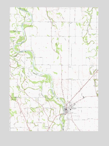
Harrisburg, OR USGS Topographic Map
Click on map above to begin viewing in our Map Viewer.

This topographic map contains these locations and features:
Feature Name Type Latitude Longitude GNIS ID View Map
AlfordLocaleN44.3096°W123.1290°1166738View Map
Alford CemeteryCemeteryN44.3098°W123.1298°1116851View Map
Alford PondLakeN44.3116°W123.1278°1116853View Map
AmericanLocaleN44.3698°W123.1595°1166382View Map
Anderson County ParkParkN44.3401°W123.2415°1966189View Map
Benton Lane ParkParkN44.2818°W123.2470°1639053View Map
Blue Lake SloughStreamN44.3204°W123.2426°1157405View Map
CartneyLocaleN44.3148°W123.1679°1136125View Map
Church of God Seventh DayChurchN44.2764°W123.1631°2508180View Map
City of HarrisburgCivilN44.2718°W123.1656°2410707View Map
Commons Airport (historical)AirportN44.2985°W123.1498°1638189View Map
Diamond Hill Wastewater Treatment PlantLocaleN44.2816°W123.1505°2697095View Map
Dodge IslandIslandN44.3035°W123.2315°1119991View Map
Dodge SloughStreamN44.3085°W123.2312°1119992View Map
Flat CreekStreamN44.3187°W123.2404°1120826View Map
Halsey Pioneer CemeteryCemeteryN44.3637°W123.1355°1130158View Map
Harken's Lake Landing Boat AccessLocaleN44.3460°W123.2318°2697236View Map
HarrisburgPopulated PlaceN44.2740°W123.1706°1121627View Map
Harrisburg Christian ChurchChurchN44.2728°W123.1664°2508179View Map
Harrisburg City HallBuildingN44.2721°W123.1735°2699432View Map
Harrisburg City LibraryBuildingN44.2721°W123.1703°2699433View Map
Harrisburg DivisionCivilN44.3658°W123.1394°1938024View Map
Harrisburg Elementary SchoolSchoolN44.2720°W123.1645°2466033View Map
Harrisburg Fire and Rescue Station 41BuildingN44.2721°W123.1681°2576566View Map
Harrisburg High SchoolSchoolN44.2693°W123.1607°2466065View Map
Harrisburg Justice Center Harrisburg Municipal CourtBuildingN44.2721°W123.1703°2699434View Map
Harrisburg Lagoon Treatment PlantLocaleN44.2897°W123.1838°2697109View Map
Harrisburg Landing City Boat RampLocaleN44.2729°W123.1741°2699435View Map
Harrisburg Middle SchoolSchoolN44.2717°W123.1657°2466045View Map
Harrisburg Post OfficePost OfficeN44.2721°W123.1720°1165375View Map
Harrisburg Public WorksBuildingN44.2667°W123.1731°2699237View Map
Harrisburg SubstationLocaleN44.3023°W123.1681°1121628View Map
Independent Order of Odd Fellows CemeteryCemeteryN44.3054°W123.1292°1157406View Map
Ingram IslandIslandN44.3176°W123.2293°1122255View Map
Ingram SloughStreamN44.3223°W123.2454°1122257View Map
Irish BendBendN44.3646°W123.2243°1122264View Map
Irish Bend County ParkParkN44.3637°W123.2234°1638188View Map
Irish Bend County Park Boat LaunchLocaleN44.3630°W123.2202°2697237View Map
Knox's Private AirstripAirportN44.2874°W123.1295°1131670View Map
Lake Creek School (historical)SchoolN44.3629°W123.1937°1122898View Map
Lancaste-Young CemeteryCemeteryN44.2741°W123.2121°1130160View Map
LancasterPopulated PlaceN44.2529°W123.1956°1122931View Map
Lancaster Post Office (historical)Post OfficeN44.2529°W123.1956°1165513View Map
Linn County Justice Court Harrisburg Justice CenterBuildingN44.2721°W123.1703°2699554View Map
Linn County Sheriff's Office Harrisburg SubstationBuildingN44.2721°W123.1704°2737832View Map
Little Muddy CreekStreamN44.3526°W123.1412°1123237View Map
Liverpool Post Office (historical)Post OfficeN44.3096°W123.1290°1164475View Map
Masonic CemeteryCemeteryN44.3060°W123.1292°1157407View Map
McCartney County ParkParkN44.3165°W123.2179°1162081View Map
McCartney County Park Boat RampLocaleN44.3169°W123.2163°2699584View Map
MillerLocaleN44.3601°W123.1659°1124181View Map
Morgan IslandIslandN44.3073°W123.2093°1124354View Map
Muddy Station Post Office (historical)Post OfficeN44.3096°W123.1290°1164531View Map
Munson AirportAirportN44.2515°W123.2280°2650871View Map
Nixon (historical)LocaleN44.3460°W123.1670°1130159View Map
Othello Post Office (historical)Post OfficeN44.2790°W123.2109°1165750View Map
Perkins SloughStreamN44.2896°W123.2065°1157404View Map
Thurston Post Office (historical)Post OfficeN44.2748°W123.1734°1164726View Map
Timber Incorporated Spur (historical)LocaleN44.3012°W123.1690°1637778View Map
Washburne State ParkParkN44.2815°W123.2451°1128692View Map
Waynes Air Service Airport (historical)AirportN44.3623°W123.1304°1131140View Map
Workman CemeteryCemeteryN44.3020°W123.1280°1129326View Map

Note: Coordinates in the location and feature list above are referenced to NAD83 datum.


Copyright (C) 2008-2024 Ryan Niemi / Sunset Dynamics ... All Rights Reserved