TopoQuest Logo
Do you find TopoQuest useful?
Help keep TopoQuest running and adding new maps/features by donating!
Bitcoin:  19c7KJd3qBynnjoSw5npx9KScwjBe4ifkT
Litecoin:  LXs6TkuXGGXo1vDsWCkWVdjQX94eUKd6ui
Home View Maps Find Maps Find Places Resources & Links


Harvey Creek, Oregon Topographic Map

USGS Map Title: Harvey Creek, OR
USGS Map MRC: 42120F7
DRG (GeoTIFF) Download: o42120f7.tif


Neighboring USGS Topographic Map Quads:


  Pole Butte, OR  
42120G8
 

  Fremont Point, OR  
42120G7
 

  South of Ana River, OR  
42120G6
 

  Shake Butte, OR  
42120F8
 

  Harvey Creek, OR  
42120F7
 

  Slide Mountain, OR  
42120F6
 

  Sandhill Crossing, OR  
42120E8
 

  Lee Thomas Crossing, OR  
42120E7
 

  Coffeepot Creek, OR  
42120E6


Map MRC Location:

N43°
W121°
N43°
W120°
H8 H7 H6 H5 H4 H3 H2 H1
G8 G7 G6 G5 G4 G3 G2 G1
F8 F7 F6 F5 F4 F3 F2 F1
E8 E7 E6 E5 E4 E3 E2 E1
D8 D7 D6 D5 D4 D3 D2 D1
C8 C7 C6 C5 C4 C3 C2 C1
B8 B7 B6 B5 B4 B3 B2 B1
A8 A7 A6 A5 A4 A3 A2 A1
N42°
W121°
N42°
W120°

Harvey Creek, OR USGS 1:24K Topographic Map Preview:
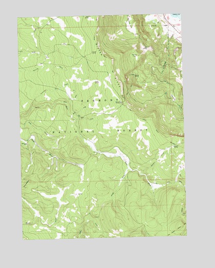
Harvey Creek, OR USGS Topographic Map
Click on map above to begin viewing in our Map Viewer.

This topographic map contains these locations and features:
Feature Name Type Latitude Longitude GNIS ID View Map
Bed SpringSpringN42.7314°W120.7777°1137861View Map
Bennett FlatFlatN42.7432°W120.7905°1137926View Map
Boulder CreekStreamN42.6599°W120.7847°1138463View Map
Boulder SpringSpringN42.6752°W120.7593°1138495View Map
Cold SpringSpringN42.7485°W120.8386°1153845View Map
Cummings CreekStreamN42.6982°W120.8672°1140547View Map
Currier SpringSpringN42.7293°W120.8196°1140566View Map
Government Harvey PassGapN42.7007°W120.7969°1142884View Map
Hanan Sycan TrailheadLocaleN42.6607°W120.7835°2548762View Map
Hanan/Coffeepot Spring Recreation SiteLocaleN42.6624°W120.7908°1952926View Map
Harvey CreekStreamN42.7479°W120.7536°1143343View Map
Harvey FlatFlatN42.7260°W120.7853°1143346View Map
Harvey SpringSpringN42.7159°W120.7879°1143350View Map
Hogwallow SpringSpringN42.6929°W120.8053°1153846View Map
Kates DairyFlatN42.7029°W120.7586°1144491View Map
Kelly CreekStreamN42.6929°W120.8355°1144523View Map
Nixon CreekStreamN42.7013°W120.8447°1146849View Map
Phelps SpringSpringN42.7125°W120.8182°1147633View Map
Rock CreekStreamN42.6915°W120.8325°1148568View Map
Rock Creek Recreation SiteLocaleN42.6915°W120.8336°1952935View Map
Skull Creek CampLocaleN42.6788°W120.8711°1149630View Map
Snow CabinLocaleN42.7165°W120.7872°1149800View Map
South Fork Sycan RiverStreamN42.6632°W120.7941°1150027View Map
Taylor ButtesRidgeN42.6563°W120.8714°1150911View Map
Winter RidgeRidgeN42.7193°W120.8033°1152547View Map
Winter Rim TrailheadLocaleN42.6997°W120.7972°2548782View Map
Wooley CreekStreamN42.7057°W120.7511°1152647View Map

Note: Coordinates in the location and feature list above are referenced to NAD83 datum.


Copyright (C) 2008-2025 Ryan Niemi / Sunset Dynamics ... All Rights Reserved