TopoQuest Logo
Do you find TopoQuest useful?
Help keep TopoQuest running and adding new maps/features by donating!
Bitcoin:  19c7KJd3qBynnjoSw5npx9KScwjBe4ifkT
Litecoin:  LXs6TkuXGGXo1vDsWCkWVdjQX94eUKd6ui
Home View Maps Find Maps Find Places Resources & Links


Harvey Creek, Texas Topographic Map

USGS Map Title: Harvey Creek, TX
USGS Map MRC: 31094C2
DRG (GeoTIFF) Download: o31094c2.tif


Neighboring USGS Topographic Map Quads:


  Chireno South, TX  
31094D3
 

  Norwood, TX  
31094D2
 

  Chinquapin, TX  
31094D1
 

  Broaddus, TX  
31094C3
 

  Harvey Creek, TX  
31094C2
 

  Bronson, TX  
31094C1
 

  Cassells-Boykin Park, TX  
31094B3
 

  Veach, TX  
31094B2
 

  Buck Bay, TX  
31094B1


Map MRC Location:

N32°
W95°
N32°
W94°
H8 H7 H6 H5 H4 H3 H2 H1
G8 G7 G6 G5 G4 G3 G2 G1
F8 F7 F6 F5 F4 F3 F2 F1
E8 E7 E6 E5 E4 E3 E2 E1
D8 D7 D6 D5 D4 D3 D2 D1
C8 C7 C6 C5 C4 C3 C2 C1
B8 B7 B6 B5 B4 B3 B2 B1
A8 A7 A6 A5 A4 A3 A2 A1
N31°
W95°
N31°
W94°

Harvey Creek, TX USGS 1:24K Topographic Map Preview:
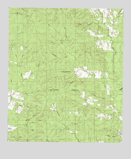
Harvey Creek, TX USGS Topographic Map
Click on map above to begin viewing in our Map Viewer.

This topographic map contains these locations and features:
Feature Name Type Latitude Longitude GNIS ID View Map
Bannister LakeReservoirN31.3616°W94.2294°1381353View Map
Bannister Wildlife Management AreaParkN31.3521°W94.2099°1383675View Map
Big BranchStreamN31.3177°W94.1696°1381419View Map
Big BranchStreamN31.3680°W94.1294°1381422View Map
Broaddus DivisionCivilN31.2688°W94.1669°1938566View Map
Caney CreekStreamN31.2938°W94.1399°1381581View Map
Chinquapin CreekStreamN31.3544°W94.1413°1381635View Map
Clay BranchStreamN31.2666°W94.2310°1381648View Map
Clear BranchStreamN31.3632°W94.1535°1381652View Map
Croker - Boren CemeteryCemeteryN31.3262°W94.1280°1381720View Map
Crow CemeteryCemeteryN31.3538°W94.1341°1381725View Map
Franklin BranchStreamN31.3071°W94.2346°1381896View Map
Hebron ChurchChurchN31.2844°W94.1430°1381984View Map
Herd Pen CreekStreamN31.2969°W94.2421°1381994View Map
Hornsby CreekStreamN31.3141°W94.1619°1382029View Map
Hunts LakeLakeN31.3702°W94.2402°1383713View Map
Little CreekStreamN31.2544°W94.2449°1382171View Map
Macedonia CemeteryCemeteryN31.3255°W94.2349°1382216View Map
MassaPopulated PlaceN31.2716°W94.1285°1382239View Map
Nathaniel Beck CemeteryCemeteryN31.3207°W94.2352°1382374View Map
Pisgah CemeteryCemeteryN31.3541°W94.1471°1382521View Map
Pisgah ChurchChurchN31.3174°W94.1466°1382522View Map
Scott CreekStreamN31.3241°W94.2399°1382731View Map
Turkey CreekStreamN31.3619°W94.1494°1382889View Map
Turkey HillSummitN31.3569°W94.1602°1382890View Map
Turkey Hill WildernessReserveN31.3630°W94.1916°1380959View Map
Walnut BranchStreamN31.2935°W94.2491°1382918View Map
Wash BranchStreamN31.3363°W94.1877°1383712View Map
White CityPopulated PlaceN31.2510°W94.2033°1382948View Map
Willow BranchStreamN31.2666°W94.2324°1382975View Map
Yellowjacket BranchStreamN31.3316°W94.1810°1383003View Map

Note: Coordinates in the location and feature list above are referenced to NAD83 datum.


Copyright (C) 2008-2024 Ryan Niemi / Sunset Dynamics ... All Rights Reserved