TopoQuest Logo
Do you find TopoQuest useful?
Help keep TopoQuest running and adding new maps/features by donating!
Bitcoin:  19c7KJd3qBynnjoSw5npx9KScwjBe4ifkT
Litecoin:  LXs6TkuXGGXo1vDsWCkWVdjQX94eUKd6ui
Home View Maps Find Maps Find Places Resources & Links


Haskinville, New York Topographic Map

USGS Map Title: Haskinville, NY
USGS Map MRC: 42077D5
DRG (GeoTIFF) Download: o42077d5.tif


Neighboring USGS Topographic Map Quads:


  Dansville, NY  
42077E6
 

  Wayland, NY  
42077E5
 

  Naples, NY  
42077E4
 

  Arkport, NY  
42077D6
 

  Haskinville, NY  
42077D5
 

  Avoca, NY  
42077D4
 

  Hornell, NY  
42077C6
 

  Canisteo, NY  
42077C5
 

  Towlesville, NY  
42077C4


Map MRC Location:

N43°
W78°
N43°
W77°
H8 H7 H6 H5 H4 H3 H2 H1
G8 G7 G6 G5 G4 G3 G2 G1
F8 F7 F6 F5 F4 F3 F2 F1
E8 E7 E6 E5 E4 E3 E2 E1
D8 D7 D6 D5 D4 D3 D2 D1
C8 C7 C6 C5 C4 C3 C2 C1
B8 B7 B6 B5 B4 B3 B2 B1
A8 A7 A6 A5 A4 A3 A2 A1
N42°
W78°
N42°
W77°

Haskinville, NY USGS 1:24K Topographic Map Preview:
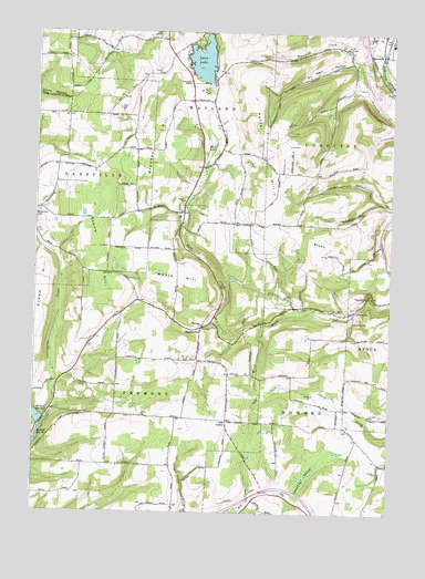
Haskinville, NY USGS Topographic Map
Click on map above to begin viewing in our Map Viewer.

This topographic map contains these locations and features:
Feature Name Type Latitude Longitude GNIS ID View Map
Allen CemeteryCemeteryN42.3969°W77.5145°2547893View Map
Babcock School (historical)SchoolN42.4497°W77.5742°2375641View Map
Bacon School (historical)SchoolN42.3783°W77.5475°2375642View Map
Beachville CemeteryCemeteryN42.4518°W77.6248°943226View Map
Brasted School (historical)SchoolN42.4028°W77.5150°2375644View Map
Bronson HillSummitN42.4659°W77.5847°944817View Map
Brown HillSummitN42.4448°W77.5255°944916View Map
Brown Hill School (historical)SchoolN42.4556°W77.5056°2375645View Map
Brownson School (historical)SchoolN42.4692°W77.5903°2375646View Map
Carrington CreekStreamN42.4001°W77.6189°945904View Map
Cohocton Elementary SchoolSchoolN42.4974°W77.5001°2597625View Map
Cream HillSummitN42.4337°W77.6244°947725View Map
D C Helicopters HeliportAirportN42.4917°W77.5072°977965View Map
Dutch Street School (historical)SchoolN42.4000°W77.5983°2375648View Map
GreenvillePopulated PlaceN42.4276°W77.5125°972568View Map
Greenville CemeteryCemeteryN42.4275°W77.5155°2547894View Map
Greenville School (historical)SchoolN42.4250°W77.5122°2375651View Map
Gulf School (historical)SchoolN42.3875°W77.5906°2375652View Map
HaskinvillePopulated PlaceN42.4231°W77.5658°952346View Map
Haskinville School (historical)SchoolN42.4147°W77.5656°2375655View Map
Haskinville Wesleyan ChurchChurchN42.4241°W77.5657°969069View Map
Healey School (historical)SchoolN42.4783°W77.6144°2375656View Map
Hornell Reservoir Number ThreeReservoirN42.3943°W77.6234°953216View Map
Hornell Reservoir Number TwoReservoirN42.3995°W77.6239°953215View Map
Jobs CornerPopulated PlaceN42.3990°W77.5569°972668View Map
Lake Hollow School (historical)SchoolN42.4858°W77.5144°2375657View Map
Lakeside CemeteryCemeteryN42.4896°W77.5718°2547890View Map
Loon LakeLakeN42.4927°W77.5669°955977View Map
Loon Lake ChapelChurchN42.4870°W77.5714°955982View Map
Loon Lake School (historical)SchoolN42.4833°W77.5708°2375658View Map
Mack School (historical)SchoolN42.4303°W77.5886°2375659View Map
Maple HillSummitN42.4362°W77.5828°956422View Map
Mount Pleasant CemeteryCemeteryN42.4150°W77.5684°2547892View Map
Mud LakeLakeN42.4701°W77.5623°958021View Map
New Gayland School (historical)SchoolN42.4575°W77.5528°2375662View Map
Oil Well HollowValleyN42.4923°W77.5158°959240View Map
Page BrookStreamN42.4248°W77.5450°959747View Map
Parkhill CemeteryCemeteryN42.4289°W77.5304°2547895View Map
Potter HillSummitN42.4706°W77.5355°961037View Map
Potter Hill School (historical)SchoolN42.4631°W77.5272°2375663View Map
Spaulding SwampSwampN42.3851°W77.5286°965957View Map
Stone HillSummitN42.4440°W77.6039°966505View Map
Swamp School (historical)SchoolN42.4258°W77.5411°2375665View Map
The RocksPillarN42.4315°W77.5075°967333View Map
Town of FremontCivilN42.3994°W77.6032°978975View Map
Village of CohoctonCivilN42.4999°W77.5000°2391617View Map
Zion Lutheran CemeteryCemeteryN42.4983°W77.5089°2547891View Map
Zion Lutheran Church of CohoctonChurchN42.4988°W77.5083°971882View Map

Note: Coordinates in the location and feature list above are referenced to NAD83 datum.


Copyright (C) 2008-2025 Ryan Niemi / Sunset Dynamics ... All Rights Reserved