TopoQuest Logo
Do you find TopoQuest useful?
Help keep TopoQuest running and adding new maps/features by donating!
Bitcoin:  19c7KJd3qBynnjoSw5npx9KScwjBe4ifkT
Litecoin:  LXs6TkuXGGXo1vDsWCkWVdjQX94eUKd6ui
Home View Maps Find Maps Find Places Resources & Links


Towlesville, New York Topographic Map

USGS Map Title: Towlesville, NY
USGS Map MRC: 42077C4
DRG (GeoTIFF) Download: o42077c4.tif


Neighboring USGS Topographic Map Quads:


  Haskinville, NY  
42077D5
 

  Avoca, NY  
42077D4
 

  Rheims, NY  
42077D3
 

  Canisteo, NY  
42077C5
 

  Towlesville, NY  
42077C4
 

  Bath, NY  
42077C3
 

  South Canisteo, NY  
42077B5
 

  Cameron, NY  
42077B4
 

  Rathbone, NY  
42077B3


Map MRC Location:

N43°
W78°
N43°
W77°
H8 H7 H6 H5 H4 H3 H2 H1
G8 G7 G6 G5 G4 G3 G2 G1
F8 F7 F6 F5 F4 F3 F2 F1
E8 E7 E6 E5 E4 E3 E2 E1
D8 D7 D6 D5 D4 D3 D2 D1
C8 C7 C6 C5 C4 C3 C2 C1
B8 B7 B6 B5 B4 B3 B2 B1
A8 A7 A6 A5 A4 A3 A2 A1
N42°
W78°
N42°
W77°

Towlesville, NY USGS 1:24K Topographic Map Preview:
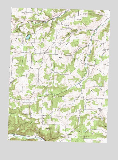
Towlesville, NY USGS Topographic Map
Click on map above to begin viewing in our Map Viewer.

This topographic map contains these locations and features:
Feature Name Type Latitude Longitude GNIS ID View Map
Annabel HillSummitN42.3442°W77.4939°942489View Map
Bath LandfillLocaleN42.3176°W77.3827°2599076View Map
Brooks HillSummitN42.3462°W77.3808°944859View Map
Buck CemeteryCemeteryN42.2923°W77.4014°945012View Map
Buck SettlementPopulated PlaceN42.2912°W77.4000°972274View Map
Bullard HillSummitN42.3373°W77.4700°945136View Map
Chamberlain BrookStreamN42.3565°W77.3908°946345View Map
Chamberlain CemeteryCemeteryN42.3558°W77.3936°946348View Map
Dickinsons Airfield (historical)AirportN42.3212°W77.4103°977908View Map
Dublin CemeteryCemeteryN42.3116°W77.4815°948722View Map
Durnian CemeteryCemeteryN42.3316°W77.4305°948841View Map
Gaskin's Hilltop AirportAirportN42.2968°W77.4636°977947View Map
Hadleyville CemeteryCemeteryN42.2549°W77.4616°951979View Map
Hathaways PinnacleSummitN42.2628°W77.4464°952377View Map
Heineman HillSummitN42.3653°W77.4178°952533View Map
Knight SettlementPopulated PlaceN42.3378°W77.3783°954779View Map
Lake DemonsLakeN42.3477°W77.4779°948291View Map
Maxwell CreekStreamN42.3101°W77.4078°956697View Map
McPherson HillSummitN42.3137°W77.3811°956847View Map
Miller HillSummitN42.2967°W77.3925°957309View Map
Mud HollowValleyN42.2523°W77.4986°958015View Map
Norris CemeteryCemeteryN42.3600°W77.4307°958660View Map
Oak HillSummitN42.2662°W77.4708°959104View Map
Oak Hill CemeteryCemeteryN42.2680°W77.4569°2547927View Map
Oak Hill ChurchChurchN42.2690°W77.4567°959130View Map
Oregon ChurchChurchN42.2570°W77.4233°959463View Map
Oregon HillSummitN42.2531°W77.4180°959464View Map
Rainbow Bridge CreekStreamN42.2951°W77.4432°2740527View Map
Rice CemeteryCemeteryN42.3431°W77.4441°962448View Map
Rice GlenValleyN42.3581°W77.4917°962451View Map
Robinson HillSummitN42.3398°W77.4319°962667View Map
Ross CemeteryCemeteryN42.2745°W77.4716°2547928View Map
Scherer CemeteryCemeteryN42.2891°W77.4739°964577View Map
School Number 3 (historical)SchoolN42.3242°W77.4025°975241View Map
Sinclair CreekStreamN42.3415°W77.3975°965300View Map
Snell HillSummitN42.3528°W77.4392°965571View Map
Steuben CountyCivilN42.2678°W77.3838°974148View Map
The Church of Jesus Christ of Latter Day SaintsChurchN42.3574°W77.3936°2597966View Map
Thomas CornersLocaleN42.2815°W77.3841°967392View Map
TowlesvillePopulated PlaceN42.3337°W77.4558°967699View Map
Victory Baptist AcademySchoolN42.2869°W77.4023°2597204View Map
WCIK-FM (Bath)TowerN42.3353°W77.4572°977679View Map
White CemeteryCemeteryN42.3006°W77.4534°971079View Map
Willis CemeteryCemeteryN42.3676°W77.3833°971323View Map
Wilson HillSummitN42.3276°W77.4364°971416View Map
Wright SchoolSchoolN42.3559°W77.4155°971755View Map

Note: Coordinates in the location and feature list above are referenced to NAD83 datum.


Copyright (C) 2008-2025 Ryan Niemi / Sunset Dynamics ... All Rights Reserved