TopoQuest Logo
Do you find TopoQuest useful?
Help keep TopoQuest running and adding new maps/features by donating!
Bitcoin:  19c7KJd3qBynnjoSw5npx9KScwjBe4ifkT
Litecoin:  LXs6TkuXGGXo1vDsWCkWVdjQX94eUKd6ui
Home View Maps Find Maps Find Places Resources & Links


Hathaway, Louisiana Topographic Map

USGS Map Title: Hathaway, LA
USGS Map MRC: 30092C6
DRG (GeoTIFF) Download: o30092c6.tif


Neighboring USGS Topographic Map Quads:


  Kinder, LA  
30092D7
 

  Elton, LA  
30092D6
 

  Basile, LA  
30092D5
 

  Welsh North, LA  
30092C7
 

  Hathaway, LA  
30092C6
 

  Evangeline, LA  
30092C5
 

  Welsh South, LA  
30092B7
 

  Jennings, LA  
30092B6
 

  Mermentau, LA  
30092B5


Map MRC Location:

N31°
W93°
N31°
W92°
H8 H7 H6 H5 H4 H3 H2 H1
G8 G7 G6 G5 G4 G3 G2 G1
F8 F7 F6 F5 F4 F3 F2 F1
E8 E7 E6 E5 E4 E3 E2 E1
D8 D7 D6 D5 D4 D3 D2 D1
C8 C7 C6 C5 C4 C3 C2 C1
B8 B7 B6 B5 B4 B3 B2 B1
A8 A7 A6 A5 A4 A3 A2 A1
N30°
W93°
N30°
W92°

Hathaway, LA USGS 1:24K Topographic Map Preview:
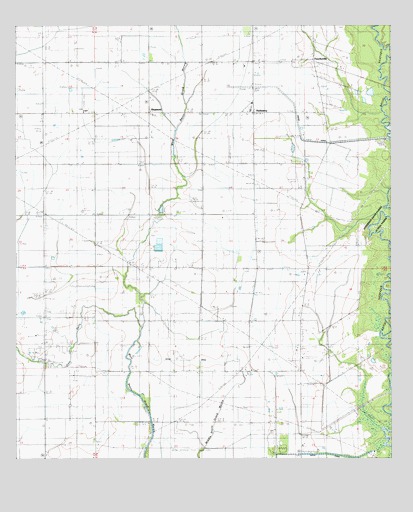
Hathaway, LA USGS Topographic Map
Click on map above to begin viewing in our Map Viewer.

This topographic map contains these locations and features:
Feature Name Type Latitude Longitude GNIS ID View Map
Academy Mobile VillagePopulated PlaceN30.2526°W92.6493°2600372View Map
Bertrand CemeteryCemeteryN30.3744°W92.6406°532961View Map
Bethel Baptist ChurchChurchN30.2503°W92.6563°2601387View Map
Bethel Christian SchoolSchoolN30.2507°W92.6569°2493396View Map
Doucet CemeteryCemeteryN30.3027°W92.7176°534569View Map
East Roanoke Gas FieldOilfieldN30.2710°W92.6763°545823View Map
Grand CanalCanalN30.3433°W92.6557°535324View Map
Gum GullyStreamN30.2874°W92.7085°535454View Map
HathawayPopulated PlaceN30.3496°W92.6715°535561View Map
Hathaway Fire DepartmentBuildingN30.3504°W92.7002°2332538View Map
Hathaway High SchoolSchoolN30.3505°W92.6716°545837View Map
Koll Airport (historical)AirportN30.3571°W92.7446°1633005View Map
Miller CemeteryCemeteryN30.2760°W92.6432°537131View Map
PanchovillePopulated PlaceN30.3652°W92.6513°543566View Map
Parish Governing Authority District 8CivilN30.3181°W92.6905°1930237View Map
RaymondPopulated PlaceN30.3499°W92.7057°538511View Map
Raymond United Methodist ChurchChurchN30.3504°W92.7051°2602428View Map
Roanoke Oil and Gas FieldOilfieldN30.2835°W92.7415°538629View Map
Saint Lawrence Catholic ChurchChurchN30.3495°W92.7044°2602683View Map
Tiptop CanalCanalN30.2674°W92.6671°539949View Map
Ward ThreeCivilN30.3433°W92.6893°545081View Map

Note: Coordinates in the location and feature list above are referenced to NAD83 datum.


Copyright (C) 2008-2025 Ryan Niemi / Sunset Dynamics ... All Rights Reserved