TopoQuest Logo
Do you find TopoQuest useful?
Help keep TopoQuest running and adding new maps/features by donating!
Bitcoin:  19c7KJd3qBynnjoSw5npx9KScwjBe4ifkT
Litecoin:  LXs6TkuXGGXo1vDsWCkWVdjQX94eUKd6ui
Home View Maps Find Maps Find Places Resources & Links


Hawley Lake West, Arizona Topographic Map

USGS Map Title: Hawley Lake West, AZ
USGS Map MRC: 33109H7
DRG (GeoTIFF) Download: o33109h7.tif


Neighboring USGS Topographic Map Quads:


  Indian Pine, AZ  
34109A8
 

  McNary, AZ  
34109A7
 

  Horseshoe Cienega, AZ  
34109A6
 

  Alchesay Flat, AZ  
33109H8
 

  Hawley Lake West, AZ  
33109H7
 

  Hawley Lake East, AZ  
33109H6
 

  Whiteriver, AZ  
33109G8
 

  Corn Creek Plateau, AZ  
33109G7
 

  Marshall Butte, AZ  
33109G6


Map MRC Location:

N34°
W110°
N34°
W109°
H8 H7 H6 H5 H4 H3 H2 H1
G8 G7 G6 G5 G4 G3 G2 G1
F8 F7 F6 F5 F4 F3 F2 F1
E8 E7 E6 E5 E4 E3 E2 E1
D8 D7 D6 D5 D4 D3 D2 D1
C8 C7 C6 C5 C4 C3 C2 C1
B8 B7 B6 B5 B4 B3 B2 B1
A8 A7 A6 A5 A4 A3 A2 A1
N33°
W110°
N33°
W109°

Hawley Lake West, AZ USGS 1:24K Topographic Map Preview:
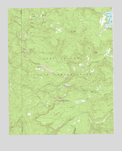
Hawley Lake West, AZ USGS Topographic Map
Click on map above to begin viewing in our Map Viewer.

This topographic map contains these locations and features:
Feature Name Type Latitude Longitude GNIS ID View Map
Badger CreekStreamN33.9173°W109.8437°937View Map
Badger LakeSwampN33.9029°W109.8289°939View Map
Christmas Tree DamDamN33.9100°W109.7707°21578View Map
Cienega CreekStreamN33.9384°W109.7859°2932View Map
Coon CreekStreamN33.9175°W109.8287°3200View Map
Cover LakeLakeN33.8921°W109.8441°3437View Map
Coyote CreekStreamN33.9534°W109.7590°3477View Map
Davis DamDamN33.9934°W109.7587°3725View Map
Diamond Creek Campsite Number ThreeParkN33.9506°W109.7645°21603View Map
Duck LakeLakeN33.9735°W109.8603°4175View Map
Hawley LakeReservoirN33.9902°W109.7522°5638View Map
Hawley Lake Campground AreaParkN33.9875°W109.7579°21651View Map
Hawley Lake Post OfficePost OfficeN33.9798°W109.7557°44899View Map
Horse MesaSummitN33.9017°W109.8126°5969View Map
Horse Mesa TrapBasinN33.9070°W109.7895°5973View Map
Kinney JunctionPopulated PlaceN33.9173°W109.7740°24479View Map
Kinney LookoutTowerN33.8778°W109.7573°21675View Map
Little Diamond CreekStreamN33.9181°W109.8404°7102View Map
Lone Pine Tank Number OneReservoirN33.9921°W109.8354°7306View Map
Lone Pine Tank Number TwoReservoirN33.9910°W109.8410°7307View Map
McKays PeakSummitN33.9762°W109.7984°7839View Map
Pistol ButteSummitN33.9553°W109.7718°9542View Map
Pistol CreekStreamN33.9442°W109.7776°9543View Map
Tsay O Ah ButteSummitN33.9112°W109.8157°12753View Map
Walton CreekStreamN33.9170°W109.7762°13333View Map
Walton RidgeRidgeN33.9281°W109.7798°13335View Map
Walton SpringSpringN33.9162°W109.7732°13336View Map
Woolsey LakeSwampN33.9398°W109.8374°14006View Map

Note: Coordinates in the location and feature list above are referenced to NAD83 datum.


Copyright (C) 2008-2025 Ryan Niemi / Sunset Dynamics ... All Rights Reserved