TopoQuest Logo
Do you find TopoQuest useful?
Help keep TopoQuest running and adding new maps/features by donating!
Bitcoin:  19c7KJd3qBynnjoSw5npx9KScwjBe4ifkT
Litecoin:  LXs6TkuXGGXo1vDsWCkWVdjQX94eUKd6ui
Home View Maps Find Maps Find Places Resources & Links


Hays Canyon, Nevada Topographic Map

USGS Map Title: Hays Canyon, NV
USGS Map MRC: 41119C8
DRG (GeoTIFF) Download: o41119c8.tif


Neighboring USGS Topographic Map Quads:


  Hansen Island, CA  
41120D1
 

  Big Hat Mountain, NV  
41119D8
 

  Boulder Lake, NV  
41119D7
 

  Eagleville, CA  
41120C1
 

  Hays Canyon, NV  
41119C8
 

  Boulder Mountain, NV  
41119C7
 

  Snake Lake, CA  
41120B1
 

  Pegleg Canyon, NV  
41119B8
 

  Wall Canyon Reservoir, NV  
41119B7


Map MRC Location:

N42°
W120°
N42°
W119°
H8 H7 H6 H5 H4 H3 H2 H1
G8 G7 G6 G5 G4 G3 G2 G1
F8 F7 F6 F5 F4 F3 F2 F1
E8 E7 E6 E5 E4 E3 E2 E1
D8 D7 D6 D5 D4 D3 D2 D1
C8 C7 C6 C5 C4 C3 C2 C1
B8 B7 B6 B5 B4 B3 B2 B1
A8 A7 A6 A5 A4 A3 A2 A1
N41°
W120°
N41°
W119°

Hays Canyon, NV USGS 1:24K Topographic Map Preview:
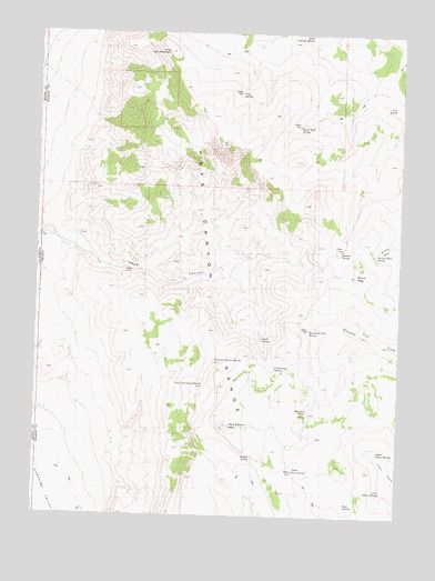
Hays Canyon, NV USGS Topographic Map
Click on map above to begin viewing in our Map Viewer.

This topographic map contains these locations and features:
Feature Name Type Latitude Longitude GNIS ID View Map
Bert Fitz SummitGapN41.3168°W119.9010°858635View Map
Birch SpringSpringN41.2958°W119.9230°838789View Map
Black Rock SpringSpringN41.3507°W119.9117°838886View Map
Bregar SpringSpringN41.2650°W119.9259°856198View Map
Browns BowlBasinN41.3196°W119.8813°839086View Map
Browns Bowl SpringSpringN41.3184°W119.8843°839087View Map
Buzz SpringSpringN41.3593°W119.9316°839248View Map
Cottonwood SpringSpringN41.2884°W119.9186°839769View Map
Devils GateGapN41.3141°W119.9702°840035View Map
Divine PeakSummitN41.3124°W119.8908°840060View Map
Finley Number Four SpringSpringN41.3032°W119.9394°846048View Map
Finley Number One SpringSpringN41.3135°W119.9622°846049View Map
Finley Number Three SpringSpringN41.3149°W119.9072°846051View Map
Hayes SpringSpringN41.3171°W119.9283°846050View Map
Hays CanyonValleyN41.3197°W119.9911°840927View Map
Hays Canyon PeakSummitN41.2735°W119.9338°854926View Map
Hays Canyon RangeRangeN41.3421°W119.9541°840928View Map
Indian Pole CampLocaleN41.2777°W119.9072°856284View Map
Little Antelope SpringSpringN41.3735°W119.9076°841657View Map
Little Hat MountainSummitN41.3702°W119.9560°841692View Map
Lower Indian SpringSpringN41.2560°W119.8815°841862View Map
Mountain View SpringSpringN41.2979°W119.9072°842284View Map
Pick and Shovel Spring Number TwoSpringN41.2837°W119.9428°842797View Map
Pick and Shovel Springs Number OneSpringN41.2903°W119.9392°842798View Map
Rock SpringsSpringN41.2532°W119.8944°856356View Map
Summit SpringSpringN41.3189°W119.8963°844093View Map
Tom SpringSpringN41.3560°W119.8785°844352View Map
Upper Indian SpringsSpringN41.2665°W119.8842°847215View Map
Upper Rock SpringSpringN41.2621°W119.9118°847216View Map

Note: Coordinates in the location and feature list above are referenced to NAD83 datum.


Copyright (C) 2008-2024 Ryan Niemi / Sunset Dynamics ... All Rights Reserved