TopoQuest Logo
Do you find TopoQuest useful?
Help keep TopoQuest running and adding new maps/features by donating!
Bitcoin:  19c7KJd3qBynnjoSw5npx9KScwjBe4ifkT
Litecoin:  LXs6TkuXGGXo1vDsWCkWVdjQX94eUKd6ui
Home View Maps Find Maps Find Places Resources & Links


Big Hat Mountain, Nevada Topographic Map

USGS Map Title: Big Hat Mountain, NV
USGS Map MRC: 41119D8
DRG (GeoTIFF) Download: o41119d8.tif


Neighboring USGS Topographic Map Quads:


  Leonards Hot Springs, CA  
41120E1
 

  Fortynine Mountain, NV  
41119E8
 

  Vya, NV  
41119E7
 

  Hansen Island, CA  
41120D1
 

  Big Hat Mountain, NV  
41119D8
 

  Boulder Lake, NV  
41119D7
 

  Eagleville, CA  
41120C1
 

  Hays Canyon, NV  
41119C8
 

  Boulder Mountain, NV  
41119C7


Map MRC Location:

N42°
W120°
N42°
W119°
H8 H7 H6 H5 H4 H3 H2 H1
G8 G7 G6 G5 G4 G3 G2 G1
F8 F7 F6 F5 F4 F3 F2 F1
E8 E7 E6 E5 E4 E3 E2 E1
D8 D7 D6 D5 D4 D3 D2 D1
C8 C7 C6 C5 C4 C3 C2 C1
B8 B7 B6 B5 B4 B3 B2 B1
A8 A7 A6 A5 A4 A3 A2 A1
N41°
W120°
N41°
W119°

Big Hat Mountain, NV USGS 1:24K Topographic Map Preview:
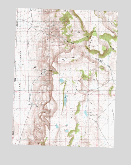
Big Hat Mountain, NV USGS Topographic Map
Click on map above to begin viewing in our Map Viewer.

This topographic map contains these locations and features:
Feature Name Type Latitude Longitude GNIS ID View Map
Big Hat MountainSummitN41.4585°W119.9272°838743View Map
Big SpringSpringN41.4113°W119.9733°838766View Map
Black CanyonValleyN41.3957°W119.8852°838815View Map
Black Canyon ReservoirReservoirN41.4058°W119.9116°838822View Map
Bull SpringsSpringN41.4749°W119.9124°839177View Map
Crampton TroughsReservoirN41.4852°W119.8755°845302View Map
Dip SpringSpringN41.4994°W119.9000°840056View Map
Drag Road CanyonValleyN41.4377°W119.9844°840113View Map
Dry WellWellN41.4274°W119.9063°840195View Map
Hog GulchValleyN41.4796°W119.9699°841019View Map
Long LakeLakeN41.4177°W119.9370°841806View Map
Long RanchLocaleN41.4118°W119.9799°841808View Map
Miller RanchLocaleN41.4107°W119.9816°855316View Map
North SpringSpringN41.4907°W119.9429°842555View Map
Rimrock SpringSpringN41.4438°W119.9615°843224View Map
Rock SpringSpringN41.4795°W119.9252°843293View Map
Roe Deer SpringSpringN41.4534°W119.8963°843337View Map
Small SpringSpringN41.4460°W119.9773°843766View Map
South SpringSpringN41.4833°W119.9471°843891View Map
South Willow CreekStreamN41.4499°W119.8869°843900View Map
Table LakesLakeN41.4177°W119.9370°844153View Map
The CratersCraterN41.3899°W119.9344°844248View Map
Willow SpringsSpringN41.4649°W119.8830°844963View Map

Note: Coordinates in the location and feature list above are referenced to NAD83 datum.


Copyright (C) 2008-2025 Ryan Niemi / Sunset Dynamics ... All Rights Reserved