TopoQuest Logo
Do you find TopoQuest useful?
Help keep TopoQuest running and adding new maps/features by donating!
Bitcoin:  19c7KJd3qBynnjoSw5npx9KScwjBe4ifkT
Litecoin:  LXs6TkuXGGXo1vDsWCkWVdjQX94eUKd6ui
Home View Maps Find Maps Find Places Resources & Links


Haystack Butte, New Mexico Topographic Map

USGS Map Title: Haystack Butte, NM
USGS Map MRC: 33104G2
DRG (GeoTIFF) Download: o33104g2.tif


Neighboring USGS Topographic Map Quads:


  Deering Place, NM  
33104H3
 

  Hernandez Lake, NM  
33104H2
 

  Olive, NM  
33104H1
 

  Cottonwood Draw, NM  
33104G3
 

  Haystack Butte, NM  
33104G2
 

  Denton Camp, NM  
33104G1
 

  Eightmile Draw, NM  
33104F3
 

  Haystack Mountain, NM  
33104F2
 

  Elkins, NM  
33104F1


Map MRC Location:

N34°
W105°
N34°
W104°
H8 H7 H6 H5 H4 H3 H2 H1
G8 G7 G6 G5 G4 G3 G2 G1
F8 F7 F6 F5 F4 F3 F2 F1
E8 E7 E6 E5 E4 E3 E2 E1
D8 D7 D6 D5 D4 D3 D2 D1
C8 C7 C6 C5 C4 C3 C2 C1
B8 B7 B6 B5 B4 B3 B2 B1
A8 A7 A6 A5 A4 A3 A2 A1
N33°
W105°
N33°
W104°

Haystack Butte, NM USGS 1:24K Topographic Map Preview:
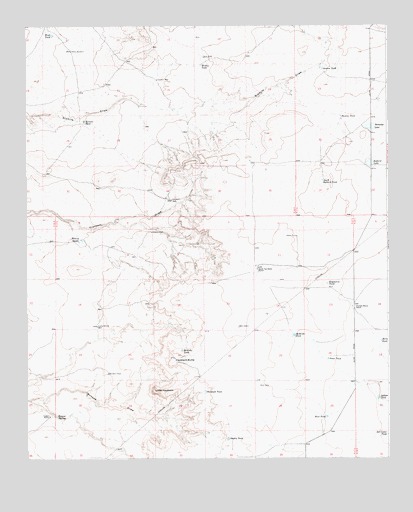
Haystack Butte, NM USGS Topographic Map
Click on map above to begin viewing in our Map Viewer.

This topographic map contains these locations and features:
Feature Name Type Latitude Longitude GNIS ID View Map
06300 Water WellWellN33.8112°W104.2058°924698View Map
06301 Water WellWellN33.8015°W104.1705°924697View Map
06302 Water WellWellN33.7615°W104.1477°924696View Map
06303 Water WellWellN33.7562°W104.1627°925034View Map
Adams WellWellN33.8158°W104.2071°885558View Map
Ballard LakeLakeN33.8350°W104.1317°886025View Map
Berts TankReservoirN33.7838°W104.1278°886266View Map
Bosque SpringSpringN33.7623°W104.2399°886650View Map
Chatten-Muncy RanchLocaleN33.7939°W104.1378°887459View Map
Cooper RanchLocaleN33.7623°W104.2425°887809View Map
Crockett WellWellN33.8247°W104.1999°888081View Map
Denton TankReservoirN33.8625°W104.1475°888328View Map
Dooley TankReservoirN33.7556°W104.1808°888462View Map
East TankReservoirN33.7620°W104.1467°888711View Map
Expensive TankReservoirN33.8005°W104.1464°888943View Map
Havens TankReservoirN33.8487°W104.1412°889831View Map
Haystack ButteSummitN33.7790°W104.1986°889856View Map
Henery TanksReservoirN33.8132°W104.2310°889906View Map
Indian TankReservoirN33.7673°W104.1290°890318View Map
Jones TankReservoirN33.7787°W104.1461°890554View Map
Little HaystackSummitN33.7698°W104.2064°891140View Map
Lucky Strike WellLocaleN33.7884°W104.2258°891479View Map
McBride TankReservoirN33.7856°W104.1578°891714View Map
McGrew TankReservoirN33.7810°W104.1967°891764View Map
Ramadge LakeLakeN33.8457°W104.1318°893634View Map
Rudolph TankReservoirN33.7693°W104.1884°894211View Map
Salt Cedar LakeLakeN33.7569°W104.1252°894338View Map
Salt Cedar TankReservoirN33.7569°W104.1252°894339View Map
Sixmile TankReservoirN33.8475°W104.2299°894886View Map
South Ballard TankReservoirN33.8303°W104.1477°895011View Map
South Van Eaton RanchLocaleN33.8045°W104.1702°895149View Map
Sulphur WellWellN33.8595°W104.2050°895423View Map
Wesley TankReservoirN33.8638°W104.1895°896324View Map
West TankReservoirN33.8724°W104.2412°896415View Map
West WindmillWellN33.8680°W104.2345°896458View Map

Note: Coordinates in the location and feature list above are referenced to NAD83 datum.


Copyright (C) 2008-2025 Ryan Niemi / Sunset Dynamics ... All Rights Reserved