TopoQuest Logo
Do you find TopoQuest useful?
Help keep TopoQuest running and adding new maps/features by donating!
Bitcoin:  19c7KJd3qBynnjoSw5npx9KScwjBe4ifkT
Litecoin:  LXs6TkuXGGXo1vDsWCkWVdjQX94eUKd6ui
Home View Maps Find Maps Find Places Resources & Links


Hazleton, Iowa Topographic Map

USGS Map Title: Hazleton, IA
USGS Map MRC: 42091E8
DRG (GeoTIFF) Download: o42091e8.tif


Neighboring USGS Topographic Map Quads:


  Fairbank, IA  
42092F1
 

  Oelwein, IA  
42091F8
 

  Stanley, IA  
42091F7
 

  Littleton, IA  
42092E1
 

  Hazleton, IA  
42091E8
 

  Oelwein SE, IA  
42091E7
 

  Jesup, IA  
42092D1
 

  Independence, IA  
42091D8
 

  Quasqueton, IA  
42091D7


Map MRC Location:

N43°
W92°
N43°
W91°
H8 H7 H6 H5 H4 H3 H2 H1
G8 G7 G6 G5 G4 G3 G2 G1
F8 F7 F6 F5 F4 F3 F2 F1
E8 E7 E6 E5 E4 E3 E2 E1
D8 D7 D6 D5 D4 D3 D2 D1
C8 C7 C6 C5 C4 C3 C2 C1
B8 B7 B6 B5 B4 B3 B2 B1
A8 A7 A6 A5 A4 A3 A2 A1
N42°
W92°
N42°
W91°

Hazleton, IA USGS 1:24K Topographic Map Preview:
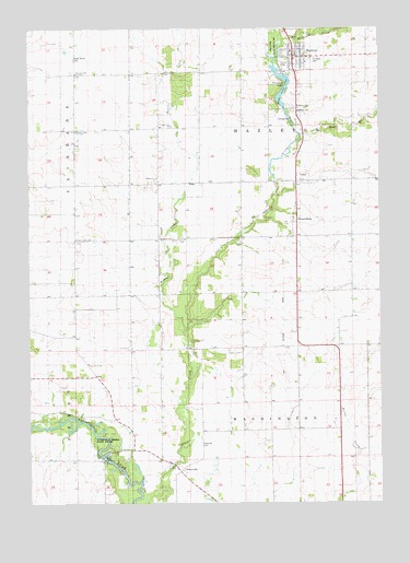
Hazleton, IA USGS Topographic Map
Click on map above to begin viewing in our Map Viewer.

This topographic map contains these locations and features:
Feature Name Type Latitude Longitude GNIS ID View Map
Bryantburg (historical)LocaleN42.5747°W91.9054°2000071View Map
BryantsburgPopulated PlaceN42.5747°W91.9054°454909View Map
Byrantburg Post Office (historical)Post OfficeN42.5747°W91.9054°2000070View Map
Charity Flat SchoolSchoolN42.5994°W91.9488°455353View Map
City of HazletonCivilN42.6177°W91.9058°2394342View Map
First Presbyterian ChurchChurchN42.6172°W91.9071°2000139View Map
Fontana CemeteryCemeteryN42.6047°W91.9054°456658View Map
Fontana LakeReservoirN42.5875°W91.9085°456659View Map
Fontana MilldamDamN42.5875°W91.9085°1669637View Map
Fontana ParkParkN42.6072°W91.9118°456660View Map
Hazelton City HallBuildingN42.6180°W91.9071°2000137View Map
Hazelton CreekStreamN42.6208°W91.9107°457367View Map
HazletonPopulated PlaceN42.6208°W91.9002°457370View Map
Hazleton (historical)LocaleN42.6208°W91.9052°2000141View Map
Hazleton CemeteryCemeteryN42.6036°W91.9054°457366View Map
Hazleton First Respond Ambulance ServiceBuildingN42.6177°W91.9064°2000138View Map
Hazleton Post OfficePost OfficeN42.6180°W91.9071°2000136View Map
Hickory Grove SchoolSchoolN42.5697°W91.9443°457443View Map
Hilltop View SchoolSchoolN42.5855°W91.9543°457515View Map
Hunter CreekStreamN42.5439°W91.9435°457728View Map
Lake OelweinLakeN42.6065°W91.9103°465364View Map
North Amish CemeteryCemeteryN42.6175°W91.9837°459550View Map
Otter Creek Wildlife AreaParkN42.6192°W91.9121°459942View Map
OttervillePopulated PlaceN42.5086°W91.9466°459950View Map
Otterville Bridge (historical)BridgeN42.5119°W91.9741°2000179View Map
Otterville Bridge State AccessLocaleN42.5161°W91.9724°1825096View Map
Otterville CemeteryCemeteryN42.5157°W91.9394°459951View Map
Otterville Post Office (historical)Post OfficeN42.5086°W91.9466°2000072View Map
Perry Number 1 Elementary SchoolSchoolN42.5369°W91.9790°460092View Map
Perry Number One SchoolSchoolN42.5369°W91.9791°1825095View Map
Prairie Grove Elementary SchoolSchoolN42.5697°W91.9835°460414View Map
Rural Elementary School Number 2SchoolN42.6133°W91.9830°465910View Map
Rural Elementary School Number 3SchoolN42.5991°W91.9828°465912View Map
Saint Mary's Catholic ChurchChurchN42.6208°W91.9002°2000142View Map
Saint Marys CemeteryCemeteryN42.6165°W91.8989°461177View Map
Township of HazletonCivilN42.5991°W91.9046°468025View Map
Township of WashingtonCivilN42.5120°W91.9047°468904View Map
Trinity United Methodist ChurchChurchN42.6200°W91.9041°2000140View Map
Wapsie Valley Number Three SchoolSchoolN42.5983°W91.9830°1825097View Map
West Prairie ChurchDamN42.5875°W91.9088°462904View Map

Note: Coordinates in the location and feature list above are referenced to NAD83 datum.


Copyright (C) 2008-2024 Ryan Niemi / Sunset Dynamics ... All Rights Reserved