TopoQuest Logo
Do you find TopoQuest useful?
Help keep TopoQuest running and adding new maps/features by donating!
Bitcoin:  19c7KJd3qBynnjoSw5npx9KScwjBe4ifkT
Litecoin:  LXs6TkuXGGXo1vDsWCkWVdjQX94eUKd6ui
Home View Maps Find Maps Find Places Resources & Links


Headcut Reservoir, New Mexico Topographic Map

USGS Map Title: Headcut Reservoir, NM
USGS Map MRC: 35107G1
DRG (GeoTIFF) Download: o35107g1.tif


Neighboring USGS Topographic Map Quads:


  Johnson Trading Post, NM  
35107H2
 

  Mesa Portales, NM  
35107H1
 

  San Pablo, NM  
35106H8
 

  Wolf Stand, NM  
35107G2
 

  Headcut Reservoir, NM  
35107G1
 

  La Ventana, NM  
35106G8
 

  Arroyo Empedrado, NM  
35107F2
 

  San Luis, NM  
35107F1
 

  Holy Ghost Spring, NM  
35106F8


Map MRC Location:

N36°
W108°
N36°
W107°
H8 H7 H6 H5 H4 H3 H2 H1
G8 G7 G6 G5 G4 G3 G2 G1
F8 F7 F6 F5 F4 F3 F2 F1
E8 E7 E6 E5 E4 E3 E2 E1
D8 D7 D6 D5 D4 D3 D2 D1
C8 C7 C6 C5 C4 C3 C2 C1
B8 B7 B6 B5 B4 B3 B2 B1
A8 A7 A6 A5 A4 A3 A2 A1
N35°
W108°
N35°
W107°

Headcut Reservoir, NM USGS 1:24K Topographic Map Preview:
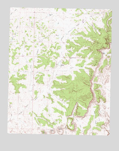
Headcut Reservoir, NM USGS Topographic Map
Click on map above to begin viewing in our Map Viewer.

This topographic map contains these locations and features:
Feature Name Type Latitude Longitude GNIS ID View Map
Anderson MineMineN35.8322°W107.0156°916271View Map
Caņada CandelariaStreamN35.7836°W107.0967°897724View Map
Caņada CeboStreamN35.7628°W107.1228°897725View Map
Casement ProspectMineN35.8322°W107.0156°915612View Map
Cerros ColoradosSummitN35.7534°W107.0623°887399View Map
Coal ProspectMineN35.7767°W107.0914°915613View Map
Coal ProspectMineN35.8139°W107.0262°915639View Map
Coal ProspectMineN35.8592°W107.0162°915640View Map
Cuba 13 ProspectMineN35.8322°W107.0156°915615View Map
Deadman PeaksSummitN35.7525°W107.0723°888244View Map
Headcut ReservoirReservoirN35.8199°W107.0635°889864View Map
Jones CanyonValleyN35.8647°W107.0328°890540View Map
La Ventana MesaSummitN35.7900°W107.0228°890845View Map
Montoya WellWellN35.7925°W107.0973°892193View Map
Padilla TankReservoirN35.8319°W107.0076°893011View Map
Peacock Number 1 MineMineN35.8203°W107.0153°939833View Map
Peacock Number 2 MineMineN35.8203°W107.0153°939834View Map
Piedra Lumbre Detention Dam Number OneDamN35.8650°W107.0323°923858View Map
Piedra Lumbre Detention Dam Number SevenDamN35.8267°W107.1089°923856View Map
Piedra Lumbre SpringSpringN35.8263°W107.0514°893254View Map
R Puerco 4 Water WellWellN35.8592°W107.0550°922720View Map
R-62 Water WellWellN35.8097°W107.1192°922718View Map
Sackett MineMineN35.8497°W107.0381°917715View Map
Tonapah MineMineN35.7717°W107.0092°916344View Map
Zambarmo LakeReservoirN35.8683°W107.0781°896840View Map

Note: Coordinates in the location and feature list above are referenced to NAD83 datum.


Copyright (C) 2008-2025 Ryan Niemi / Sunset Dynamics ... All Rights Reserved