TopoQuest Logo
Do you find TopoQuest useful?
Help keep TopoQuest running and adding new maps/features by donating!
Bitcoin:  19c7KJd3qBynnjoSw5npx9KScwjBe4ifkT
Litecoin:  LXs6TkuXGGXo1vDsWCkWVdjQX94eUKd6ui
Home View Maps Find Maps Find Places Resources & Links


Axtell West, Nebraska Topographic Map

USGS Map Title: Axtell West, NE
USGS Map MRC: 40099D2
DRG (GeoTIFF) Download: o40099d2.tif


Neighboring USGS Topographic Map Quads:


  Elm Creek SE, NE  
40099E3
 

  Kearney SW, NE  
40099E2
 

  Kearney SE, NE  
40099E1
 

  Holdrege East, NE  
40099D3
 

  Axtell West, NE  
40099D2
 

  Axtell East, NE  
40099D1
 

  Ragan, NE  
40099C3
 

  Wilcox, NE  
40099C2
 

  Hildreth, NE  
40099C1


Map MRC Location:

N41°
W100°
N41°
W99°
H8 H7 H6 H5 H4 H3 H2 H1
G8 G7 G6 G5 G4 G3 G2 G1
F8 F7 F6 F5 F4 F3 F2 F1
E8 E7 E6 E5 E4 E3 E2 E1
D8 D7 D6 D5 D4 D3 D2 D1
C8 C7 C6 C5 C4 C3 C2 C1
B8 B7 B6 B5 B4 B3 B2 B1
A8 A7 A6 A5 A4 A3 A2 A1
N40°
W100°
N40°
W99°

Axtell West, NE USGS 1:24K Topographic Map Preview:
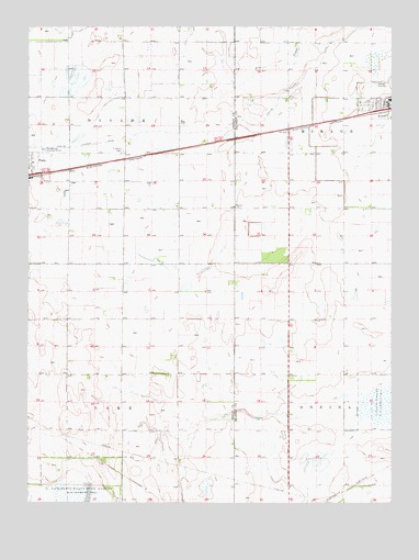
Axtell West, NE USGS Topographic Map
Click on map above to begin viewing in our Map Viewer.

This topographic map contains these locations and features:
Feature Name Type Latitude Longitude GNIS ID View Map
AxtellPopulated PlaceN40.4783°W99.1268°835239View Map
AxtellLocaleN40.4778°W99.1259°1873874View Map
Axtell City ParkParkN40.4783°W99.1268°1873892View Map
Axtell Community SchoolsSchoolN40.4808°W99.1259°1873882View Map
Axtell Medical ClinicHospitalN40.4783°W99.1268°1873877View Map
Axtell Nebraska Historical MarkerParkN40.4783°W99.1268°1873891View Map
Axtell Post OfficePost OfficeN40.4796°W99.1268°1873881View Map
Axtell Public LibraryBuildingN40.4803°W99.1259°1873879View Map
Axtell Volunteer Fire and RescueBuildingN40.4802°W99.1271°1873876View Map
Election Precinct 5CivilN40.4380°W99.2416°2712334View Map
First Presbyterian ChurchChurchN40.4803°W99.1276°1873880View Map
Fridhem CemeteryCemeteryN40.4678°W99.2179°829419View Map
Fridhem Lutheran ChurchChurchN40.4625°W99.2493°1873990View Map
FunkLocaleN40.4606°W99.2498°1873991View Map
FunkPopulated PlaceN40.4625°W99.2493°829431View Map
Funk Federal Waterfowl Production AreaParkN40.4972°W99.2184°1873919View Map
Funk First Response TeamBuildingN40.4615°W99.2494°2553679View Map
Funk Nebraska Historical MarkerParkN40.4625°W99.2493°1873974View Map
Funk Public SchoolSchoolN40.4603°W99.2498°1873987View Map
Funk Rural Fire DepartmentBuildingN40.4615°W99.2494°2553276View Map
Harmony ParkParkN40.4625°W99.2493°1873975View Map
Kearney County Waterfowl Production AreaParkN40.4009°W99.1282°2765355View Map
Midland Co-op ElevatorLocaleN40.4783°W99.1268°1873875View Map
Midland Co-op ElevatorLocaleN40.4625°W99.2493°1873988View Map
Salem ChurchChurchN40.4528°W99.1795°833134View Map
Township of DivideCivilN40.4828°W99.2384°837964View Map
Township of LakeCivilN40.3936°W99.2395°838082View Map
Village of AxtellCivilN40.4799°W99.1288°2398014View Map

Note: Coordinates in the location and feature list above are referenced to NAD83 datum.


Copyright (C) 2008-2025 Ryan Niemi / Sunset Dynamics ... All Rights Reserved