TopoQuest Logo
Do you find TopoQuest useful?
Help keep TopoQuest running and adding new maps/features by donating!
Bitcoin:  19c7KJd3qBynnjoSw5npx9KScwjBe4ifkT
Litecoin:  LXs6TkuXGGXo1vDsWCkWVdjQX94eUKd6ui
Home View Maps Find Maps Find Places Resources & Links


Axtell East, Nebraska Topographic Map

USGS Map Title: Axtell East, NE
USGS Map MRC: 40099D1
DRG (GeoTIFF) Download: o40099d1.tif


Neighboring USGS Topographic Map Quads:


  Kearney SW, NE  
40099E2
 

  Kearney SE, NE  
40099E1
 

  Minden North, NE  
40098E8
 

  Axtell West, NE  
40099D2
 

  Axtell East, NE  
40099D1
 

  Minden South, NE  
40098D8
 

  Wilcox, NE  
40099C2
 

  Hildreth, NE  
40099C1
 

  Upland, NE  
40098C8


Map MRC Location:

N41°
W100°
N41°
W99°
H8 H7 H6 H5 H4 H3 H2 H1
G8 G7 G6 G5 G4 G3 G2 G1
F8 F7 F6 F5 F4 F3 F2 F1
E8 E7 E6 E5 E4 E3 E2 E1
D8 D7 D6 D5 D4 D3 D2 D1
C8 C7 C6 C5 C4 C3 C2 C1
B8 B7 B6 B5 B4 B3 B2 B1
A8 A7 A6 A5 A4 A3 A2 A1
N40°
W100°
N40°
W99°

Axtell East, NE USGS 1:24K Topographic Map Preview:
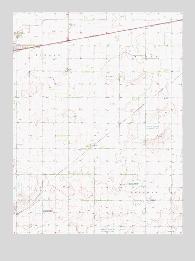
Axtell East, NE USGS Topographic Map
Click on map above to begin viewing in our Map Viewer.

This topographic map contains these locations and features:
Feature Name Type Latitude Longitude GNIS ID View Map
Bethany ChurchChurchN40.4675°W99.0854°827363View Map
Bethpage MissionChurchN40.4870°W99.1215°827394View Map
Bluestem Federal Waterfowl Production AreaParkN40.4417°W99.0587°1873846View Map
Clark Federal Waterfowl Production AreaParkN40.3764°W99.0545°1873818View Map
Garden Plain CemeteryCemeteryN40.3792°W99.0190°829453View Map
Gleason Federal Waterfowl Production AreaParkN40.4375°W99.0268°1873820View Map
KeenePopulated PlaceN40.4253°W99.0659°835344View Map
Keene (historical)LocaleN40.4250°W99.0656°1873873View Map
Keene CemeteryCemeteryN40.4228°W99.0748°830449View Map
Keene Co-op Grain and Supply Company ElevatorLocaleN40.4253°W99.0659°1873871View Map
Keene Evangelical Free ChurchChurchN40.4253°W99.0659°1873870View Map
Keene Post Office (historical)Post OfficeN40.4253°W99.0659°1873872View Map
Kildeer Federal Waterfowl Production AreaParkN40.3889°W99.1059°1873815View Map
Lindau Federal Waterfowl Production AreaParkN40.4028°W99.0365°1873819View Map
MotalaLocaleN40.4917°W99.0281°1873822View Map
Prairie Dog Federal Waterfowl Production AreaParkN40.4014°W99.1248°1873817View Map
Township of HayesCivilN40.4812°W99.0087°838053View Map
Township of MirageCivilN40.4813°W99.1226°838141View Map
Township of OneidaCivilN40.3942°W99.1225°838175View Map
Township of ShermanCivilN40.3941°W99.0086°838249View Map
Trinity Lutheran ChurchChurchN40.4806°W99.1229°1873878View Map

Note: Coordinates in the location and feature list above are referenced to NAD83 datum.


Copyright (C) 2008-2025 Ryan Niemi / Sunset Dynamics ... All Rights Reserved