TopoQuest Logo
Do you find TopoQuest useful?
Help keep TopoQuest running and adding new maps/features by donating!
Bitcoin:  19c7KJd3qBynnjoSw5npx9KScwjBe4ifkT
Litecoin:  LXs6TkuXGGXo1vDsWCkWVdjQX94eUKd6ui
Home View Maps Find Maps Find Places Resources & Links


Hebbronville SE, Texas Topographic Map

USGS Map Title: Hebbronville SE, TX
USGS Map MRC: 27098C5
DRG (GeoTIFF) Download: o27098c5.tif


Neighboring USGS Topographic Map Quads:


  Hebbronville NW, TX  
27098D6
 

  Realitos, TX  
27098D5
 

  Concepcion NW, TX  
27098D4
 

  Hebbronville, TX  
27098C6
 

  Hebbronville SE, TX  
27098C5
 

  Ramirez, TX  
27098C4
 

  McCampbell Ranch, TX  
27098B6
 

  Baluarte Ranch, TX  
27098B5
 

  Palomas Ranch NW, TX  
27098B4


Map MRC Location:

N28°
W99°
N28°
W98°
H8 H7 H6 H5 H4 H3 H2 H1
G8 G7 G6 G5 G4 G3 G2 G1
F8 F7 F6 F5 F4 F3 F2 F1
E8 E7 E6 E5 E4 E3 E2 E1
D8 D7 D6 D5 D4 D3 D2 D1
C8 C7 C6 C5 C4 C3 C2 C1
B8 B7 B6 B5 B4 B3 B2 B1
A8 A7 A6 A5 A4 A3 A2 A1
N27°
W99°
N27°
W98°

Hebbronville SE, TX USGS 1:24K Topographic Map Preview:
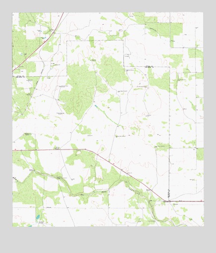
Hebbronville SE, TX USGS Topographic Map
Click on map above to begin viewing in our Map Viewer.

This topographic map contains these locations and features:
Feature Name Type Latitude Longitude GNIS ID View Map
Agua Negra WindmillLocaleN27.3292°W98.5564°1329266View Map
Balderas Altas WindmillLocaleN27.3048°W98.6170°1329976View Map
Balderas WindmillLocaleN27.2831°W98.6111°1329977View Map
Creek WindmillLocaleN27.2531°W98.5320°1333649View Map
El Nuevo WindmillLocaleN27.2525°W98.6078°1335235View Map
Guadalupe WindmillLocaleN27.2956°W98.5947°1337073View Map
Gutierrez Alto WindmillLocaleN27.3031°W98.5581°1337146View Map
Gutierrez WindmillLocaleN27.3473°W98.5733°1337147View Map
La India WindmillLocaleN27.3356°W98.5172°1339329View Map
Las Mujeres WindmillLocaleN27.3317°W98.5372°1339675View Map
Llano WindmillLocaleN27.3153°W98.5356°1340282View Map
Medanito WindmillLocaleN27.2723°W98.5347°1341313View Map
Mesquite CreekStreamN27.2767°W98.6217°1341408View Map
Noriacitas CreekStreamN27.2764°W98.6217°1375141View Map
Palacios WindmillLocaleN27.3411°W98.5506°1343450View Map
Papalote Nuevo WindmillLocaleN27.3320°W98.5939°1343570View Map
Peņa WindmillLocaleN27.3275°W98.6125°1343823View Map
Pump Jack WindmillLocaleN27.2787°W98.5956°1344627View Map
Rancho Viejo WindmillLocaleN27.3164°W98.5925°1344777View Map
San Tomas WindmillLocaleN27.2970°W98.5320°1346478View Map
Sube Vaja WindmillLocaleN27.3356°W98.6150°1348025View Map

Note: Coordinates in the location and feature list above are referenced to NAD83 datum.


Copyright (C) 2008-2025 Ryan Niemi / Sunset Dynamics ... All Rights Reserved