TopoQuest Logo
Do you find TopoQuest useful?
Help keep TopoQuest running and adding new maps/features by donating!
Bitcoin:  19c7KJd3qBynnjoSw5npx9KScwjBe4ifkT
Litecoin:  LXs6TkuXGGXo1vDsWCkWVdjQX94eUKd6ui
Home View Maps Find Maps Find Places Resources & Links


Heidelberg, Mississippi Topographic Map

USGS Map Title: Heidelberg, MS
USGS Map MRC: 31088H8
DRG (GeoTIFF) Download: o31088h8.tif


Neighboring USGS Topographic Map Quads:


  Paulding, MS  
32089A1
 

  Pachuta, MS  
32088A8
 

  Wautubbee, MS  
32088A7
 

  Waldrup, MS  
31089H1
 

  Heidelberg, MS  
31088H8
 

  Hale, MS  
31088H7
 

  Sandersville, MS  
31089G1
 

  Heidelberg SW, MS  
31088G8
 

  Eucutta, MS  
31088G7


Map MRC Location:

N32°
W89°
N32°
W88°
H8 H7 H6 H5 H4 H3 H2 H1
G8 G7 G6 G5 G4 G3 G2 G1
F8 F7 F6 F5 F4 F3 F2 F1
E8 E7 E6 E5 E4 E3 E2 E1
D8 D7 D6 D5 D4 D3 D2 D1
C8 C7 C6 C5 C4 C3 C2 C1
B8 B7 B6 B5 B4 B3 B2 B1
A8 A7 A6 A5 A4 A3 A2 A1
N31°
W89°
N31°
W88°

Heidelberg, MS USGS 1:24K Topographic Map Preview:
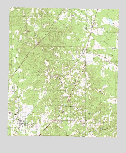
Heidelberg, MS USGS Topographic Map
Click on map above to begin viewing in our Map Viewer.

This topographic map contains these locations and features:
Feature Name Type Latitude Longitude GNIS ID View Map
BarnettPopulated PlaceN31.9868°W88.9051°691683View Map
Barnett Oil FieldOilfieldN31.9724°W88.8876°709412View Map
Blacks DamDamN31.8835°W88.9501°680927View Map
Bounds Mill (historical)LocaleN31.8849°W88.8898°687495View Map
Burns Lake DamDamN31.9085°W88.9701°680938View Map
Castaffa CreekStreamN31.9763°W88.9042°668140View Map
Church of ChristChurchN31.9574°W88.9134°668448View Map
Davisville (historical)Populated PlaceN31.9613°W88.9759°686635View Map
East Baptist ChurchChurchN31.9618°W88.8773°669558View Map
East Baptist School (historical)SchoolN31.9627°W88.8787°687507View Map
East Heidelberg Oil FieldOilfieldN31.9002°W88.9973°707792View Map
Eddins Memorial ChurchChurchN31.9863°W88.9039°669662View Map
Eddins Mill (historical)LocaleN31.9738°W88.9031°687508View Map
Goodwater School (historical)SchoolN31.9121°W88.8820°687515View Map
HeidelbergPopulated PlaceN31.8868°W88.9839°671086View Map
Heidelberg CemeteryCemeteryN31.8946°W88.9931°707802View Map
Heidelberg CemeteryCemeteryN31.9296°W88.9109°671088View Map
Heidelberg High SchoolSchoolN31.8960°W88.9909°707803View Map
Heidelberg Lookout TowerTowerN31.9021°W88.9184°711243View Map
Heidelberg Police DepartmentBuildingN31.8858°W88.9818°2754300View Map
Heidelberg Post OfficePost OfficeN31.8874°W88.9852°712805View Map
Heidelberg Volunteer Fire DepartmentBuildingN31.8856°W88.9838°2667818View Map
Interchange 118CrossingN31.9649°W88.9673°691498View Map
Jerusalem ChurchChurchN31.9177°W88.9926°671854View Map
John the Baptist ChurchChurchN31.9902°W88.9128°671895View Map
Lake BoundsLakeN31.8828°W88.8923°667465View Map
Lake UtopiaReservoirN31.9515°W88.9134°679165View Map
Lake WaukawayReservoirN31.8988°W88.9061°679391View Map
McDonnal Mill (historical)LocaleN31.8963°W88.9056°687537View Map
Pleasant Grove CemeteryCemeteryN31.9476°W88.8845°709460View Map
Pleasant Grove ChurchChurchN31.9479°W88.8850°676005View Map
Pleasant Valley ChurchChurchN31.8938°W88.9837°676136View Map
Saint John ChurchChurchN31.9329°W88.9089°677053View Map
Saint Peter CemeteryCemeteryN31.9415°W88.9575°677225View Map
Saint Peter ChurchChurchN31.9343°W88.9367°677229View Map
Salem CemeteryCemeteryN31.9640°W88.9642°677262View Map
Salem Missionary ChurchChurchN31.9765°W88.9812°677297View Map
Shady Grove CemeteryCemeteryN31.8907°W88.9409°707825View Map
Shady Grove Missionary Baptist ChurchChurchN31.8904°W88.9420°677560View Map
South Side High SchoolSchoolN31.9224°W88.9953°678014View Map
Stafford SpringsSpringN31.9049°W88.9331°686647View Map
Stafford SpringsPopulated PlaceN31.9049°W88.9334°678203View Map
Stagecoach Road Oil FieldOilfieldN31.9960°W88.9056°709477View Map
Tanner Lake DamDamN31.8818°W88.9684°680925View Map
Town of HeidelbergCivilN31.8897°W88.9878°2405814View Map
Upper Tuscaloosa Oil PoolOilfieldN31.8807°W88.9862°707830View Map
VossburgPopulated PlaceN31.9288°W88.9409°690941View Map
Vossburg - Heidelberg Volunteer Fire DepartmentBuildingN31.9274°W88.9388°2668057View Map
Vossburg CemeteryCemeteryN31.9238°W88.9378°679229View Map
Vossburg Post OfficePost OfficeN31.9279°W88.9394°712216View Map
Weems (historical)Populated PlaceN31.9085°W88.9645°686651View Map
West Nancy Oil FieldOilfieldN31.9543°W88.9028°709484View Map

Note: Coordinates in the location and feature list above are referenced to NAD83 datum.


Copyright (C) 2008-2024 Ryan Niemi / Sunset Dynamics ... All Rights Reserved