TopoQuest Logo
Do you find TopoQuest useful?
Help keep TopoQuest running and adding new maps/features by donating!
Bitcoin:  19c7KJd3qBynnjoSw5npx9KScwjBe4ifkT
Litecoin:  LXs6TkuXGGXo1vDsWCkWVdjQX94eUKd6ui
Home View Maps Find Maps Find Places Resources & Links


Sandersville, Mississippi Topographic Map

USGS Map Title: Sandersville, MS
USGS Map MRC: 31089G1
DRG (GeoTIFF) Download: o31089g1.tif


Neighboring USGS Topographic Map Quads:


  Lake Como, MS  
31089H2
 

  Waldrup, MS  
31089H1
 

  Heidelberg, MS  
31088H8
 

  Moss, MS  
31089G2
 

  Sandersville, MS  
31089G1
 

  Heidelberg SW, MS  
31088G8
 

  Laurel West, MS  
31089F2
 

  Laurel East, MS  
31089F1
 

  Myrick, MS  
31088F8


Map MRC Location:

N32°
W90°
N32°
W89°
H8 H7 H6 H5 H4 H3 H2 H1
G8 G7 G6 G5 G4 G3 G2 G1
F8 F7 F6 F5 F4 F3 F2 F1
E8 E7 E6 E5 E4 E3 E2 E1
D8 D7 D6 D5 D4 D3 D2 D1
C8 C7 C6 C5 C4 C3 C2 C1
B8 B7 B6 B5 B4 B3 B2 B1
A8 A7 A6 A5 A4 A3 A2 A1
N31°
W90°
N31°
W89°

Sandersville, MS USGS 1:24K Topographic Map Preview:
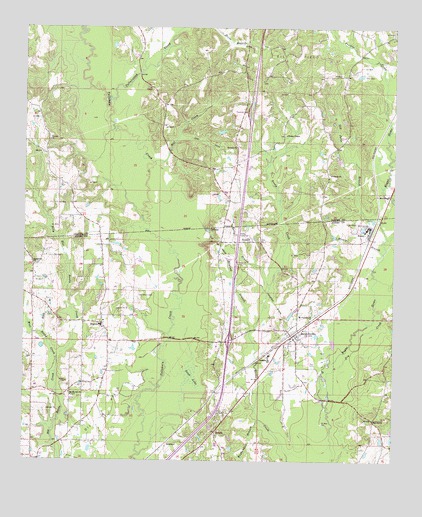
Sandersville, MS USGS Topographic Map
Click on map above to begin viewing in our Map Viewer.

This topographic map contains these locations and features:
Feature Name Type Latitude Longitude GNIS ID View Map
Bethlehem ChurchChurchN31.8068°W89.1223°666992View Map
Billy Hill Reedy CreekStreamN31.7788°W89.1134°667171View Map
Black BranchStreamN31.7865°W89.1189°667204View Map
BonnerPopulated PlaceN31.8138°W89.0489°667429View Map
Bonner Store (historical)LocaleN31.8121°W89.0239°685456View Map
Corinth CemeteryCemeteryN31.8410°W89.0531°707790View Map
Corinth Missionary Baptist ChurchChurchN31.8404°W89.0551°668833View Map
Dead LakeSwampN31.7743°W89.0683°669163View Map
Dry CreekStreamN31.7660°W89.0217°669432View Map
Erata School (historical)SchoolN31.7577°W89.0603°707345View Map
ErrataPopulated PlaceN31.7588°W89.0601°691557View Map
Errata Lookout TowerTowerN31.7638°W89.0592°711231View Map
Erratta CemeteryCemeteryN31.7618°W89.0587°707346View Map
Erratta ChurchChurchN31.7618°W89.0595°685484View Map
Fergusons Bridge (historical)BridgeN31.7752°W89.0239°685487View Map
First Baptist Church of SharonChurchN31.7885°W89.0984°685592View Map
HaneyPopulated PlaceN31.8160°W89.0095°691917View Map
Haney BranchStreamN31.8104°W89.0039°670880View Map
Hart DitchCanalN31.8424°W89.0656°670988View Map
HawkesPopulated PlaceN31.7549°W89.0762°691924View Map
Hoy School (historical)SchoolN31.7660°W89.1223°685510View Map
Interchange 104CrossingN31.7849°W89.0556°691496View Map
Jim Kelly BranchStreamN31.8002°W89.0423°671882View Map
Kuykendall BranchStreamN31.7621°W89.0445°672222View Map
Liberty ChurchChurchN31.8329°W89.0223°672445View Map
Lindsey School (historical)SchoolN31.8071°W89.0589°685527View Map
MarkwaldPopulated PlaceN31.8263°W89.0026°692043View Map
May CemeteryCemeteryN31.7785°W89.0262°673255View Map
Mayhaw BranchStreamN31.7877°W89.0484°673264View Map
McFarland School (historical)SchoolN31.8404°W89.0198°686640View Map
McGill CemeteryCemeteryN31.8190°W89.0125°673355View Map
Mill CreekStreamN31.8354°W89.0831°673604View Map
Mount Moriah Baptist ChurchChurchN31.7690°W89.1087°674062View Map
Mount Pleasant Baptist ChurchChurchN31.7915°W89.0281°674224View Map
Mount Zion Church (historical)ChurchN31.8252°W89.0564°686641View Map
Old Julie BranchStreamN31.8146°W89.0023°675198View Map
Old Sharon CemeteryCemeteryN31.7982°W89.0867°675255View Map
Prairie CreekStreamN31.8477°W89.0014°676303View Map
Red Hill ChurchChurchN31.7624°W89.0067°676536View Map
Red Hill School (historical)SchoolN31.7565°W89.0070°685579View Map
SandersvillePopulated PlaceN31.7865°W89.0323°677364View Map
Sandersville Baptist ChurchChurchN31.7882°W89.0303°685585View Map
Sandersville CemeteryCemeteryN31.7879°W89.0298°707391View Map
Sandersville Elementary SchoolSchoolN31.7810°W89.0423°711651View Map
Sandersville Police DepartmentBuildingN31.7804°W89.0423°2754296View Map
Sandersville Post OfficePost OfficeN31.7866°W89.0331°2768781View Map
Sandersville Volunteer Fire DepartmentBuildingN31.7858°W89.0336°2667737View Map
SharonPopulated PlaceN31.7896°W89.0987°677615View Map
Sharon CemeteryCemeteryN31.7896°W89.0981°707394View Map
Sharon Census Designated PlaceCensusN31.7921°W89.0984°2586610View Map
Sharon Elementary SchoolSchoolN31.7890°W89.0989°707395View Map
Sharon Oil FieldOilfieldN31.8140°W89.1153°707826View Map
Sharon Volunteer Fire DepartmentBuildingN31.7758°W89.0962°2668069View Map
Tallahattah CreekStreamN31.8529°W89.0984°678548View Map
Town of SandersvilleCivilN31.7879°W89.0362°2407283View Map
Victory Missionary Baptist ChurchChurchN31.8424°W89.1170°679221View Map
Wesley ChapelChurchN31.8443°W89.0376°679446View Map
West Reedy CreekStreamN31.7788°W89.1137°679525View Map
Whynot Church (historical)ChurchN31.8107°W89.1245°685619View Map

Note: Coordinates in the location and feature list above are referenced to NAD83 datum.


Copyright (C) 2008-2024 Ryan Niemi / Sunset Dynamics ... All Rights Reserved